MyTopo
Vermilac Michigan US Topo Map
Couldn't load pickup availability
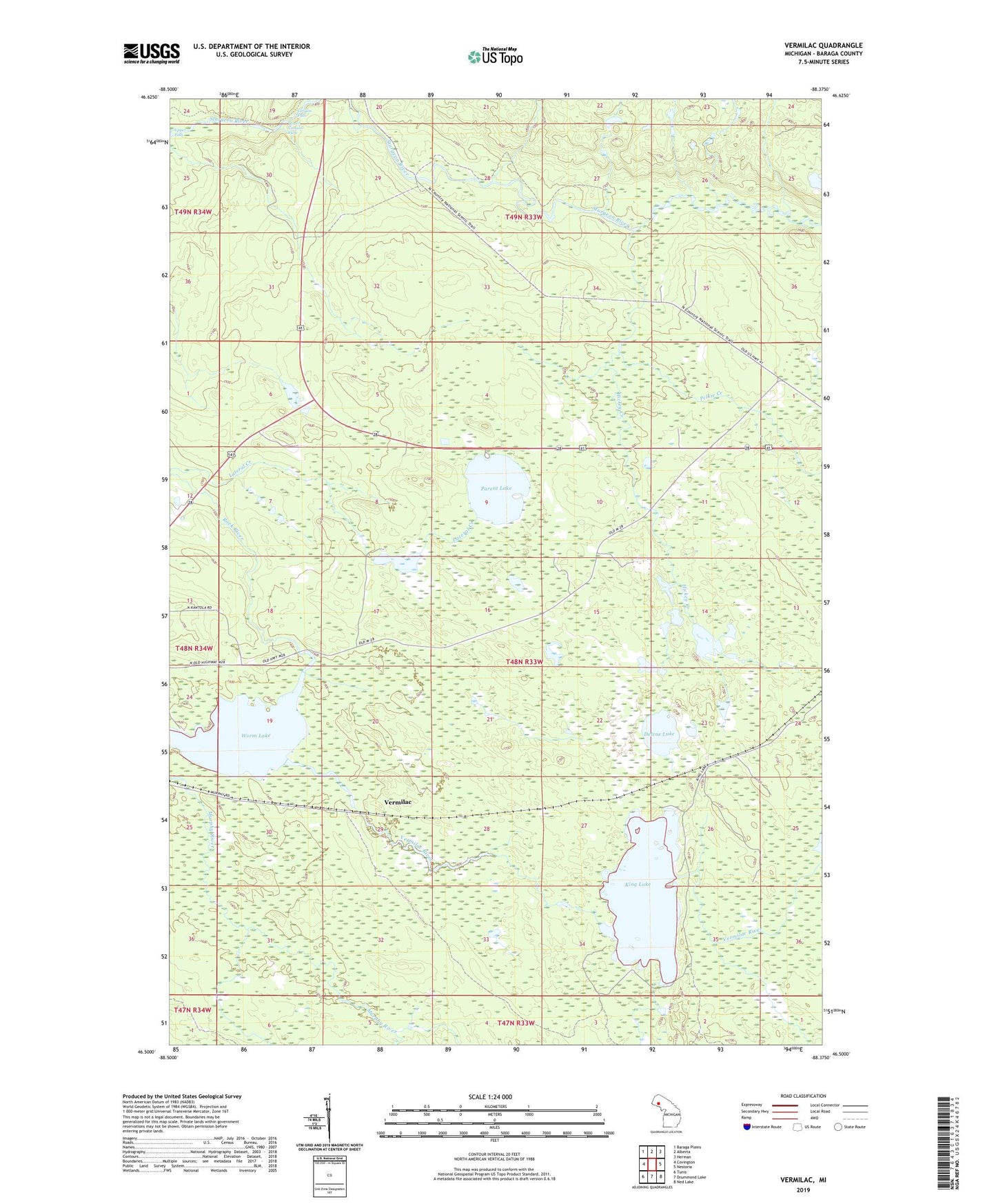
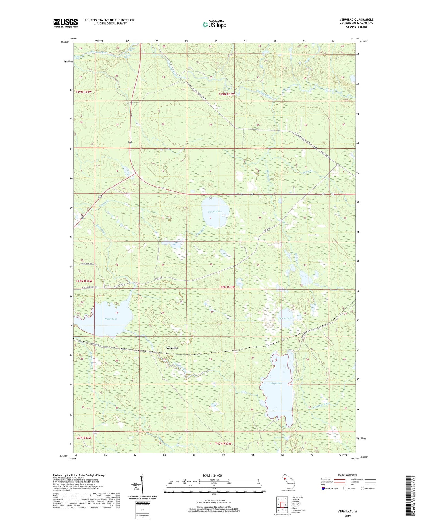
2019 topographic map quadrangle Vermilac in the state of Michigan. Scale: 1:24000. Based on the newly updated USGS 7.5' US Topo map series, this map is in the following counties: Baraga. The map contains contour data, water features, and other items you are used to seeing on USGS maps, but also has updated roads and other features. This is the next generation of topographic maps. Printed on high-quality waterproof paper with UV fade-resistant inks.
Quads adjacent to this one:
West: Covington
Northwest: Baraga Plains
North: Alberta
Northeast: Herman
East: Nestoria
Southeast: Ned Lake
South: Drummond Lake
Southwest: Tunis
Contains the following named places: Beaver Lake, Bocco Creek, Canyon Falls, Delene Lake, Hickey Creek, King Lake, King Lake State Forest Campground, Lower Canyon Falls, Parent Lake, Pelkie Creek, Upper Falls, Vermilac, Vermilac River, Worm Lake