MyTopo
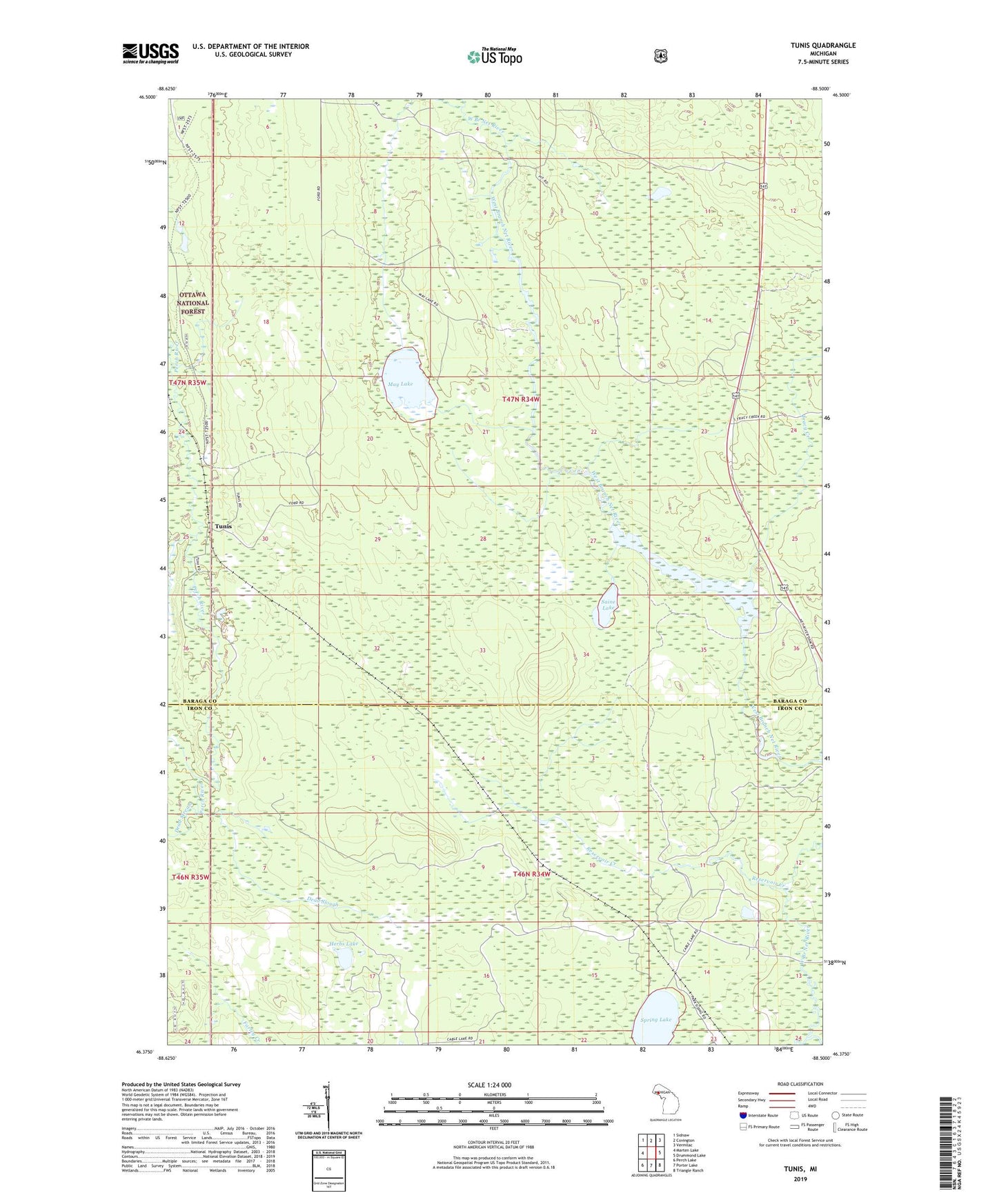
Tunis Michigan US Topo Map
Couldn't load pickup availability
Also explore the Tunis Forest Service Topo of this same quad for updated USFS data
2023 topographic map quadrangle Tunis in the state of Michigan. Scale: 1:24000. Based on the newly updated USGS 7.5' US Topo map series, this map is in the following counties: Baraga, Iron. The map contains contour data, water features, and other items you are used to seeing on USGS maps, but also has updated roads and other features. This is the next generation of topographic maps. Printed on high-quality waterproof paper with UV fade-resistant inks.
Quads adjacent to this one:
West: Marten Lake
Northwest: Sidnaw
North: Covington
Northeast: Vermilac
East: Drummond Lake
Southeast: Triangle Ranch
South: Porter Lake
Southwest: Perch Lake
This map covers the same area as the classic USGS quad with code o46088d5.
Contains the following named places: Dead Slough, Dead Stream, East Branch Net River, Goblin Creek, Herbs Lake, May Lake, Net River Flooding, Net River Post Office, Parks Siding, Reservoir Creek, Saine Lake, Spring Lake, Tracy Creek, Tunis, West Branch Net River