MyTopo
Webberville Michigan US Topo Map
Couldn't load pickup availability
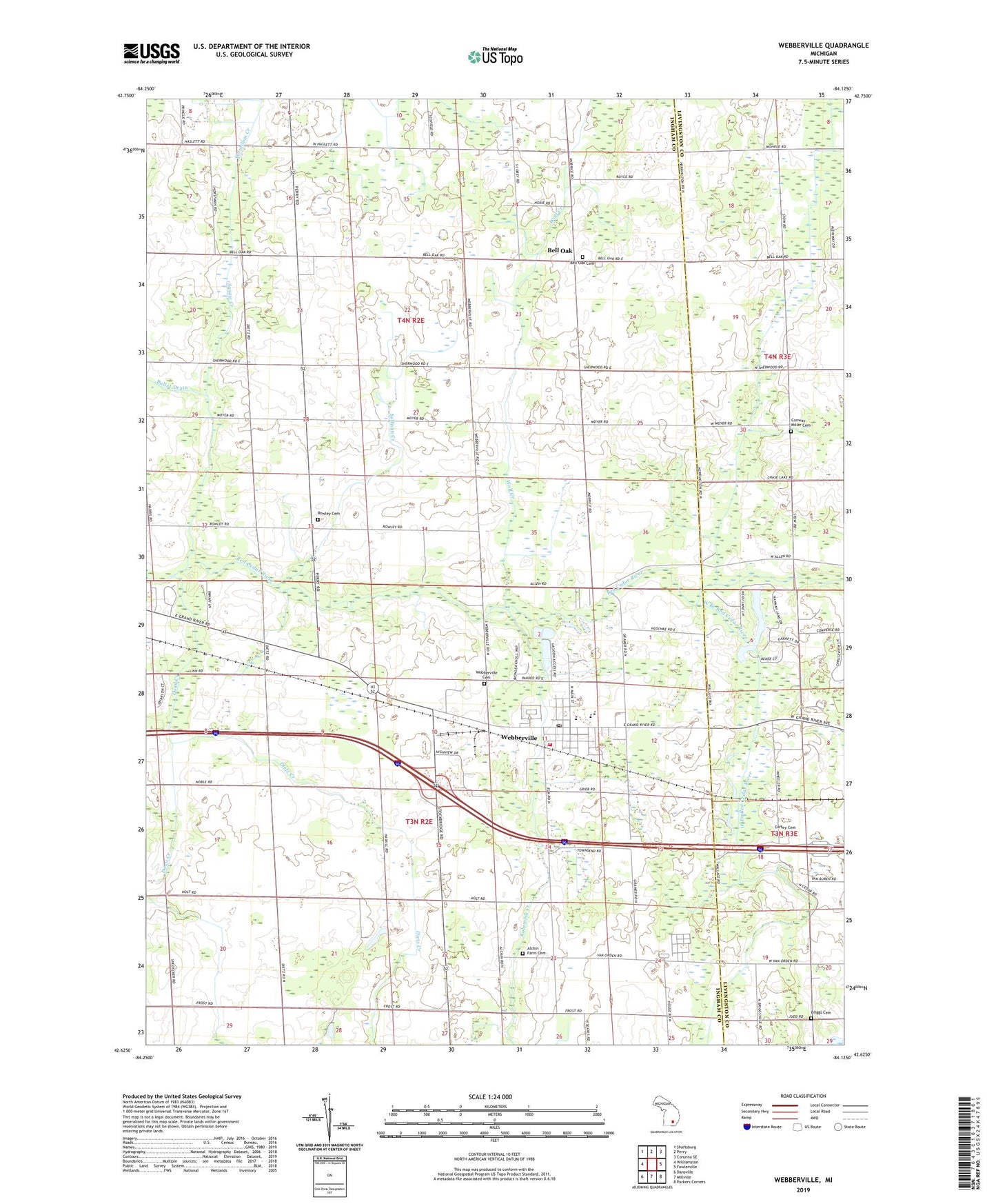
2019 topographic map quadrangle Webberville in the state of Michigan. Scale: 1:24000. Based on the newly updated USGS 7.5' US Topo map series, this map is in the following counties: Ingham, Livingston. The map contains contour data, water features, and other items you are used to seeing on USGS maps, but also has updated roads and other features. This is the next generation of topographic maps. Printed on high-quality waterproof paper with UV fade-resistant inks.
Quads adjacent to this one:
West: Williamston
Northwest: Shaftsburg
North: Perry
Northeast: Corunna SE
East: Fowlerville
Southeast: Parkers Corners
South: Millville
Southwest: Dansville
Contains the following named places: Alchin Farm Cemetery, Bell Oak, Bell Oak Cemetery, Briggs Cemetery, Browell Roadside Park, Calvary Baptist Church, Church of Christ, Coffey Cemetery, Conway Church, Conway Miller Cemetery, Dietz Creek, Doan Creek, Kalamink Creek, LeRoy Township District Number Six School Historical Marker, Leroy Township Fire Department, Locke Post Office, Mount Hope Church, Oak Lane Golf Club, Phelpstown Post Office, Rowley Cemetery, Rowley Church, Squaw Creek, Sullivan Creek, Township of Leroy, Township of Locke, Village of Webberville, Wayside Tabernacle Church, Webbervilla Mobile Home Park, Webberville, Webberville Cemetery, Webberville Elementary School, Webberville High School, Webberville Library, Webberville Park, Webberville Police Department, Webberville Post Office, Webberville Station, Webberville United Methodist Church, West Branch Red Cedar River, Wolf Creek, ZIP Code: 48892