MyTopo
Corunna SE Michigan US Topo Map
Couldn't load pickup availability
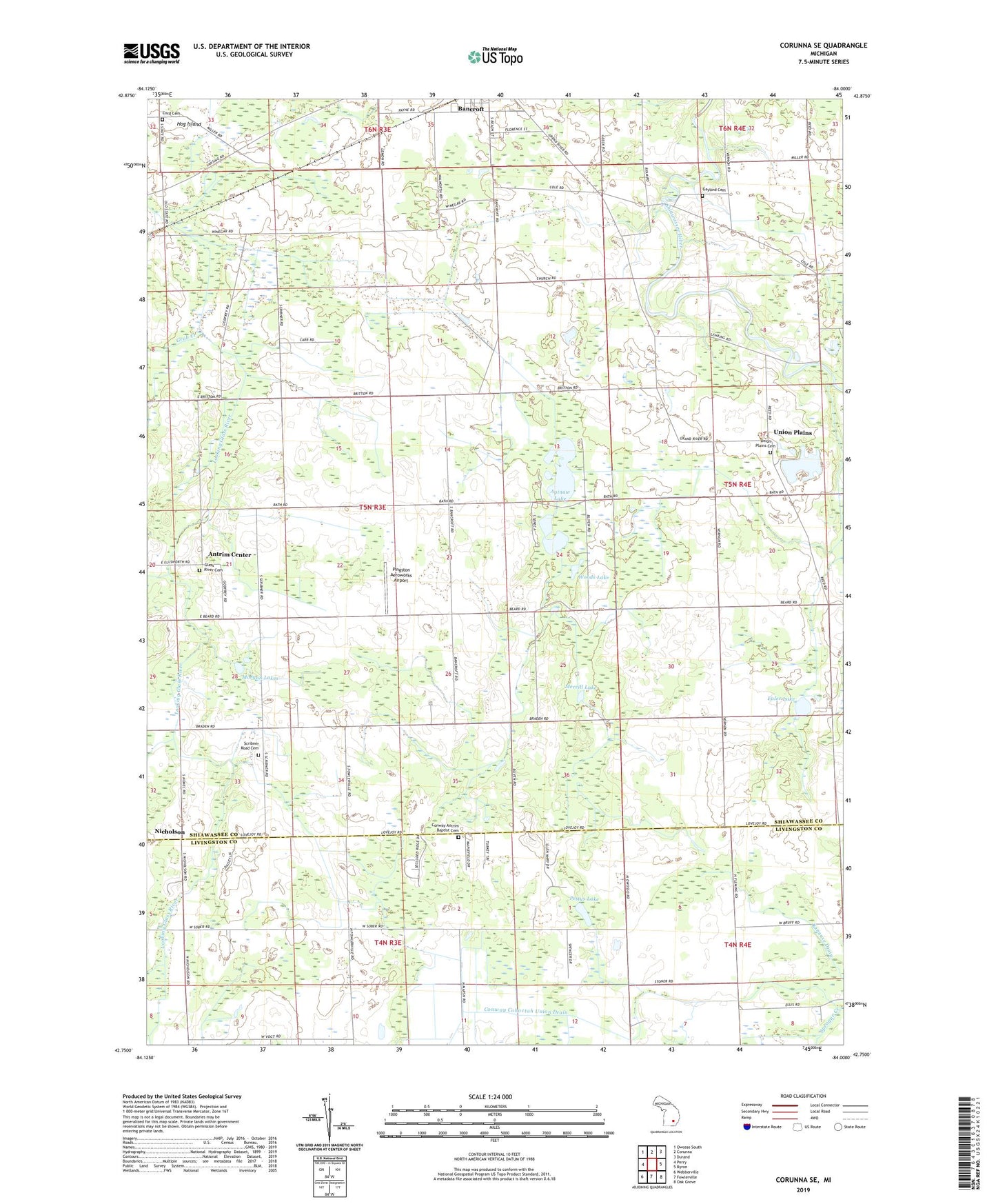
2023 topographic map quadrangle Corunna SE in the state of Michigan. Scale: 1:24000. Based on the newly updated USGS 7.5' US Topo map series, this map is in the following counties: Shiawassee, Livingston. The map contains contour data, water features, and other items you are used to seeing on USGS maps, but also has updated roads and other features. This is the next generation of topographic maps. Printed on high-quality waterproof paper with UV fade-resistant inks.
Quads adjacent to this one:
West: Perry
Northwest: Owosso South
North: Corunna
Northeast: Durand
East: Byron
Southeast: Oak Grove
South: Fowlerville
Southwest: Webberville
This map covers the same area as the classic USGS quad with code o42084g1.
Contains the following named places: Aginaw Lake, Antrim Center, Antrim Church, Burns Post Office, Congregational Church, Conway Antrim Baptist Cemetery, Conway Cohoctah Union Drain, Cord Cemetery, Euler Lake, Gaylord Cemetery, Glass River Cemetery, Glass River Post Office, Grub Creek, Kanause Drain, Knaggs Bridge Area Historical Marker, Merrill Lake, Morgan Lakes, Nicholson, Pettys Lake, Pingston Aeroworks Airport, Rose Lake, Round Lake, Scribner Drain, Scribner Road Cemetery, Township of Antrim, Union Plains, Union Plains Cemetery, Walnut Hills Family Campground, Woods Lake, ZIP Code: 48414