MyTopo
Shaftsburg Michigan US Topo Map
Couldn't load pickup availability
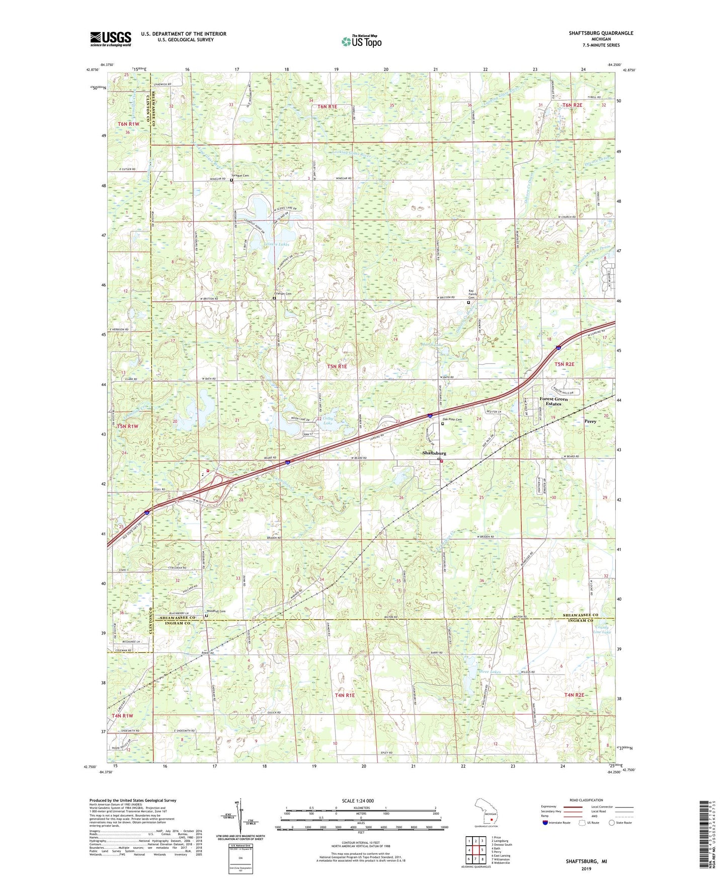
2023 topographic map quadrangle Shaftsburg in the state of Michigan. Scale: 1:24000. Based on the newly updated USGS 7.5' US Topo map series, this map is in the following counties: Shiawassee, Ingham, Clinton. The map contains contour data, water features, and other items you are used to seeing on USGS maps, but also has updated roads and other features. This is the next generation of topographic maps. Printed on high-quality waterproof paper with UV fade-resistant inks.
Quads adjacent to this one:
West: Bath
Northwest: Price
North: Laingsburg
Northeast: Owosso South
East: Perry
Southeast: Webberville
South: Williamston
Southwest: East Lansing
This map covers the same area as the classic USGS quad with code o42084g3.
Contains the following named places: Alverson Post Office, Church of the Bible Covenant, Colby Lake, Community Bible Church, Countryside Village Mobile Home Park, County Line Lake, Devore Drain, Dunham Memorial Library, Dunn Lakes, Forest Green Estates, Graham Cemetery, Graham Church, Hickory Lake, Hickory Lake Campground, Kay Family Cemetery, Laingsburg Sciota Woodhull Fire and Emergency Services Station 2, Leisure Lakes, Loon Lake, Marsh Lake, Michigan Department of Natural Resources Rose Lake Office, Moon Lake, Oak Plain Cemetery, Osborn Creek Drain, Perry Aero Park Airport, Perry Number Two Drain, Perry School, Quiet Cove Mobile Home Park, Shaftsburg, Shaftsburg Census Designated Place, Shaftsburg Elementary School, Shaftsburg Post Office, Shaftsburg Station, Shaftsburg United Methodist Church, Sprague Cemetery, Three Lakes, Township of Woodhull, Wolf Lake, Woodbury Rest Area, Woodhull Cemetery