MyTopo
Albion Center Minnesota US Topo Map
Couldn't load pickup availability
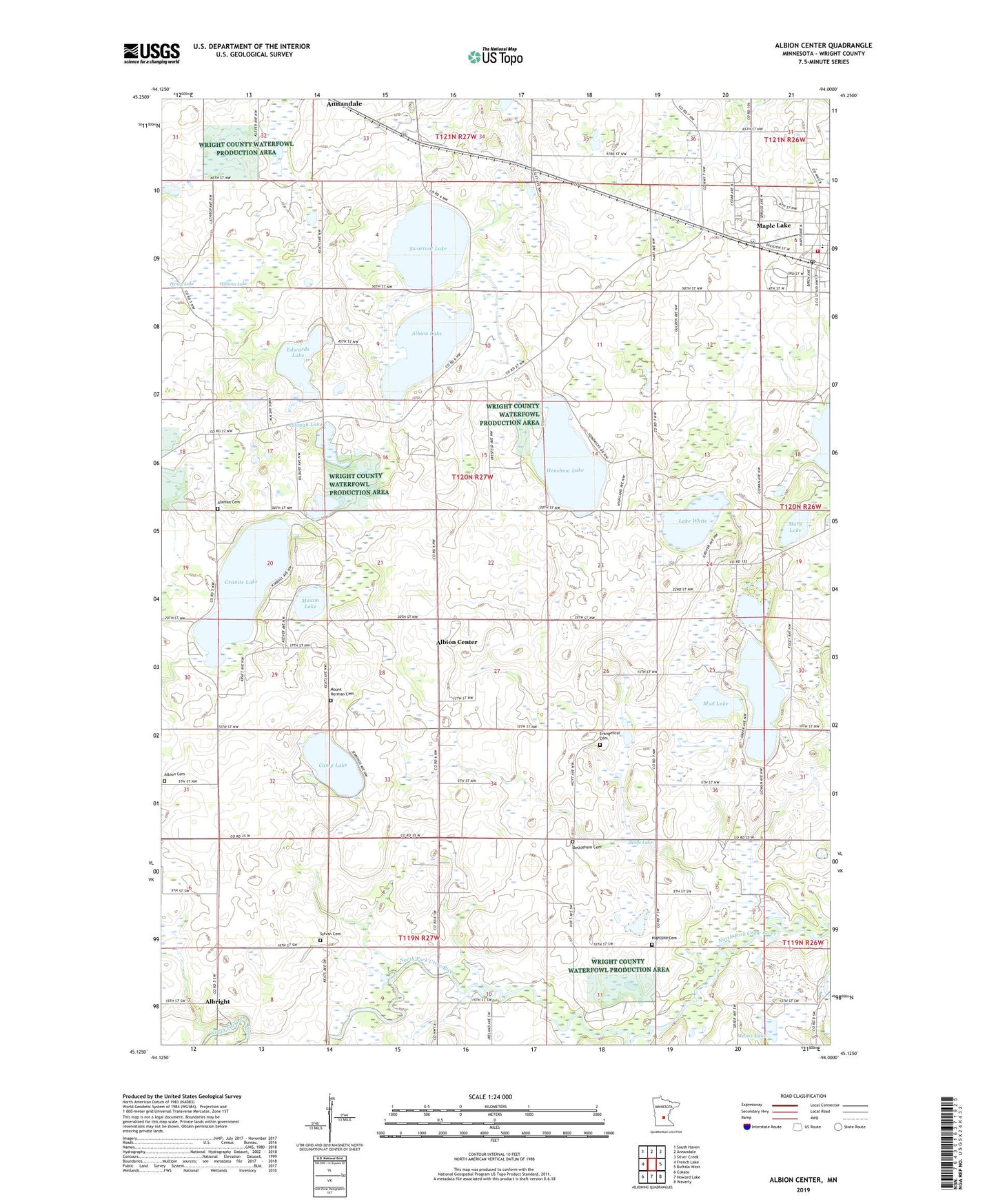
2019 topographic map quadrangle Albion Center in the state of Minnesota. Scale: 1:24000. Based on the newly updated USGS 7.5' US Topo map series, this map is in the following counties: Wright. The map contains contour data, water features, and other items you are used to seeing on USGS maps, but also has updated roads and other features. This is the next generation of topographic maps. Printed on high-quality waterproof paper with UV fade-resistant inks.
Quads adjacent to this one:
West: French Lake
Northwest: South Haven
North: Annandale
Northeast: Silver Creek
East: Buffalo West
Southeast: Waverly
South: Howard Lake
Southwest: Cokato
Contains the following named places: Alamaa Cemetery, Albion Cemetery, Albion Center, Albion Center School, Albion Church, Albion Lake, Albion Post Office, Albion State Wildlife Management Area, Albright, Bethelehem School, Bethlehem Cemetery, Bethlehem Church, Breezy Hills, Camp Lake, Centerville Lake Seaplane Base, City of Maple Lake, Corinna State Wildlife Management Area, Edwards Lake, Evangelical Cemetery, Fitzpatrick School, Granite Lake, Granite Lake Post Office, Henshaw Lake, Highland Cemetery, Holy Cross Lutheran Church, Lake White, Little Rock Lake, Mains Lake, Maple Grove School, Maple Lake, Maple Lake City Hall, Maple Lake Fire Department, Maple Lake Mobile Home Park, Maple Lake Post Office, Mary Lake, Maxim Lake, Middleville Church, Mount Herman Cemetery, Mount Vernon Church, Mud Lake, Rock Lake, Saint Timothy's Catholic Church, Slough Lake, Swart Watts Lake Dam, Swartout Lake, Swartout State Wildlife Management Area, Sylvan Cemetery, Sylvan Church, Township of Albion, Willima Lake, Wolfe Lake, Wolfe School, ZIP Code: 55302