MyTopo
Waverly Minnesota US Topo Map
Couldn't load pickup availability
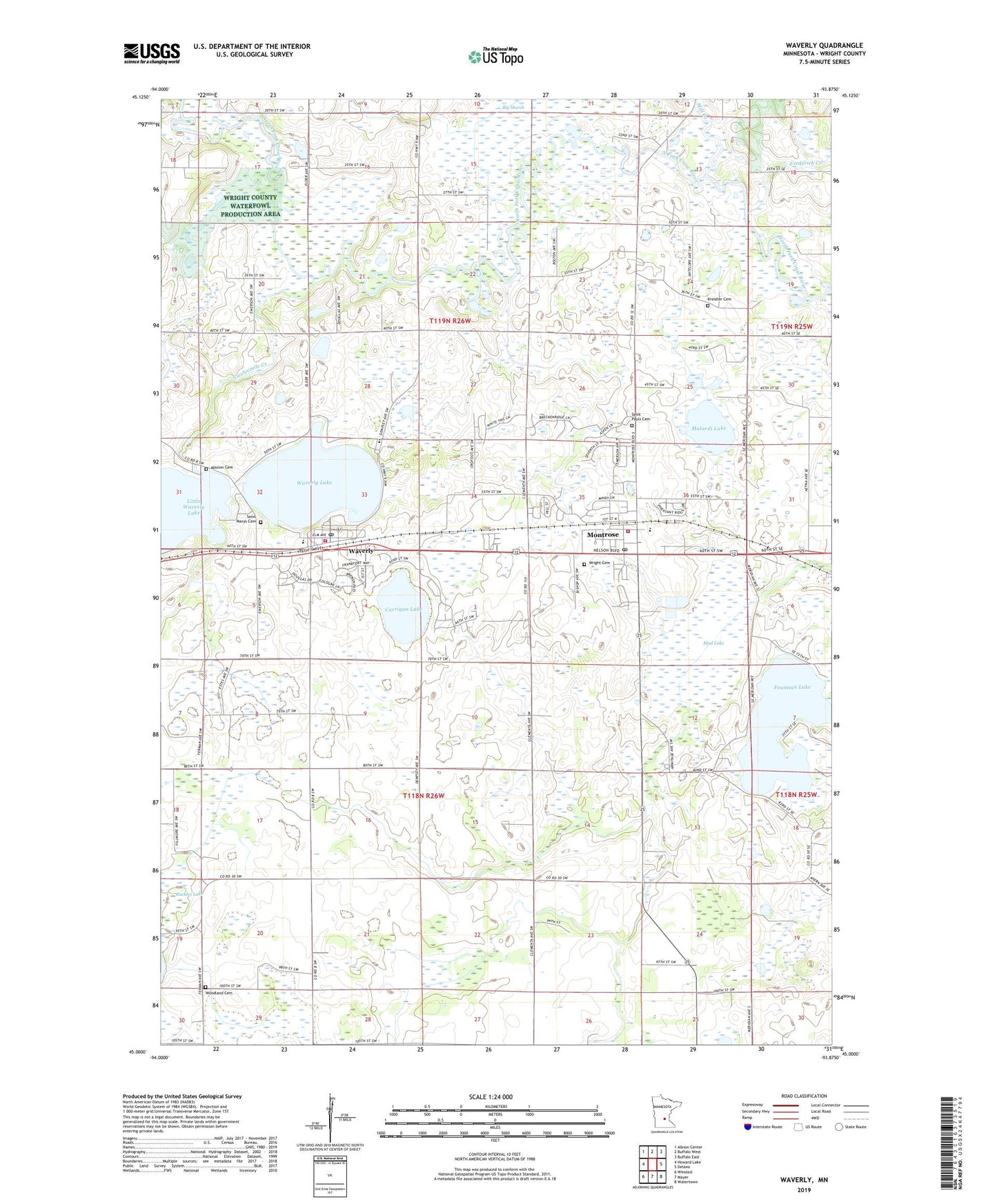
2022 topographic map quadrangle Waverly in the state of Minnesota. Scale: 1:24000. Based on the newly updated USGS 7.5' US Topo map series, this map is in the following counties: Wright. The map contains contour data, water features, and other items you are used to seeing on USGS maps, but also has updated roads and other features. This is the next generation of topographic maps. Printed on high-quality waterproof paper with UV fade-resistant inks.
Quads adjacent to this one:
West: Howard Lake
Northwest: Albion Center
North: Buffalo West
Northeast: Buffalo East
East: Delano
Southeast: Watertown
South: Mayer
Southwest: Winsted
This map covers the same area as the classic USGS quad with code o45093a8.
Contains the following named places: Bland School Number 940, Carrigan Lake, City of Montrose, City of Waverly, County Ditch Number Thirtyone, County Ditch Number Twentytwo, Fall Harvest Orchard, Fountain Lake, Fountain Lake Seaplane Base, Frederick Creek, Humphrey Elementary School, Humphrey-Arends Memorial County Park, Kreidler Cemetery, Little Waverly Dam, Little Waverly Lake, Malardi Lake, Malardi Lake State Wildlife Management Area, Mill Creek, Mission Cemetery, Montrose, Montrose City Hall, Montrose Elementary School, Montrose Fire Department, Montrose Manor Mobile Home Park, Montrose Post Office, Montrose United Methodist Church, Mud Lake, North Saint Paul Post Office, Saint Mary's Catholic Church, Saint Marys Cemetery, Saint Paul's and Trinity Lutheran Church, Saint Pauls Cemetery, Section Eight School, Swedesburg Church, Township of Marysville, Township of Woodland, Twelve Hi Mobile Home Estates, Twelvemile Creek, Union Presbyterian Church, Waverly, Waverly Fire and Rescue, Waverly Group Home, Waverly Lake, Waverly Post Office, Waverly Village Hall, Woodland Cemetery, Woodland School, Woodland State Wildlife Management Area, Wright Cemetery, ZIP Codes: 55363, 55390