MyTopo
South Haven Minnesota US Topo Map
Couldn't load pickup availability
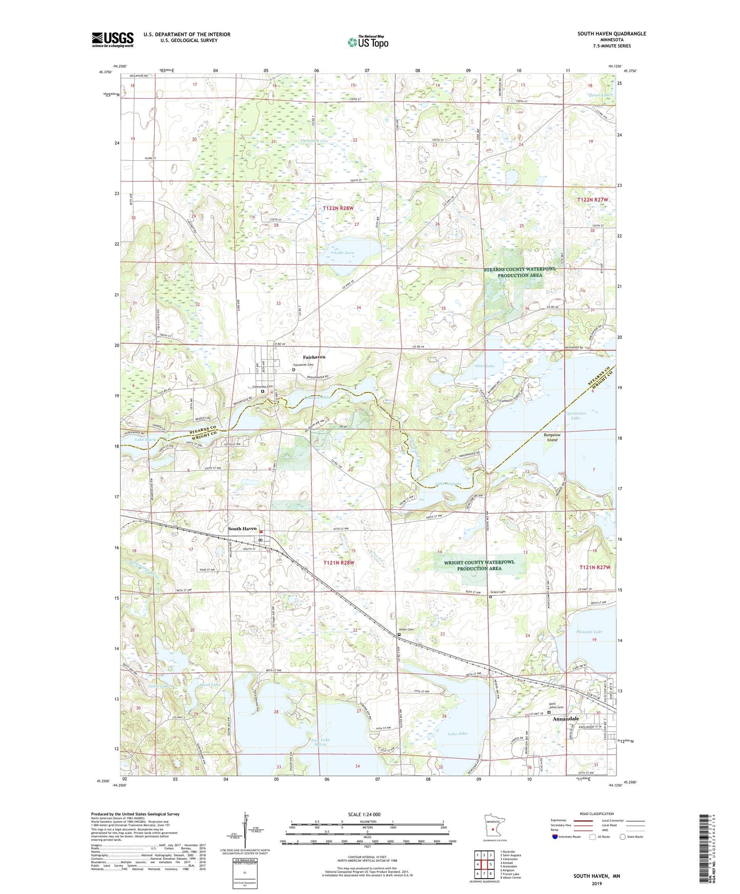
2022 topographic map quadrangle South Haven in the state of Minnesota. Scale: 1:24000. Based on the newly updated USGS 7.5' US Topo map series, this map is in the following counties: Wright, Stearns. The map contains contour data, water features, and other items you are used to seeing on USGS maps, but also has updated roads and other features. This is the next generation of topographic maps. Printed on high-quality waterproof paper with UV fade-resistant inks.
Quads adjacent to this one:
West: Kimball
Northwest: Rockville
North: Saint Augusta
Northeast: Clearwater
East: Annandale
Southeast: Albion Center
South: French Lake
Southwest: Kingston
This map covers the same area as the classic USGS quad with code o45094c2.
Contains the following named places: Bungalow Island, Camp Heritage, City of South Haven, Concordia Cemetery, Concordia Lutheran Church, East Lake Sylvia, Fair Haven Christian Church, Fair Haven Farm, Fairhaven, Fairhaven Cemetery, Fairhaven Census Designated Place, Fairhaven Post Office, Goble Lake, Grace Cemetery, Koinonia Retreat Church, Lake Augusta, Lake Caroline, Lake John, Lake Louisa, Lake Lura, Lake Marie, Little John Lake, Mead Lake, Otter Lake, Saint Johns Lutheran Cemetery, Saint John's Lutheran Church, South Haven, South Haven City Hall, South Haven Fire Department, South Haven Post Office, Threemile Creek, Township of Fair Haven, Township of Southside, Union Cemetery, West Lake Sylvia, Zion United Methodist Church, ZIP Code: 55382