MyTopo
Badger Minnesota US Topo Map
Couldn't load pickup availability
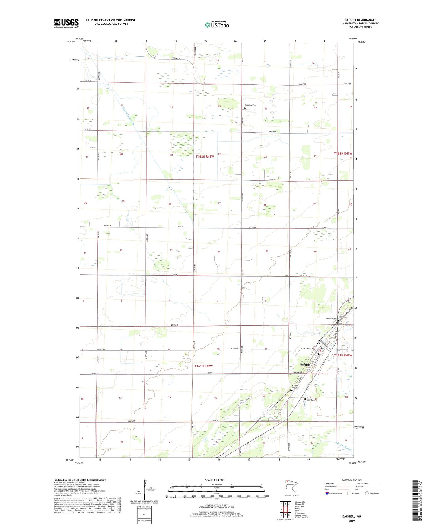
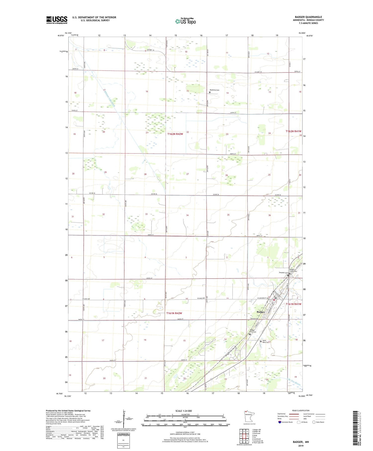
2019 topographic map quadrangle Badger in the state of Minnesota. Scale: 1:24000. Based on the newly updated USGS 7.5' US Topo map series, this map is in the following counties: Roseau. The map contains contour data, water features, and other items you are used to seeing on USGS maps, but also has updated roads and other features. This is the next generation of topographic maps. Printed on high-quality waterproof paper with UV fade-resistant inks.
Quads adjacent to this one:
West: Haug
Northwest: Badger NW
North: Badger NE
Northeast: Pinecreek
East: Fox
Southeast: Thief Lake NW
South: Greenbush NE
Southwest: Greenbush
Contains the following named places: Badger, Badger City Cemetery, Badger Creek, Badger Creek Cemetery, Badger Creek Free Lutheran Church, Badger Fire Department, Badger Post Office, Badger Station, City of Badger, County Ditch Number Five, Lolita Post Office, Oak View Mobile Home Park, Our Redeemer Lutheran Church, Palisade Mobile Home Park, Pioneer Mobile Home Park, Roselund Cemetery, Roselund Church, Saint Mary Cemetery, Saint Mary's Catholic Church, Swedish Cemetery, Township of Moose, Township of Skagen, Whitney Lake Ditch, ZIP Code: 56714