MyTopo
Badger NE Minnesota US Topo Map
Couldn't load pickup availability
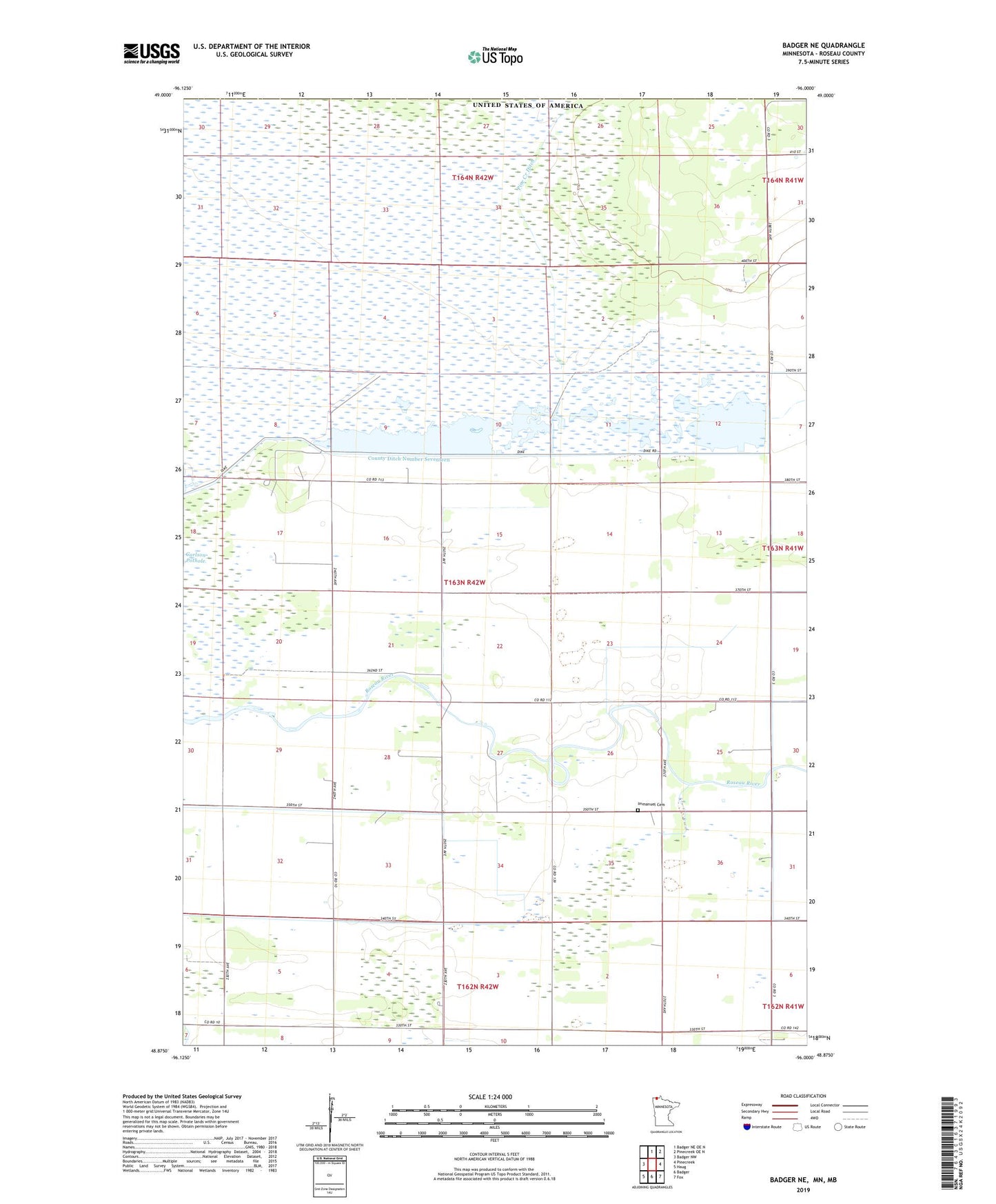
2022 topographic map quadrangle Badger NE in the state of Minnesota. Scale: 1:24000. Based on the newly updated USGS 7.5' US Topo map series, this map is in the following counties: Roseau. The map contains contour data, water features, and other items you are used to seeing on USGS maps, but also has updated roads and other features. This is the next generation of topographic maps. Printed on high-quality waterproof paper with UV fade-resistant inks.
Quads adjacent to this one:
West: Badger NW
North: Badger NE OE N
Northeast: Pinecreek OE N
East: Pinecreek
Southeast: Fox
South: Badger
Southwest: Haug
This map covers the same area as the classic USGS quad with code o48096h1.
Contains the following named places: County Ditch Number Seventeen, Duxby Post Office, Immanuel Cemetery, Pine Creek Ditch, Pool 1, Pool Number One, Roseau River Wildlife Management Area Pool 1 Dam, Township of Pohlitz