MyTopo
Bagley Lake Minnesota US Topo Map
Couldn't load pickup availability
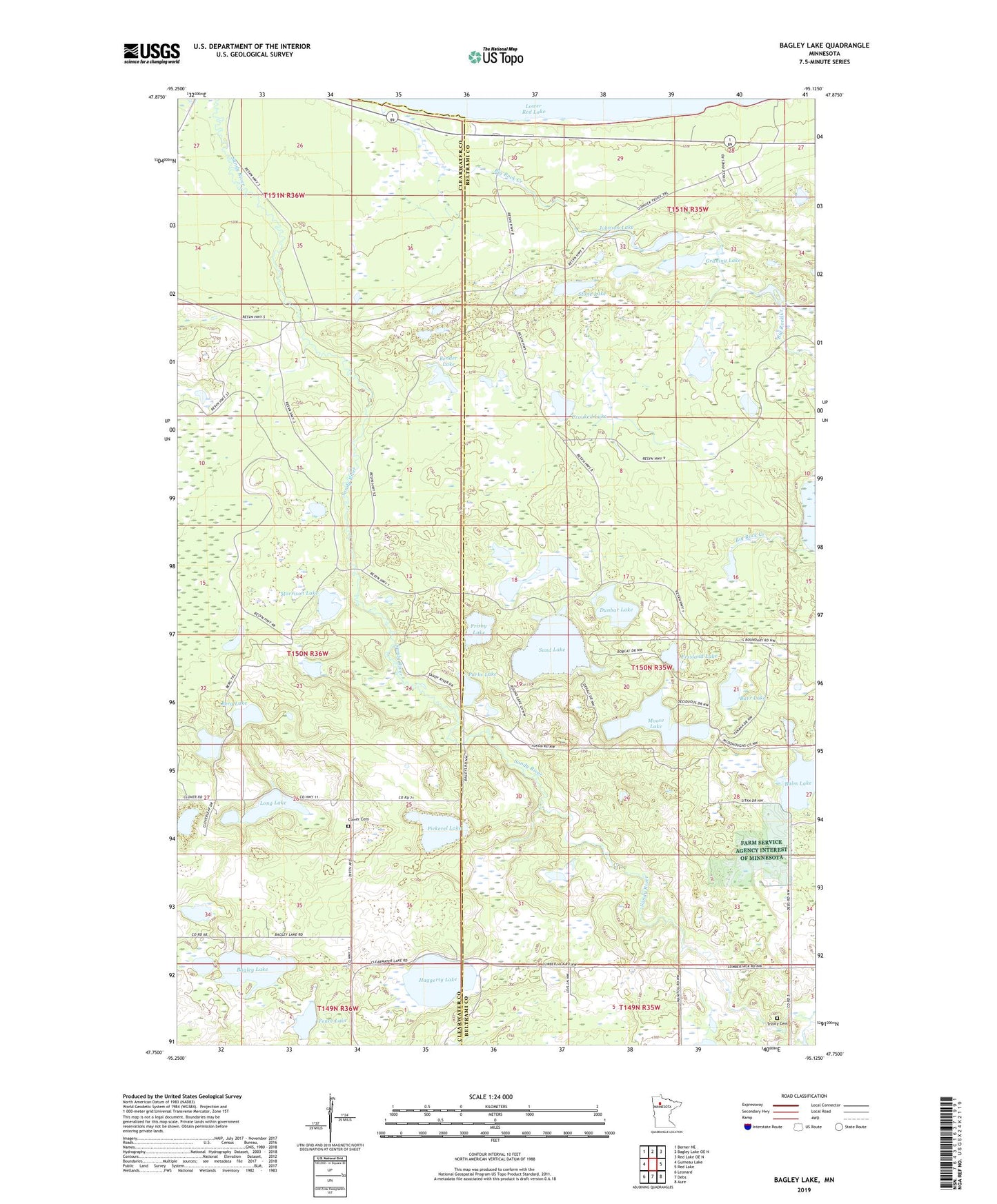
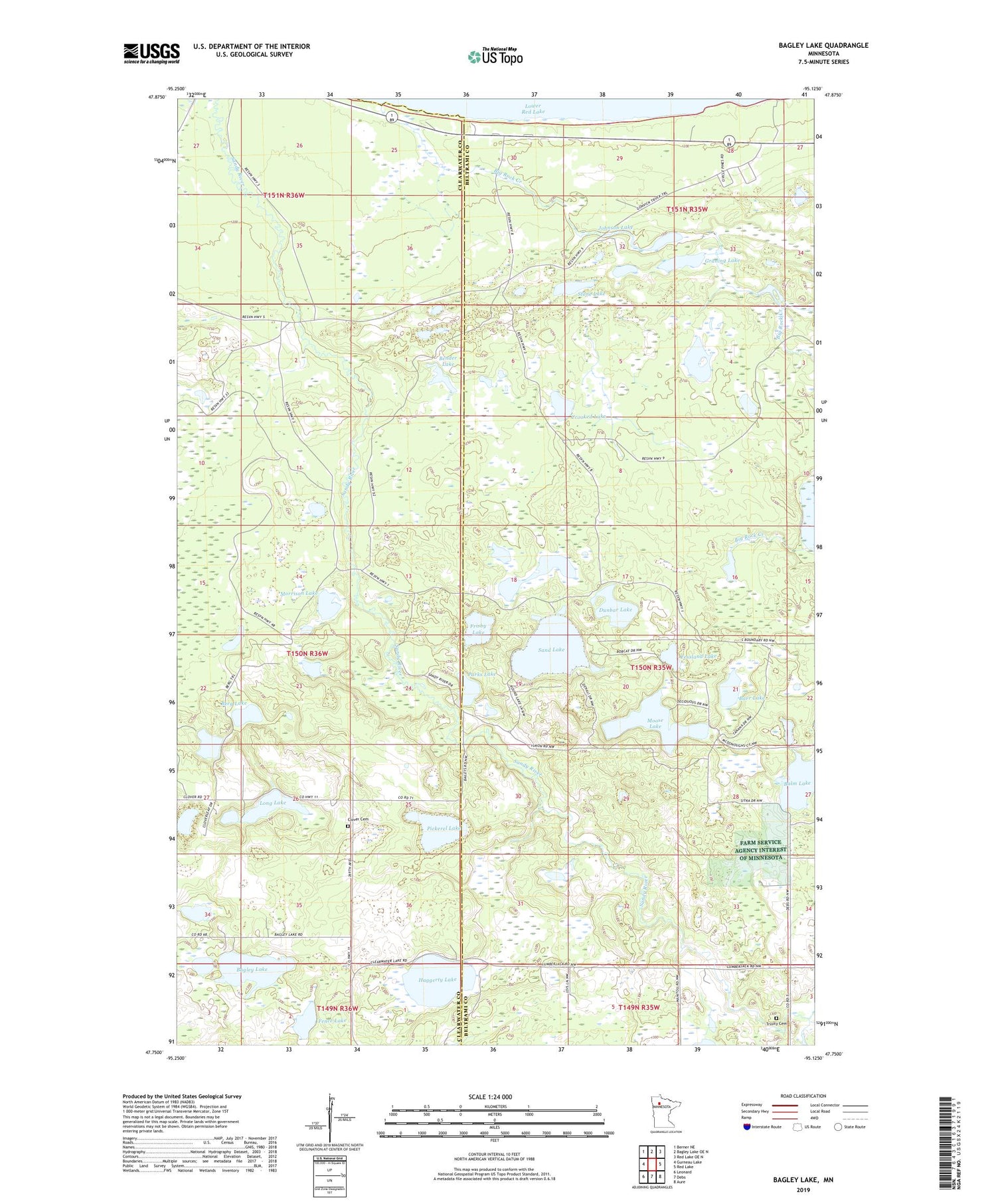
2019 topographic map quadrangle Bagley Lake in the state of Minnesota. Scale: 1:24000. Based on the newly updated USGS 7.5' US Topo map series, this map is in the following counties: Beltrami, Clearwater. The map contains contour data, water features, and other items you are used to seeing on USGS maps, but also has updated roads and other features. This is the next generation of topographic maps. Printed on high-quality waterproof paper with UV fade-resistant inks.
Quads adjacent to this one:
West: Gurneau Lake
Northwest: Berner NE
North: Bagley Lake OE N
Northeast: Red Lake OE N
East: Red Lake
Southeast: Aure
South: Debs
Southwest: Leonard
Contains the following named places: Bagley Lake, Bagley Lake State Wildlife Management Area, Barr Lake, Bender Lake, Berg Lake, Big Meadows Lookout Tower, Big Rock Creek, Camp Hiawatha, Clover Cemetery, Crooked Lake, Dunbar Lake, Dunowen Post Office, Faith Chapel, Fence Lake, Fessland Lake, Frisby Lake, Graning Lake, Haggerty Lake, Johnson Lake, Long Lake, Mollison Lake, Moose Lake, Morrison Lake, Parks Lake, Pickerel Lake, Pine Island Lake, Sand Lake, Stone Lake, Trinity Cemetery, Trinity Church