MyTopo
Leonard Minnesota US Topo Map
Couldn't load pickup availability
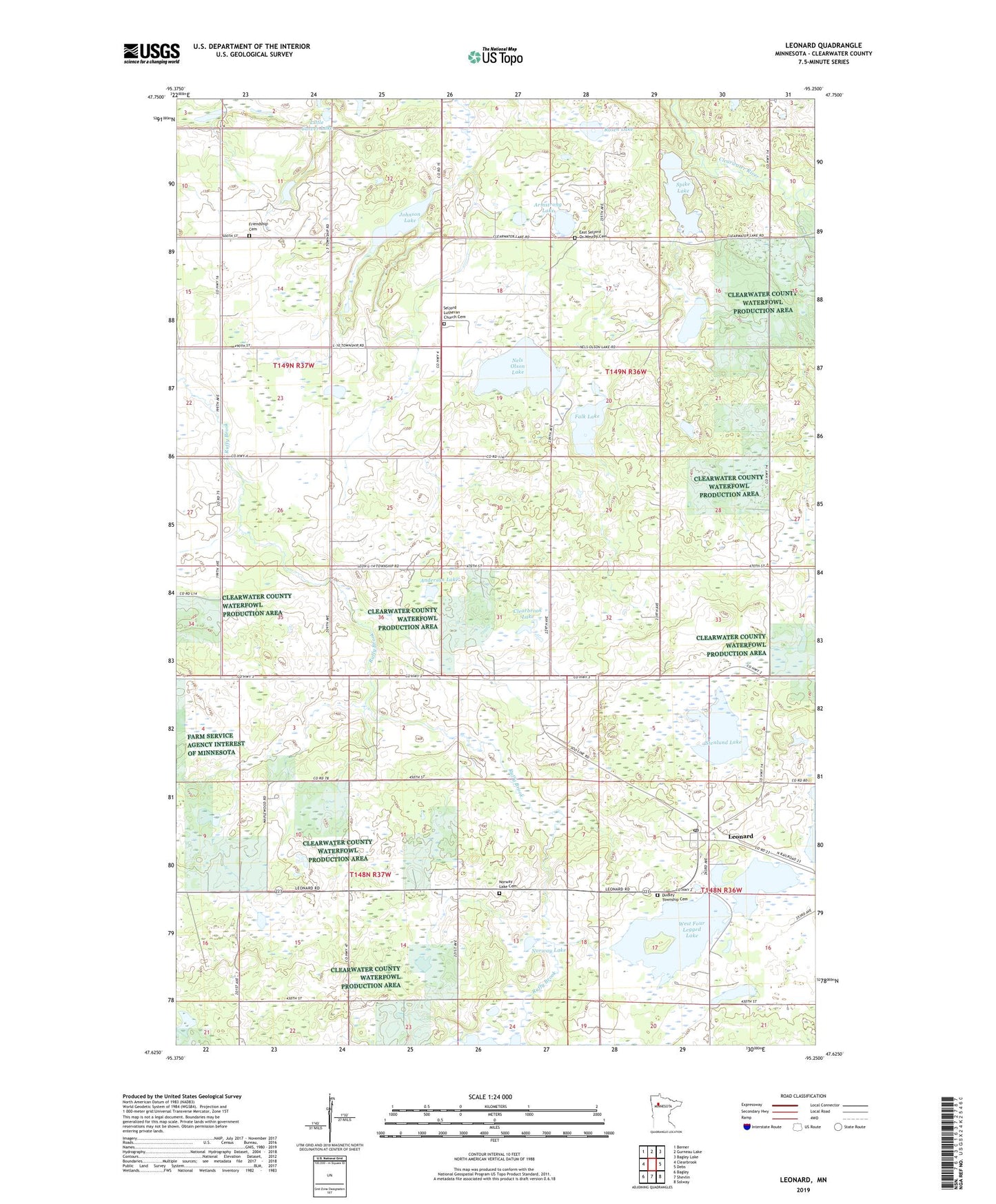
2022 topographic map quadrangle Leonard in the state of Minnesota. Scale: 1:24000. Based on the newly updated USGS 7.5' US Topo map series, this map is in the following counties: Clearwater. The map contains contour data, water features, and other items you are used to seeing on USGS maps, but also has updated roads and other features. This is the next generation of topographic maps. Printed on high-quality waterproof paper with UV fade-resistant inks.
Quads adjacent to this one:
West: Clearbrook
Northwest: Berner
North: Gurneau Lake
Northeast: Bagley Lake
East: Debs
Southeast: Solway
South: Shevlin
Southwest: Bagley
This map covers the same area as the classic USGS quad with code o47095f3.
Contains the following named places: Anderson Lake, Armstrong Lake, Beard Post Office, City of Leonard, Clearbrook Lake, Clearwater County Waterfowl Production Area, Dudley Township Cemetery, East Seljord Or Westby Cemetery, Falk Lake, Ferdi Anderson Wildlife Pond Dam, Ferdi Johnson Wildlife Pond, Friendship Cemetery, Johnson Lake, Leonard, Leonard Post Office - CPO, Little Carver Lake, Nels Olson Lake, Norway Lake, Norway Lake Cemetery, Ollestad Park, Rosen Lake, Seljord Church, Seljord Lutheran Church Cemetery, Spike Lake, Starlight Post Office, Stenlund Lake, Township of Holst, Township of Sinclair, West Four Legged Lake