MyTopo
Ball Bluff Minnesota US Topo Map
Couldn't load pickup availability
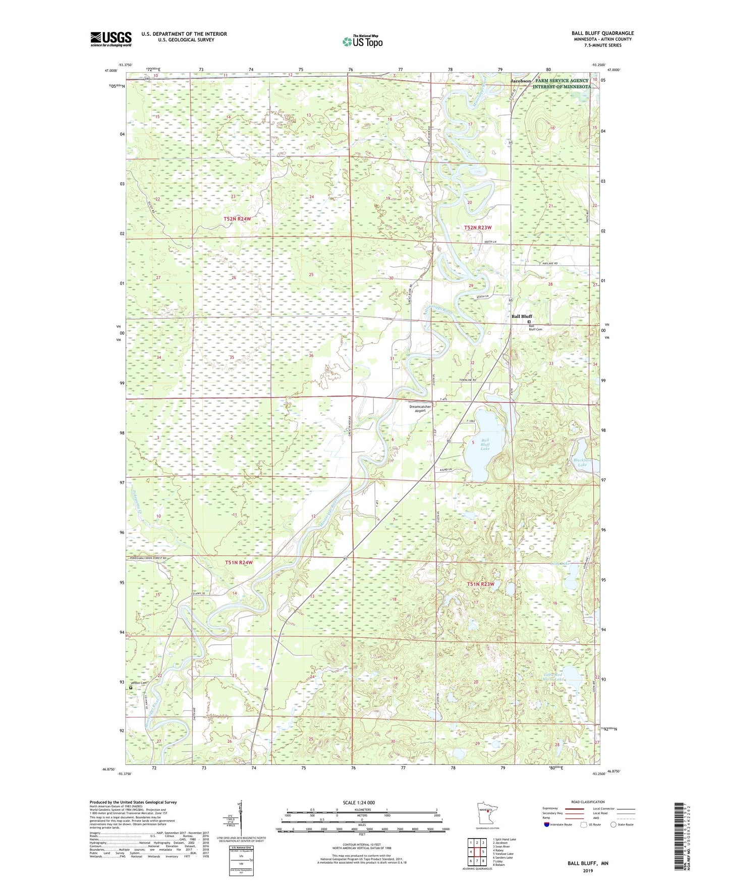
2019 topographic map quadrangle Ball Bluff in the state of Minnesota. Scale: 1:24000. Based on the newly updated USGS 7.5' US Topo map series, this map is in the following counties: Aitkin. The map contains contour data, water features, and other items you are used to seeing on USGS maps, but also has updated roads and other features. This is the next generation of topographic maps. Printed on high-quality waterproof paper with UV fade-resistant inks.
Quads adjacent to this one:
West: Rabey
Northwest: Split Hand Lake
North: Jacobson
Northeast: Swan River
East: Vanduse Lake
Southeast: Balsam
South: Libby
Southwest: Sanders Lake
Contains the following named places: Ball Bluff, Ball Bluff Cemetery, Ball Bluff Lake, Ball Bluff Park, Dreamcatcher Airport, Little Ball Bluff Lake, Little Red Horse Lake, Long Lake, Pokegama Creek, Township of Ball Bluff, Township of Cornish, Verdon Cemetery, ZIP Code: 55752