MyTopo
Split Hand Lake Minnesota US Topo Map
Couldn't load pickup availability
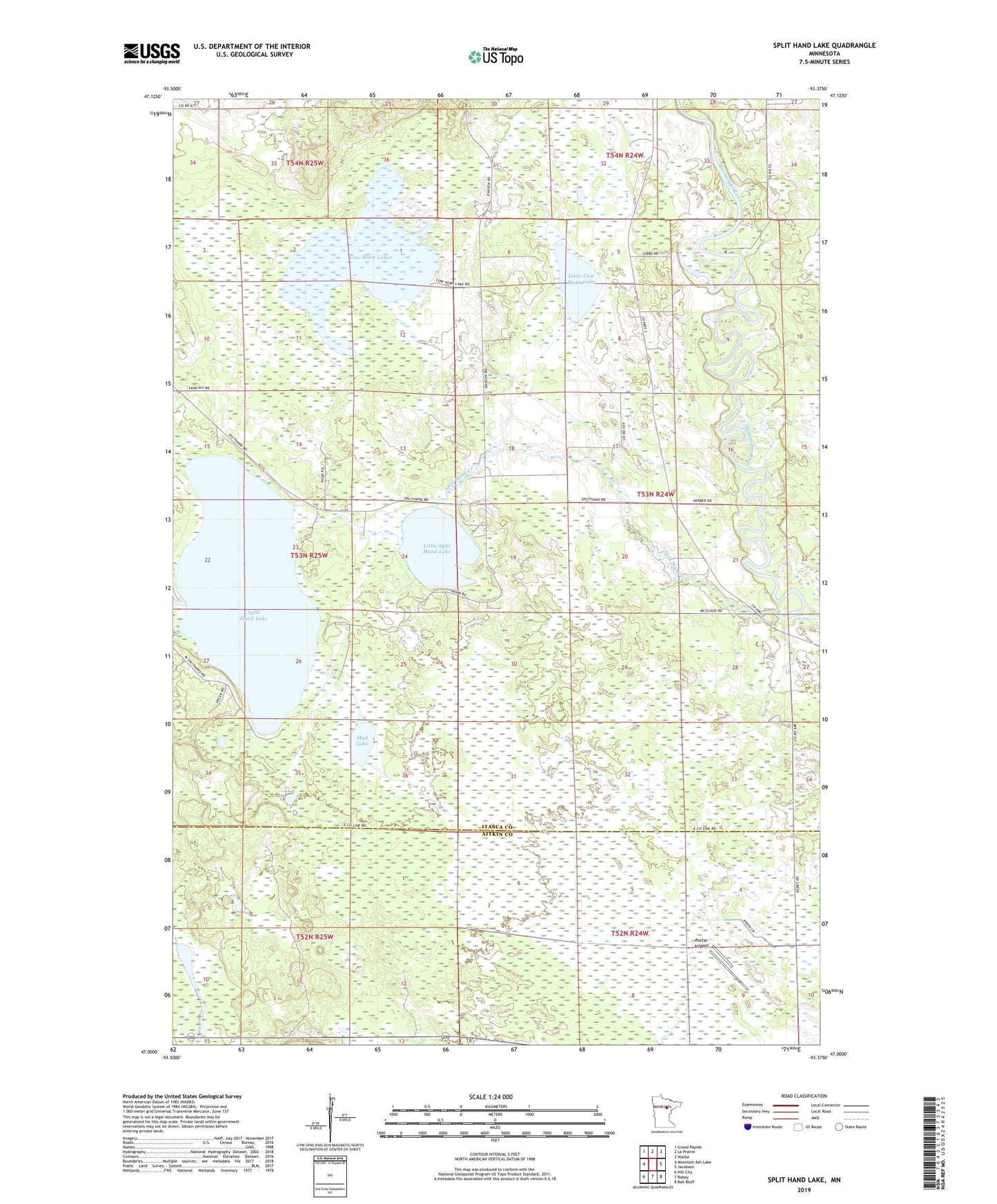
2022 topographic map quadrangle Split Hand Lake in the state of Minnesota. Scale: 1:24000. Based on the newly updated USGS 7.5' US Topo map series, this map is in the following counties: Itasca, Aitkin. The map contains contour data, water features, and other items you are used to seeing on USGS maps, but also has updated roads and other features. This is the next generation of topographic maps. Printed on high-quality waterproof paper with UV fade-resistant inks.
Quads adjacent to this one:
West: Mountain Ash Lake
Northwest: Grand Rapids
North: La Prairie
Northeast: Warba
East: Jacobson
Southeast: Ball Bluff
South: Rabey
Southwest: Hill City
This map covers the same area as the classic USGS quad with code o47093a4.
Contains the following named places: Cow Horn Lake, Golden Anniversary State Forest, Little Cow Horn Lake, Little Split Hand Lake, Little Splithand Lake, Little Splithand Lake Dam, Mud Lake, Porter Airport, Split Hand Creek, Split Hand Lake, Splithand Baptist Church, Splithand Lake Dam, Splithand Post Office, Township of Splithand