MyTopo
Bass Creek Minnesota US Topo Map
Couldn't load pickup availability
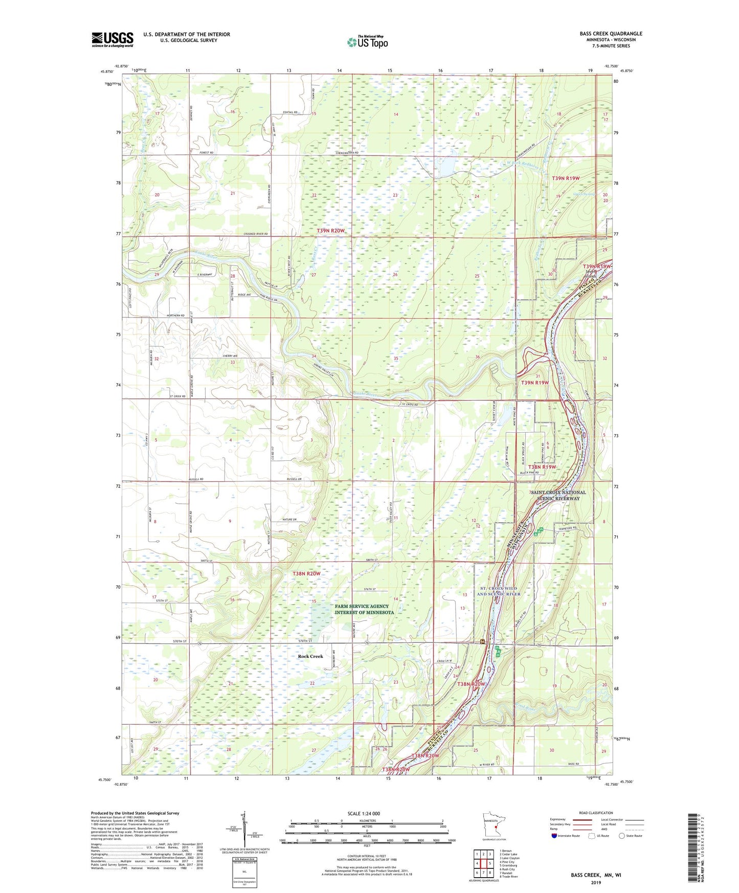
2019 topographic map quadrangle Bass Creek in the states of Minnesota, Wisconsin. Scale: 1:24000. Based on the newly updated USGS 7.5' US Topo map series, this map is in the following counties: Pine, Burnett. The map contains contour data, water features, and other items you are used to seeing on USGS maps, but also has updated roads and other features. This is the next generation of topographic maps. Printed on high-quality waterproof paper with UV fade-resistant inks.
Quads adjacent to this one:
West: Pine City
Northwest: Beroun
North: Cedar Lake
Northeast: Lake Clayton
East: Grantsburg
Southeast: Trade River
South: Randall
Southwest: Rush City
Contains the following named places: Bass Creek, Chengwatanna Wildlife Structure Dam, Green Swamp, Long Meadows Lake, Milburn Church, Raspberry Landing, Redhorse Creek, Saint Croix Pit, Sandrock Cliff Campground, School Number 1573, School Number 1580, School Number 1589, Seven Islands, Snake River, Snake River Campground, Snake River Landing, Soderbeck Landing, Township of Chengwatana, West Fork Redhorse Creek, Wood River