MyTopo
Trade River Wisconsin US Topo Map
Couldn't load pickup availability
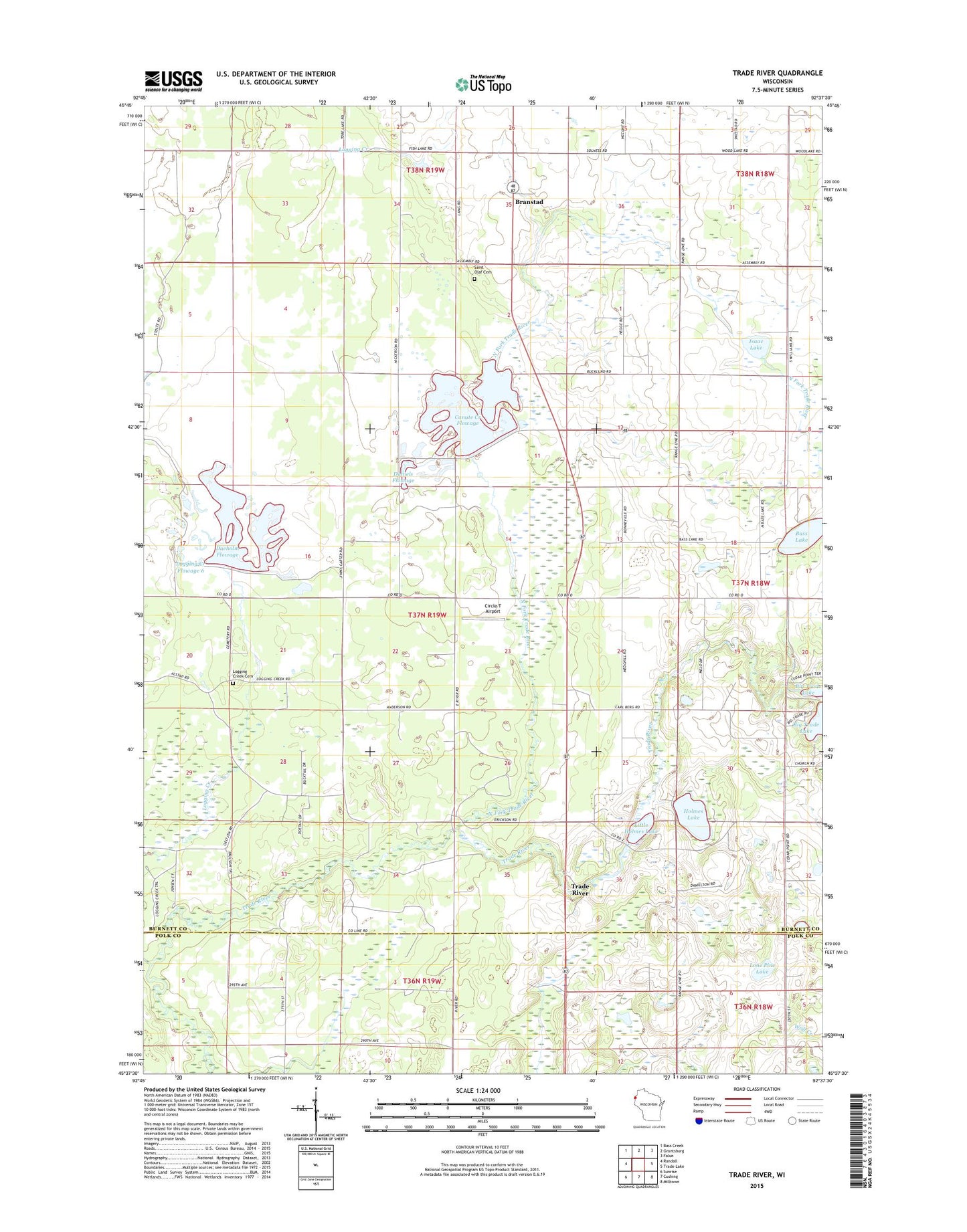
2022 topographic map quadrangle Trade River in the state of Wisconsin. Scale: 1:24000. Based on the newly updated USGS 7.5' US Topo map series, this map is in the following counties: Burnett, Polk. The map contains contour data, water features, and other items you are used to seeing on USGS maps, but also has updated roads and other features. This is the next generation of topographic maps. Printed on high-quality waterproof paper with UV fade-resistant inks.
Quads adjacent to this one:
West: Randall
Northwest: Bass Creek
North: Grantsburg
Northeast: Falun
East: Trade Lake
Southeast: Milltown
South: Cushing
Southwest: Sunrise
This map covers the same area as the classic USGS quad with code o45092f6.
Contains the following named places: Anderson Townhall, Bass Lake, Bethany Church, Branstad, Branstad School, Canute Creek Flowage, Circle T Airport, Daniels Flowage, Dueholm Flowage, Fish Lake Canute Flowage G12.410 Dam, Fish Lake Pines State Natural Area, Fish Lake State Wildlife Area, Grettum School, Holmes Lake, Holmes Lake Orchard, Isaac Lake, Little Holmes Lake, Logging Creek, Logging Creek Cemetery, Logging Creek Dike H12.395 Dam, Logging Creek Flowage 6, Lone Pine Lake, North Fork Trade River, Saint Olaf Cemetery, Trade River, Trade River School, Wood River School