MyTopo
Belle Plaine South Minnesota US Topo Map
Couldn't load pickup availability
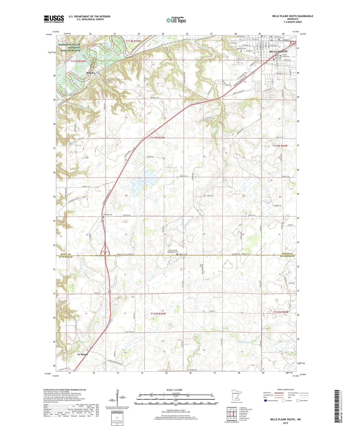
2019 topographic map quadrangle Belle Plaine South in the state of Minnesota. Scale: 1:24000. Based on the newly updated USGS 7.5' US Topo map series, this map is in the following counties: Scott, Le Sueur, Sibley. The map contains contour data, water features, and other items you are used to seeing on USGS maps, but also has updated roads and other features. This is the next generation of topographic maps. Printed on high-quality waterproof paper with UV fade-resistant inks.
Quads adjacent to this one:
West: Henderson
Northwest: Hamburg
North: Belle Plaine North
Northeast: Jordan West
East: Union Hill
Southeast: Le Center
South: Saint Thomas
Southwest: Le Sueur
Contains the following named places: Belle Plaine, Belle Plaine Fire Department, Belle Plaine Junior High School, Belle Plaine Police Department, Belle Plaine Post Office, Belle Plaine Public Library, Belle Plaine Senior High School, Big Possum Creek, Blakeley, Blakeley Post Office, Chatfield Elementary School, Church of the Redeemer, Church of the Transfiguration Protestant Episcopal Cemetery, City of Belle Plaine, Clark Lake, Early Childhood Program, Emma Krumbee's Apple Orchard, First Presbyterian Church, Judicial Ditch Number Four, Judicial Ditch Number Two, Mahoney State Wildlife Management Area, Minnesota River Valley Special Education Cooperative, Nagel and Schultz Airport, Oak Crest Elementary School, Oakwood Cemetery, Our Lady of the Prairie Catholic School, Our Lady of the Prairie Church, Prairie Park, Redeemer Lutheran Cemetery, River Rock Church, Sacred Heart Cemetery, Saint Johns Lutheran Church, Saints Peter and Paul Cemetery, Schlegel Cemetery, Southern Metro Medical Clinic, Township of Blakeley, Township of Tyrone, Trinity Lutheran Church, Trinity Lutheran School, Valley View Golf Club, ZIP Code: 56011