MyTopo
Belle Plaine North Minnesota US Topo Map
Couldn't load pickup availability
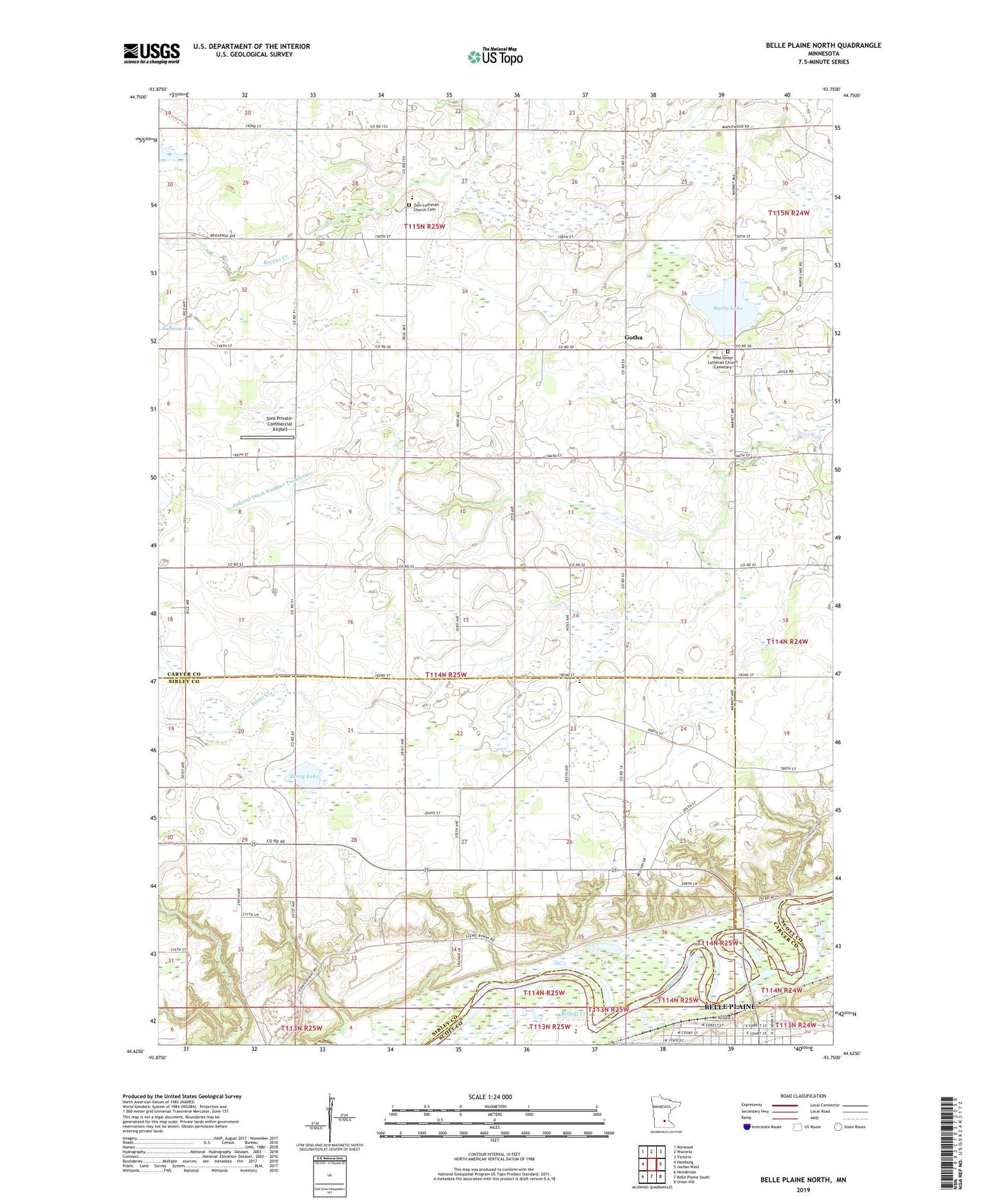
2022 topographic map quadrangle Belle Plaine North in the state of Minnesota. Scale: 1:24000. Based on the newly updated USGS 7.5' US Topo map series, this map is in the following counties: Carver, Sibley, Scott. The map contains contour data, water features, and other items you are used to seeing on USGS maps, but also has updated roads and other features. This is the next generation of topographic maps. Printed on high-quality waterproof paper with UV fade-resistant inks.
Quads adjacent to this one:
West: Hamburg
Northwest: Norwood
North: Waconia
Northeast: Victoria
East: Jordan West
Southeast: Union Hill
South: Belle Plaine South
Southwest: Henderson
This map covers the same area as the classic USGS quad with code o44093f7.
Contains the following named places: A R S Sport Strip, Bachman Lake, Belle Plaine, Faxon Marsh State Wildlife Management Area, Fountain Park, Gotha, Gotha Post Office, Judicial Ditch Number Twentyone, Judicial Ditch Number Twentytwo, Kerry Lake, Maria Lake, Robert Creek, Saint Johns Church, School Number 24, Sons Private-Commercial Airport, Township of Faxon, Township of Hancock, Valley View Terrace, West Union Church, West Union Lutheran Church and Cemetery, Zion Church, Zion Lutheran Church Cemetery, Zion Lutheran School