MyTopo
Union Hill Minnesota US Topo Map
Couldn't load pickup availability
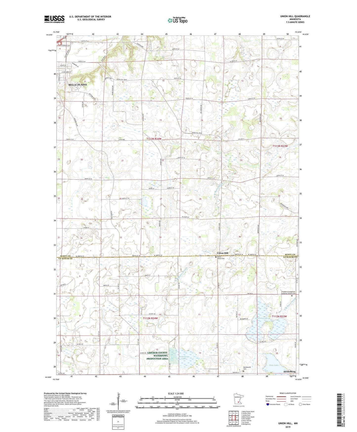
2022 topographic map quadrangle Union Hill in the state of Minnesota. Scale: 1:24000. Based on the newly updated USGS 7.5' US Topo map series, this map is in the following counties: Scott, Le Sueur. The map contains contour data, water features, and other items you are used to seeing on USGS maps, but also has updated roads and other features. This is the next generation of topographic maps. Printed on high-quality waterproof paper with UV fade-resistant inks.
Quads adjacent to this one:
West: Belle Plaine South
Northwest: Belle Plaine North
North: Jordan West
Northeast: Jordan East
East: New Prague
Southeast: Montgomery
South: Le Center
Southwest: Saint Thomas
This map covers the same area as the classic USGS quad with code o44093e6.
Contains the following named places: County Ditch Number Ten, County Ditch Number Three, Frieden Church, Friedens Evangelical Lutheran Church Cemetery, Graham Lake, Karnitz State Wildlife Management Area, Michel State Wildlife Management Area, Pomeranian Cemetery, Raven Stream Post Office, Renneberg Lake, Saint Johns Cemetery, School Number 107, School Number 61, Tietz Lake, Township of Belle Plaine, Township of Derrynane, Union Hill, Union Hill Post Office