
MyTopo
Berner Minnesota US Topo Map
Couldn't load pickup availability
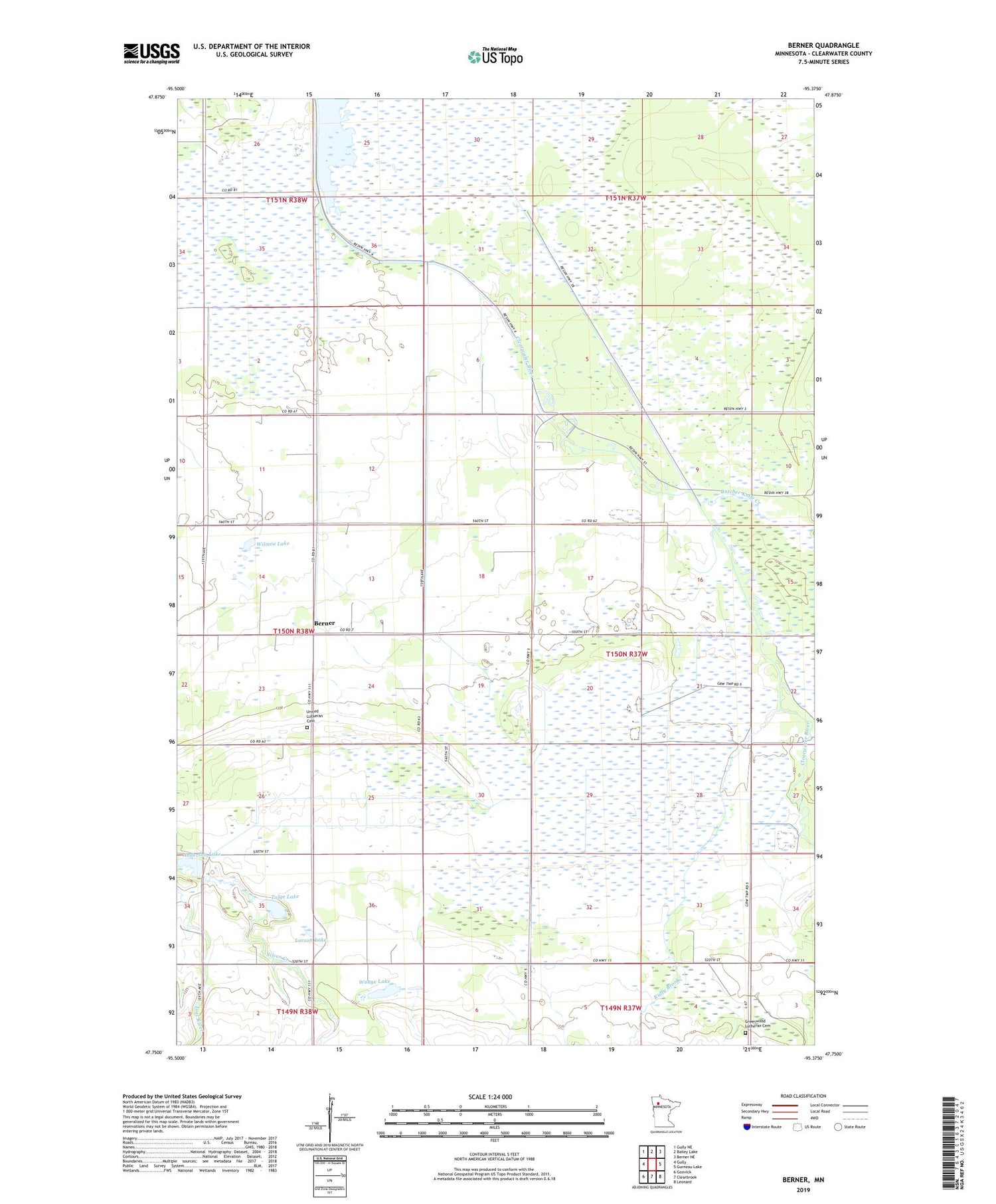
2019 topographic map quadrangle Berner in the state of Minnesota. Scale: 1:24000. Based on the newly updated USGS 7.5' US Topo map series, this map is in the following counties: Clearwater. The map contains contour data, water features, and other items you are used to seeing on USGS maps, but also has updated roads and other features. This is the next generation of topographic maps. Printed on high-quality waterproof paper with UV fade-resistant inks.
Quads adjacent to this one:
West: Gully
Northwest: Gully NE
North: Bailey Lake
Northeast: Berner NE
East: Gurneau Lake
Southeast: Leonard
South: Clearbrook
Southwest: Gonvick
Contains the following named places: Anderson Lake, Berner, Berner Post Office, Big Swamp, Big Swamp Dam, Butcher Knife Creek, Greenwood Lutheran Cemetery, Larson Lake, Meadows Post Office, Ruffy Brook, Silver Creek, Talge Lake, Township of Greenwood, United Lutheran Cemetery, Waage Lake, Wilmoe Lake, ZIP Code: 56644


