MyTopo
Clearbrook Minnesota US Topo Map
Couldn't load pickup availability
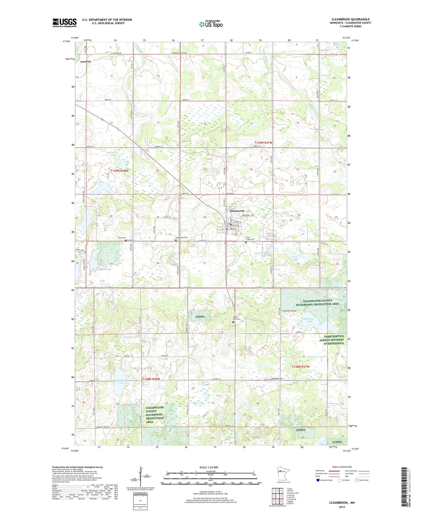
2022 topographic map quadrangle Clearbrook in the state of Minnesota. Scale: 1:24000. Based on the newly updated USGS 7.5' US Topo map series, this map is in the following counties: Clearwater. The map contains contour data, water features, and other items you are used to seeing on USGS maps, but also has updated roads and other features. This is the next generation of topographic maps. Printed on high-quality waterproof paper with UV fade-resistant inks.
Quads adjacent to this one:
West: Gonvick
Northwest: Gully
North: Berner
Northeast: Gurneau Lake
East: Leonard
Southeast: Shevlin
South: Bagley
Southwest: Fosston SE
This map covers the same area as the classic USGS quad with code o47095f4.
Contains the following named places: Augustana Cemetery, City of Clearbrook, Clearbrook, Clearbrook City Park Campground, Clearbrook Fire Department, Clearbrook Gonvick School, Clearbrook Police Department, Clearbrook Post Office, Clearwater Good Samaritan Center, Deep Lake, Elim Cemetery, Elim Lutheran Brethren Church, Erie Lake, First Baptist Church, Johnson Lake, Klongerbo Lake, Leon Post Office, Lindberg Lake, Maple Hill Cemetery, Peterson Lake, Silver Creek Cemetery, Steenerson Lake, Sterling Lake, Taflin Lake, The Church of Jesus Christ of Latter Day Saints, Township of Eddy, Township of Leon, ZIP Code: 56634