MyTopo
Big Cormorant Lake Minnesota US Topo Map
Couldn't load pickup availability
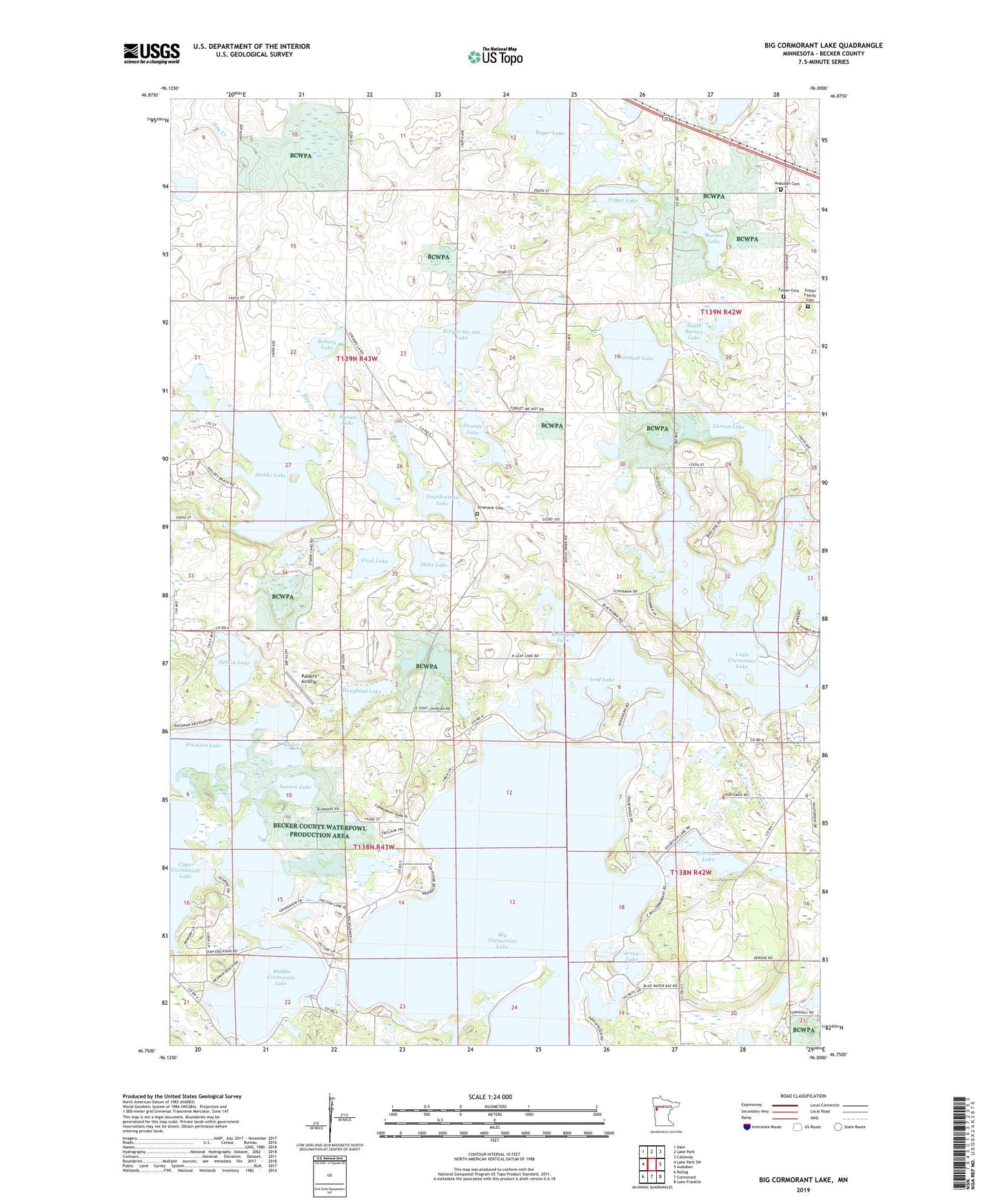
2022 topographic map quadrangle Big Cormorant Lake in the state of Minnesota. Scale: 1:24000. Based on the newly updated USGS 7.5' US Topo map series, this map is in the following counties: Becker. The map contains contour data, water features, and other items you are used to seeing on USGS maps, but also has updated roads and other features. This is the next generation of topographic maps. Printed on high-quality waterproof paper with UV fade-resistant inks.
Quads adjacent to this one:
West: Lake Park SW
Northwest: Dale
North: Lake Park
Northeast: Callaway
East: Audubon
Southeast: Lake Franklin
South: Cormorant
Southwest: Rollag
This map covers the same area as the classic USGS quad with code o46096g1.
Contains the following named places: Arrow Lake, Audubon Cemetery, Barnes Lake, Big Cormorant Lake, Boyer Lake, Camp Cormorant, Dahlberg Lake, Eilertson Lake, Engebretson Lake, Erickson Lake, Felker Cemetery, Felker Family Cemetery, Felker Lake, Forget-me-not Lake, Frisk Lake, Gilbertson Lake, Horan Lake, Hougland Lake, Kaiser's Airstrip, Larson Lake, Leaf Lake, Little Cormorant Lake, Marshall Lake, Marshall Lake Dam, Middle Cormorant Lake, Mollar Lake, Nelson Lake, North Shore Trailer Park, Orange Lake, Roberg Lake, Rose Haven Campground, South Barnes Lake, Stakke Lake, Strandvik Cemetery, Strandvik Church, Swanies Campground, Township of Cormorant, Township of Lake Park, West Lake