
MyTopo
Canby NW Minnesota US Topo Map
Couldn't load pickup availability
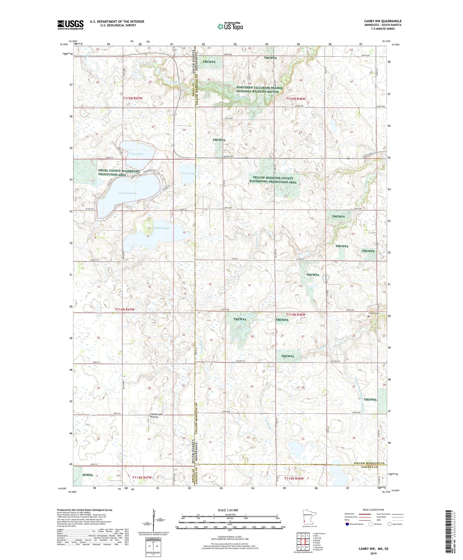
2019 topographic map quadrangle Canby NW in the states of Minnesota, South Dakota. Scale: 1:24000. Based on the newly updated USGS 7.5' US Topo map series, this map is in the following counties: Yellow Medicine, Deuel, Lincoln. The map contains contour data, water features, and other items you are used to seeing on USGS maps, but also has updated roads and other features. This is the next generation of topographic maps. Printed on high-quality waterproof paper with UV fade-resistant inks.
Quads adjacent to this one:
West: Brandt
Northwest: Lake Francis
North: Gary
Northeast: Gary SE
East: Canby
Southeast: Canby SE
South: Hendricks
Southwest: Astoria
Contains the following named places: Bohemian State Wildlife Management Area, Cobb Creek, County Ditch Number Fiftyfive, Culver Lake, Deuel Post Office, Fortier Cemetery, Lake Cochrane, Lake Oliver, Minn-Kota State Wildlife Management Area, Penthole State Wildlife Management Area, School Number 11, Sioux Nation State Wildlife Management Area, South Slough, State Line Wayside Park, Stone Hill, Township of Fortier


