MyTopo
Gary SE Minnesota US Topo Map
Couldn't load pickup availability
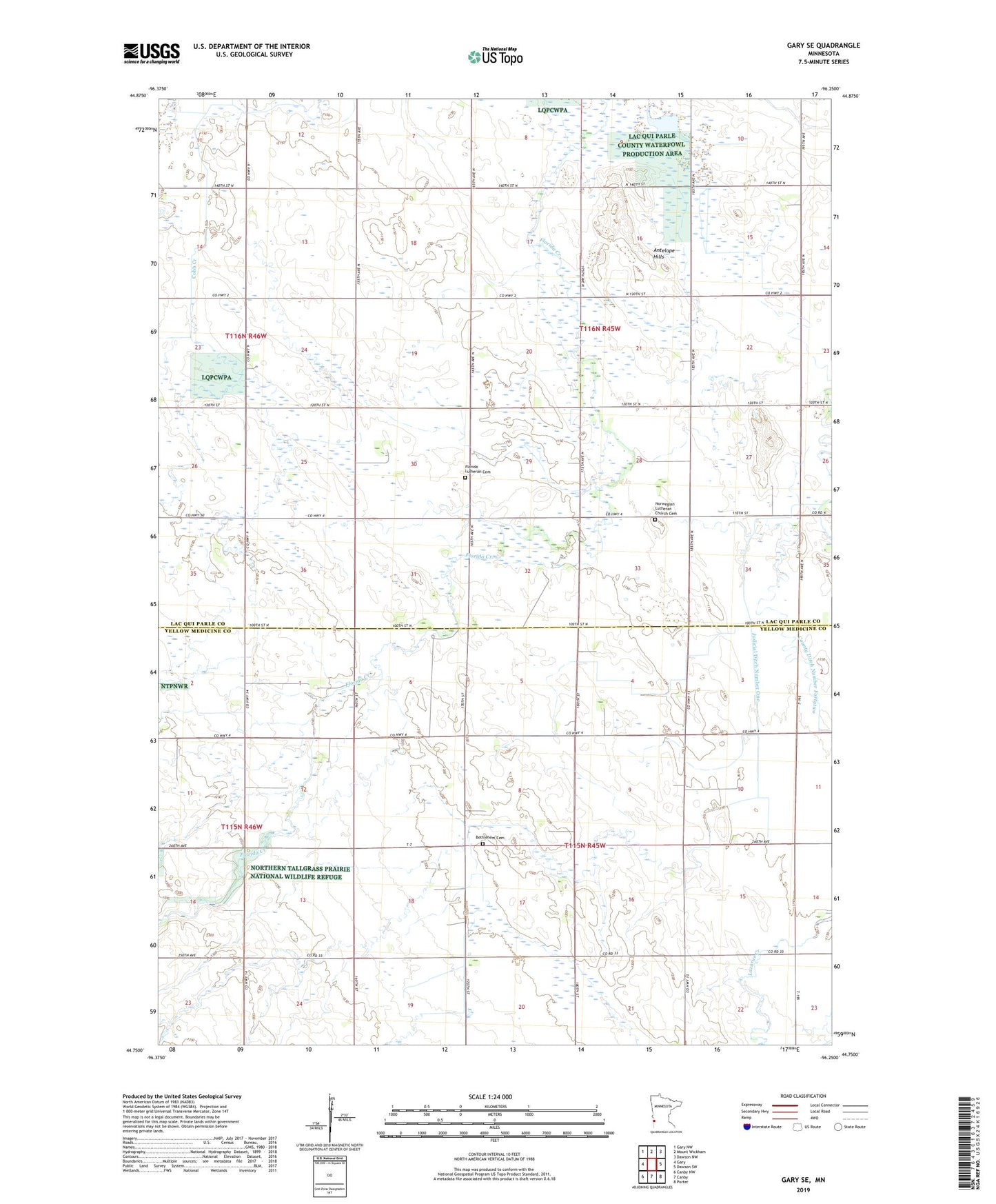
2022 topographic map quadrangle Gary SE in the state of Minnesota. Scale: 1:24000. Based on the newly updated USGS 7.5' US Topo map series, this map is in the following counties: Lac qui Parle, Yellow Medicine. The map contains contour data, water features, and other items you are used to seeing on USGS maps, but also has updated roads and other features. This is the next generation of topographic maps. Printed on high-quality waterproof paper with UV fade-resistant inks.
Quads adjacent to this one:
West: Gary
Northwest: Gary NW
North: Mount Wickham
Northeast: Dawson NW
East: Dawson SW
Southeast: Porter
South: Canby
Southwest: Canby NW
This map covers the same area as the classic USGS quad with code o44096g3.
Contains the following named places: Antelope Hills, Bethlehem Cemetery, County Ditch Number Fortytwo, Florida Church, Florida Lutheran Cemetery, Judicial Ditch Number One, Norwegian Lutheran Church Cemetery, Township of Freeland, Township of Hammer