MyTopo
Canby Minnesota US Topo Map
Couldn't load pickup availability
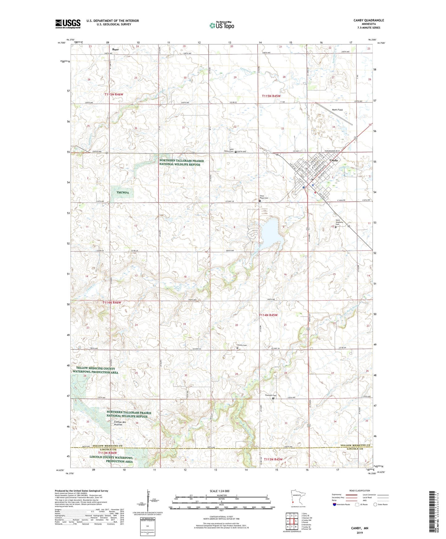
2022 topographic map quadrangle Canby in the state of Minnesota. Scale: 1:24000. Based on the newly updated USGS 7.5' US Topo map series, this map is in the following counties: Yellow Medicine, Lincoln. The map contains contour data, water features, and other items you are used to seeing on USGS maps, but also has updated roads and other features. This is the next generation of topographic maps. Printed on high-quality waterproof paper with UV fade-resistant inks.
Quads adjacent to this one:
West: Canby NW
Northwest: Gary
North: Gary SE
Northeast: Dawson SW
East: Porter
Southeast: Porter SW
South: Canby SE
Southwest: Hendricks
This map covers the same area as the classic USGS quad with code o44096f3.
Contains the following named places: Burr, Burr Post Office, Canby, Canby Elementary School, Canby Fire Department, Canby Golf Club, Canby Hospital, Canby Junior-Senior High School, Canby Lake, Canby Lake Dam, Canby Police Department, Canby Post Office, Canby Public Library, Canby Triangle Park Campground, City of Canby, First Baptist Church of Canby, Full Gospel Assembly, Lake Sylvan, Minnesota West Community College, Myers Field, Nicolai Lutheran Church, Our Saviour's Lutheran Church, Presbyterian Church, Saint Pauls Cemetery, Saint Peter Elementary School, Saint Peter's Catholic Church, Saint Peters Cemetery, Saint Stephens Cemetery, Sanford Canby Ambulance, Sanford Canby Medical Center, Senior Haven Nursing Home, Swenson Cemetery, Township of Norman, Trinity Cemetery, ZIP Code: 56220