MyTopo
Cedar Mills Minnesota US Topo Map
Couldn't load pickup availability
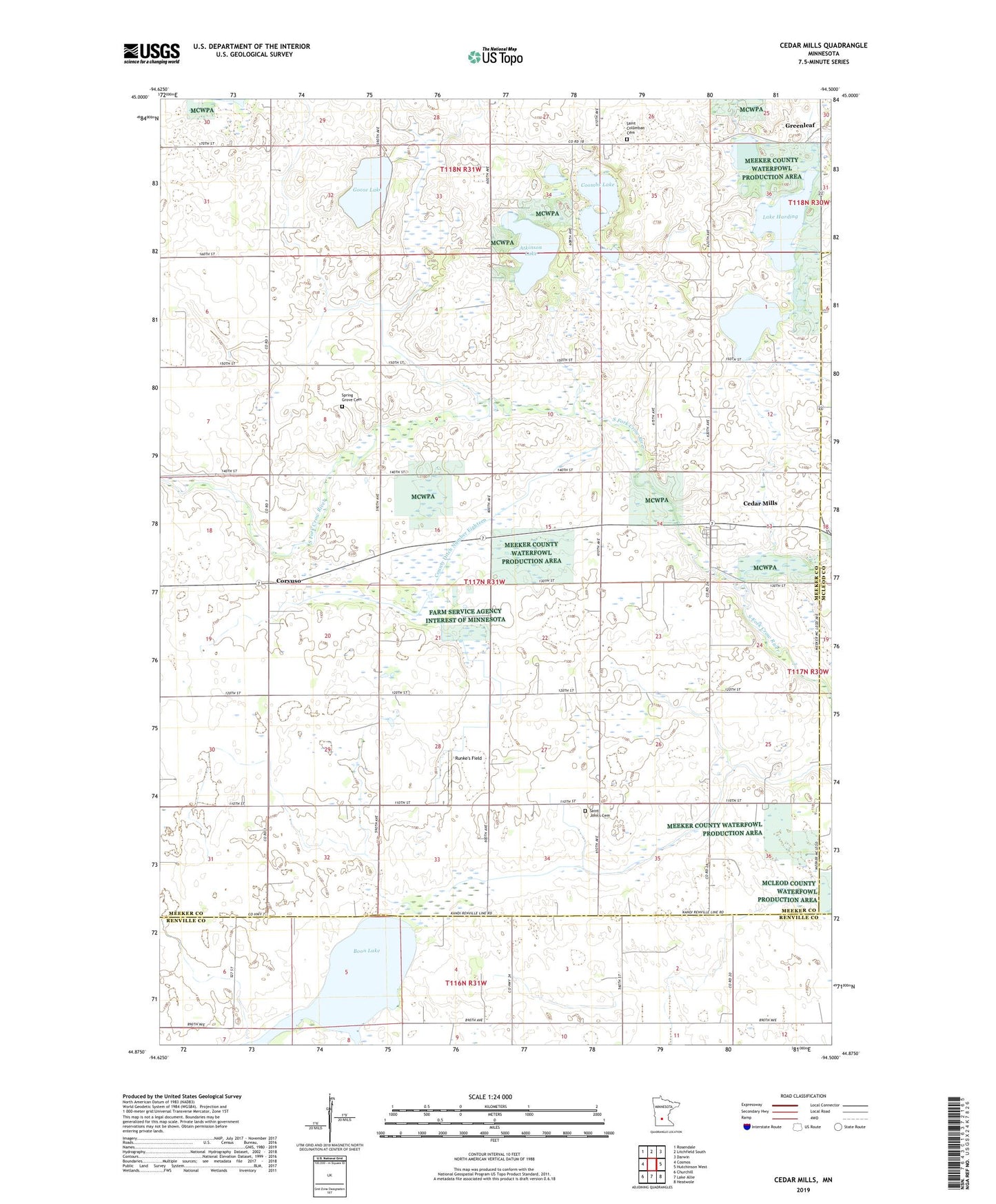
2022 topographic map quadrangle Cedar Mills in the state of Minnesota. Scale: 1:24000. Based on the newly updated USGS 7.5' US Topo map series, this map is in the following counties: Meeker, Renville, McLeod. The map contains contour data, water features, and other items you are used to seeing on USGS maps, but also has updated roads and other features. This is the next generation of topographic maps. Printed on high-quality waterproof paper with UV fade-resistant inks.
Quads adjacent to this one:
West: Cosmos
Northwest: Rosendale
North: Litchfield South
Northeast: Darwin
East: Hutchinson West
Southeast: Heatwole
South: Lake Allie
Southwest: Churchill
This map covers the same area as the classic USGS quad with code o44094h5.
Contains the following named places: Atkinson Lake, Boon Lake, Cedar Mills, Cedar Mills Post Office, City of Cedar Mills, Coombs Lake, Corvuso, Corvuso Post Office, County Ditch Number Eighteen, Goose Lake, Greenleaf State Wildlife Management Area, Hoff Lake, Kaping Farms, Lake Harding, Peterson Farms, Pipe Lake, Pipe Lake School, Runke's Field, Saint Columban Cemetery, Saint Columban Church, Saint John's Cemetery, Saint Johns Church, Saint Johns School, School Number 1118, Spring Grove Cemetery, Spring Grove Church, Township of Cedar Mills