MyTopo
Chase Brook Minnesota US Topo Map
Couldn't load pickup availability
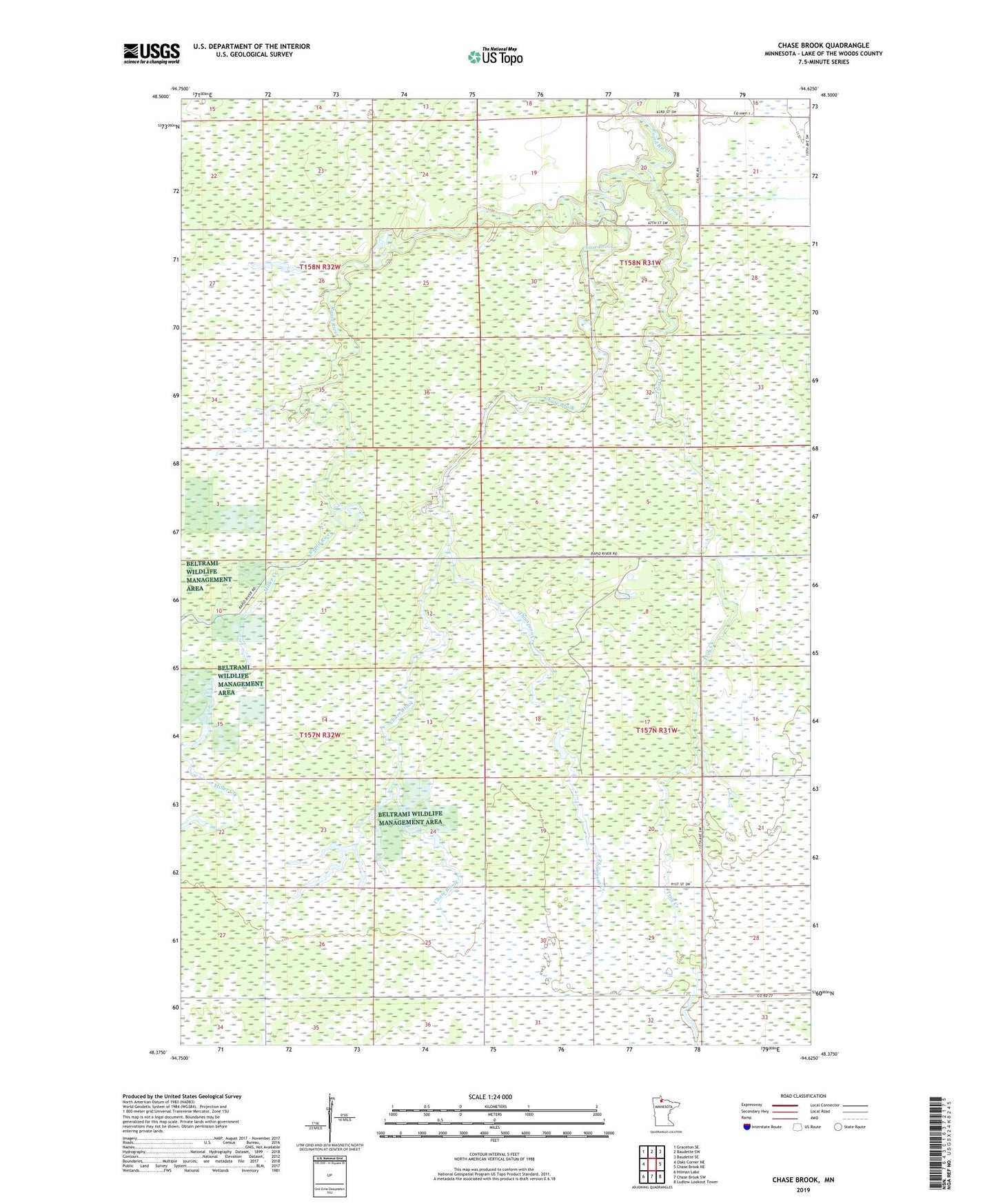
2022 topographic map quadrangle Chase Brook in the state of Minnesota. Scale: 1:24000. Based on the newly updated USGS 7.5' US Topo map series, this map is in the following counties: Lake of the Woods. The map contains contour data, water features, and other items you are used to seeing on USGS maps, but also has updated roads and other features. This is the next generation of topographic maps. Printed on high-quality waterproof paper with UV fade-resistant inks.
Quads adjacent to this one:
West: Oaks Corner NE
Northwest: Graceton SE
North: Baudette SW
Northeast: Baudette SE
East: Chase Brook NE
Southeast: Ludlow Lookout Tower
South: Chase Brook SW
Southwest: Hilman Lake
This map covers the same area as the classic USGS quad with code o48094d6.
Contains the following named places: Chase Brook, Lovedale Post Office, Miller Creek, Rako Post Office, Thompson Creek, Township of Swiftwater, Troy Creek