MyTopo
Clontarf North Minnesota US Topo Map
Couldn't load pickup availability
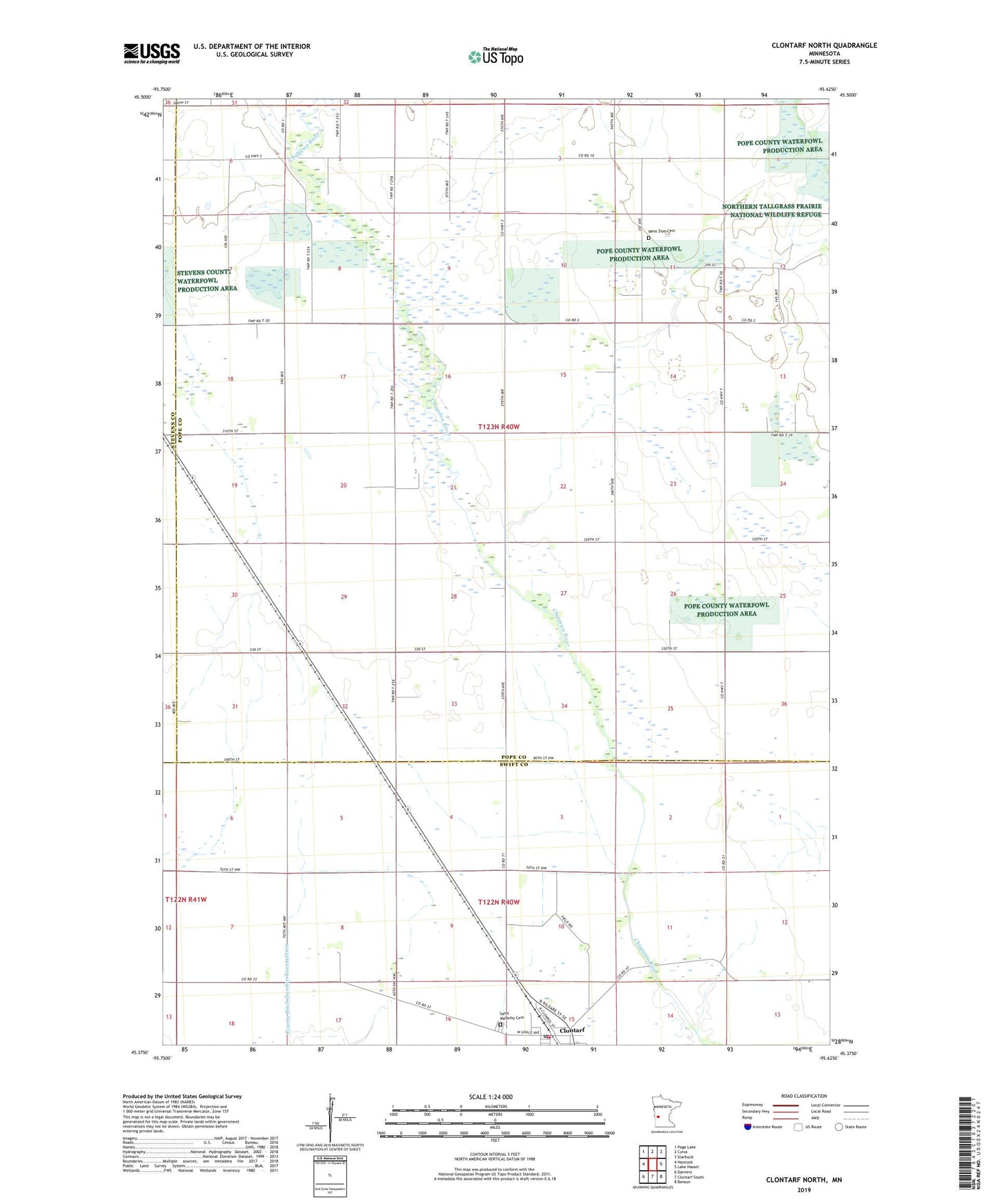
2022 topographic map quadrangle Clontarf North in the state of Minnesota. Scale: 1:24000. Based on the newly updated USGS 7.5' US Topo map series, this map is in the following counties: Pope, Swift, Stevens. The map contains contour data, water features, and other items you are used to seeing on USGS maps, but also has updated roads and other features. This is the next generation of topographic maps. Printed on high-quality waterproof paper with UV fade-resistant inks.
Quads adjacent to this one:
West: Hancock
Northwest: Page Lake
North: Cyrus
Northeast: Starbuck
East: Lake Hassel
Southeast: Benson
South: Clontarf South
Southwest: Danvers
This map covers the same area as the classic USGS quad with code o45095d6.
Contains the following named places: City of Clontarf, Clontarf, Clontarf Fire Department, Clontarf Post Office, County Ditch Number Twentythree, Saint Malachy Cemetery, Township of Hoff, West Zion Cemetery, West Zion Church, ZIP Code: 56226