MyTopo
Cranberry Bay Minnesota US Topo Map
Couldn't load pickup availability
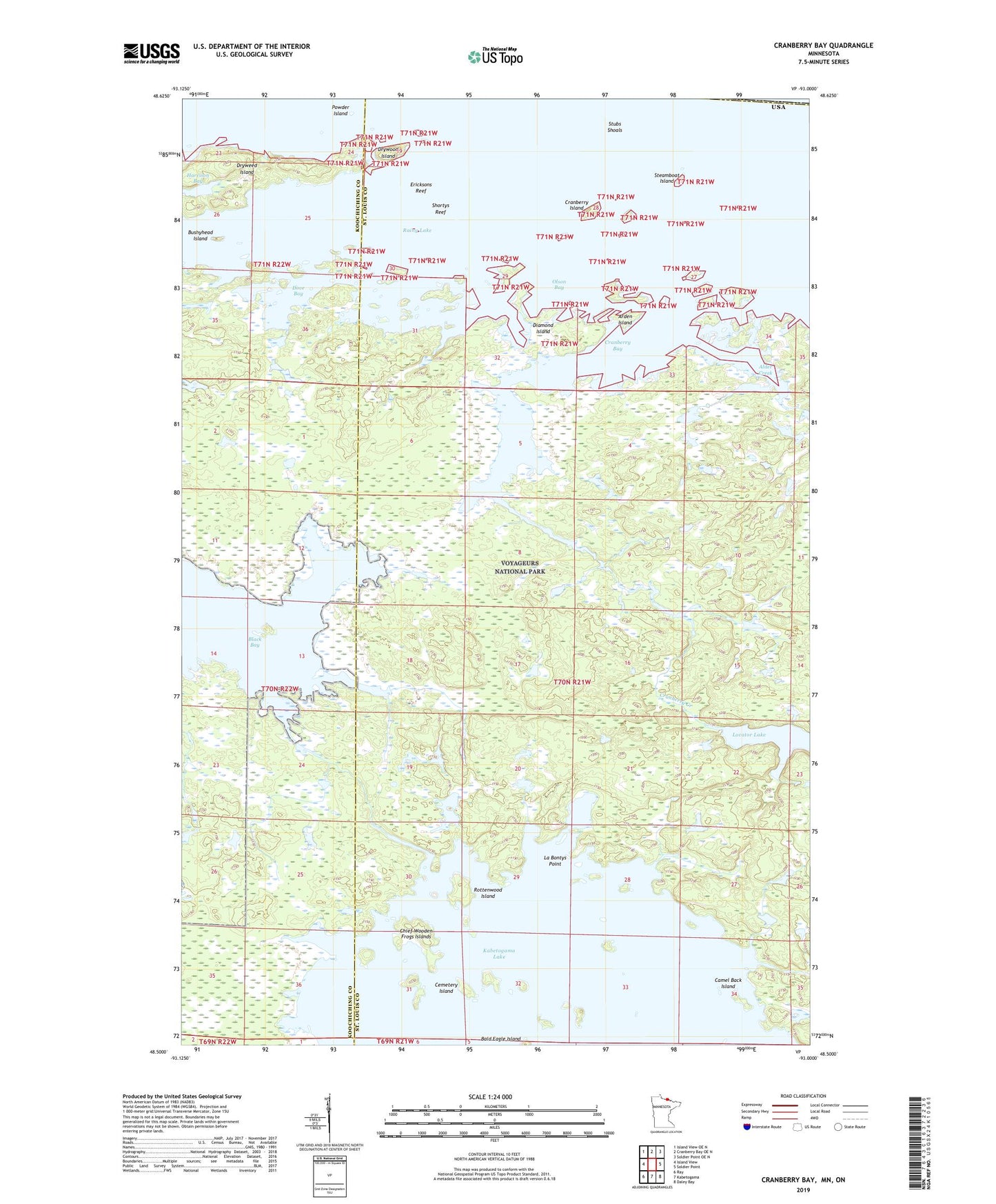
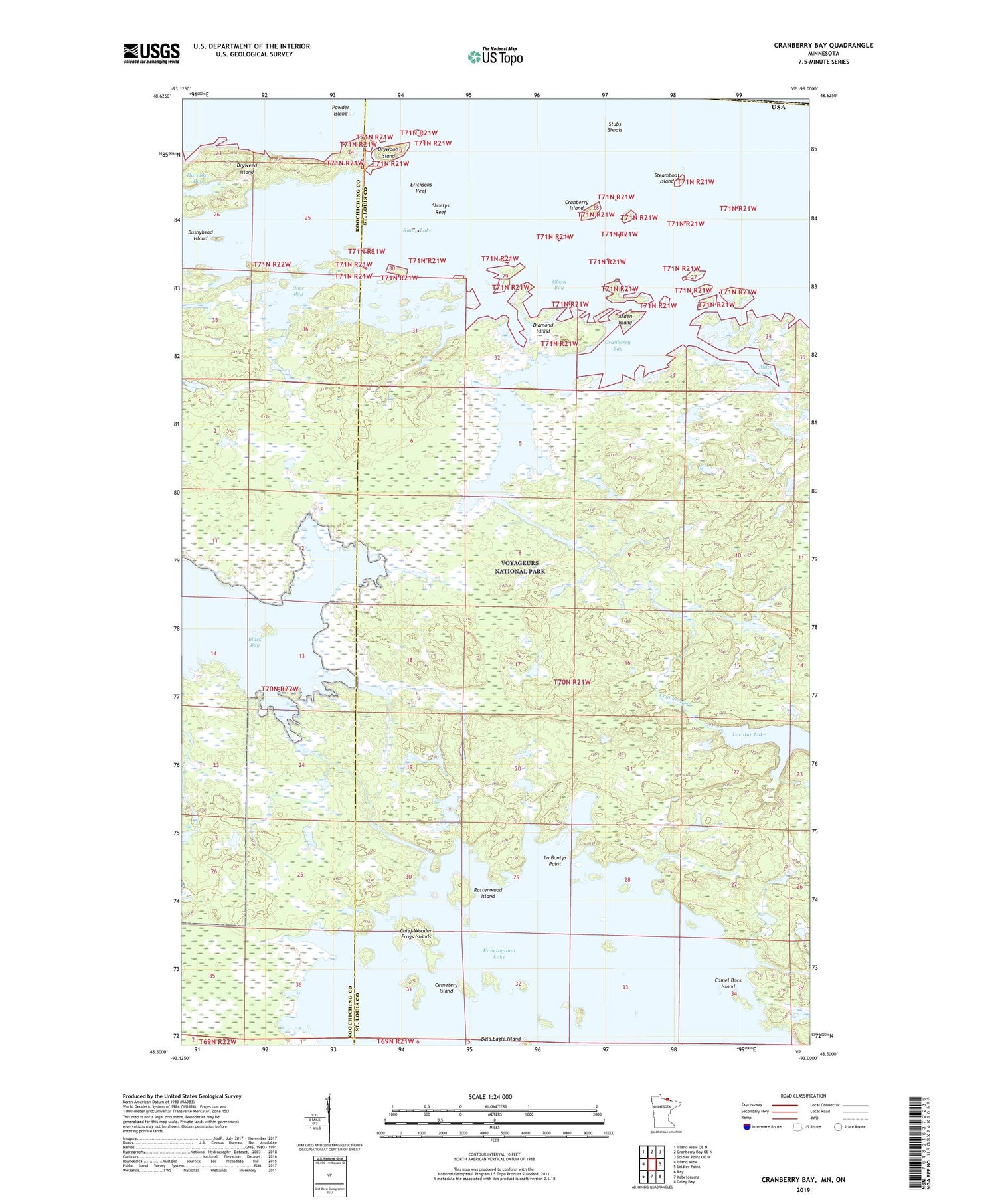
2019 topographic map quadrangle Cranberry Bay in the state of Minnesota. Scale: 1:24000. Based on the newly updated USGS 7.5' US Topo map series, this map is in the following counties: St. Louis, Koochiching. The map contains contour data, water features, and other items you are used to seeing on USGS maps, but also has updated roads and other features. This is the next generation of topographic maps. Printed on high-quality waterproof paper with UV fade-resistant inks.
Quads adjacent to this one:
West: Island View
Northwest: Island View OE N
North: Cranberry Bay OE N
Northeast: Soldier Point OE N
East: Soldier Point
Southeast: Daley Bay
South: Kabetogama
Southwest: Ray
Contains the following named places: Alder Creek, Arden Island, Bald Eagle Island, Bushyhead Island, Camel Back Island, Cemetery Island, Chief Wooden Frogs Islands, Cranberry Bay, Cranberry Creek, Cranberry Island, Diamond Island, Dove Bay, Dryweed Island, Drywood Island, Ericksons Reef, Gold Portage, Gold Portage State Wildlife Management Area, La Bontys Point, Olson Bay, Powder Island, Rottenwood Island, Shortys Reef, Steamboat Island, Stubs Shoals, Sucker Creek