MyTopo
Soldier Point Minnesota US Topo Map
Couldn't load pickup availability
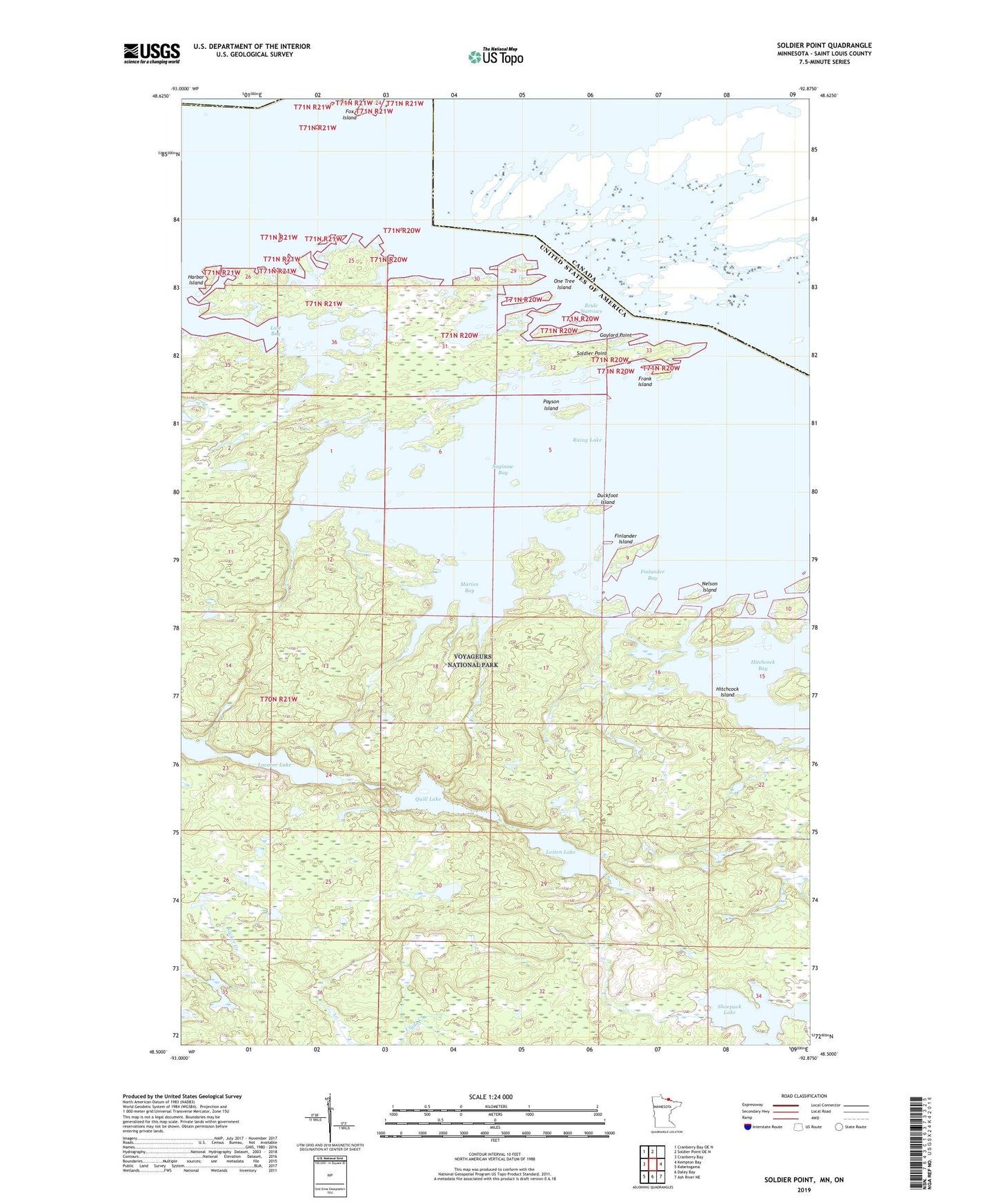
2022 topographic map quadrangle Soldier Point in the state of Minnesota. Scale: 1:24000. Based on the newly updated USGS 7.5' US Topo map series, this map is in the following counties: St. Louis. The map contains contour data, water features, and other items you are used to seeing on USGS maps, but also has updated roads and other features. This is the next generation of topographic maps. Printed on high-quality waterproof paper with UV fade-resistant inks.
Quads adjacent to this one:
West: Cranberry Bay
Northwest: Cranberry Bay OE N
North: Soldier Point OE N
East: Kempton Bay
Southeast: Ash River NE
South: Daley Bay
Southwest: Kabetogama
This map covers the same area as the classic USGS quad with code o48092e8.
Contains the following named places: Brule Narrows, Duckfoot Island, Finlander Bay, Finlander Island, Frank Island, Gaylord Point, Harbor Island, Hitchcock Bay, Hitchcock Island, Kawawia Island, Locator Lake, Loiten Lake, Lost Bay, Marion Bay, Nelson Island, One Tree Island, Payson Island, Quill Lake, Saginaw Bay, Shoepack Lake, Soldier Point, War Club Lake, ZIP Code: 56649