MyTopo
Cromwell East Minnesota US Topo Map
Couldn't load pickup availability
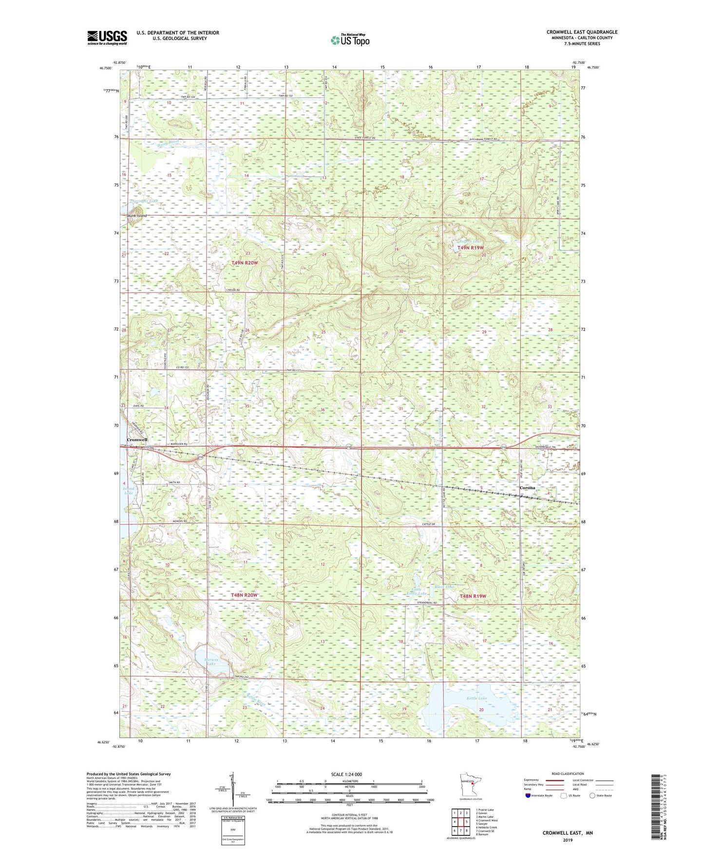
2019 topographic map quadrangle Cromwell East in the state of Minnesota. Scale: 1:24000. Based on the newly updated USGS 7.5' US Topo map series, this map is in the following counties: Carlton. The map contains contour data, water features, and other items you are used to seeing on USGS maps, but also has updated roads and other features. This is the next generation of topographic maps. Printed on high-quality waterproof paper with UV fade-resistant inks.
Quads adjacent to this one:
West: Cromwell West
Northwest: Prairie Lake
North: Gowan
Northeast: Martin Lake
East: Sawyer
Southeast: Barnum
South: Cromwell SE
Southwest: Heikkila Creek
Contains the following named places: Black Lake, City of Cromwell, Corona, Corona Post Office, County Ditch Number Two, Cromwell Lookout Tower, Fond du Lac State Forest, Island Lake Campgrounds, Island Lake Park, Kettle Lake, Kettle Lake State Wildlife Management Area, Little Kettle Lake, Mervin State Wildlife Management Area, Merwin Lake, Rogers Lake, Sawyer State Wildlife Management Area, Skunk Island, Springer Lake, Township of Eagle, Unorganized Territory of North Carlton, ZIP Code: 55726