MyTopo
Martin Lake Minnesota US Topo Map
Couldn't load pickup availability
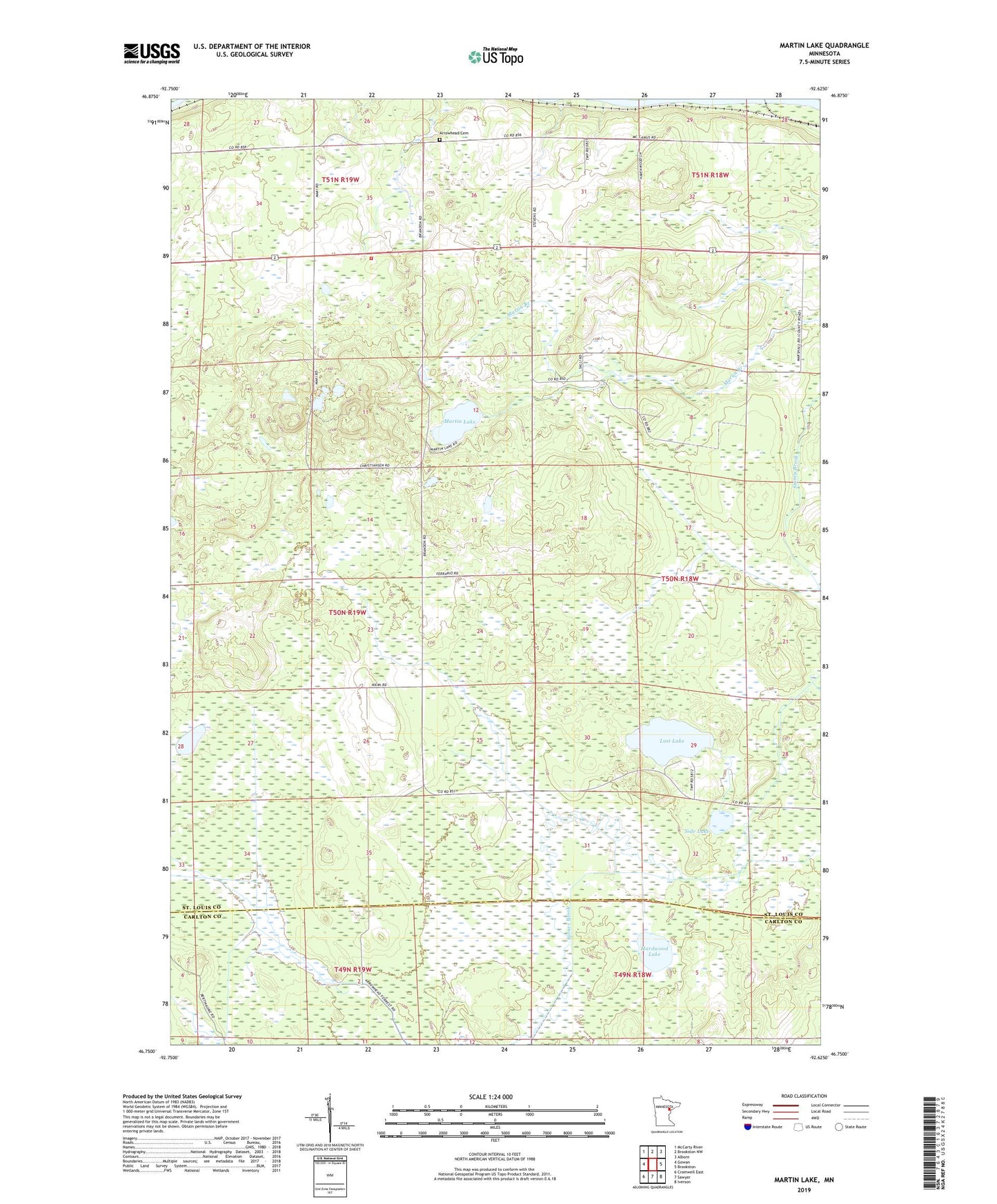
2022 topographic map quadrangle Martin Lake in the state of Minnesota. Scale: 1:24000. Based on the newly updated USGS 7.5' US Topo map series, this map is in the following counties: St. Louis, Carlton. The map contains contour data, water features, and other items you are used to seeing on USGS maps, but also has updated roads and other features. This is the next generation of topographic maps. Printed on high-quality waterproof paper with UV fade-resistant inks.
Quads adjacent to this one:
West: Gowan
Northwest: McCarty River
North: Brookston NW
Northeast: Alborn
East: Brookston
Southeast: Iverson
South: Sawyer
Southwest: Cromwell East
This map covers the same area as the classic USGS quad with code o46092g6.
Contains the following named places: Arrowhead Cemetery, Arrowhead Fire Department, Arrowhead Lookout Tower, Hardwood Lake, Lost Lake, Martin Lake, Side Lake, Township of Arrowhead, ZIP Code: 55711