MyTopo
Dalbo Minnesota US Topo Map
Couldn't load pickup availability
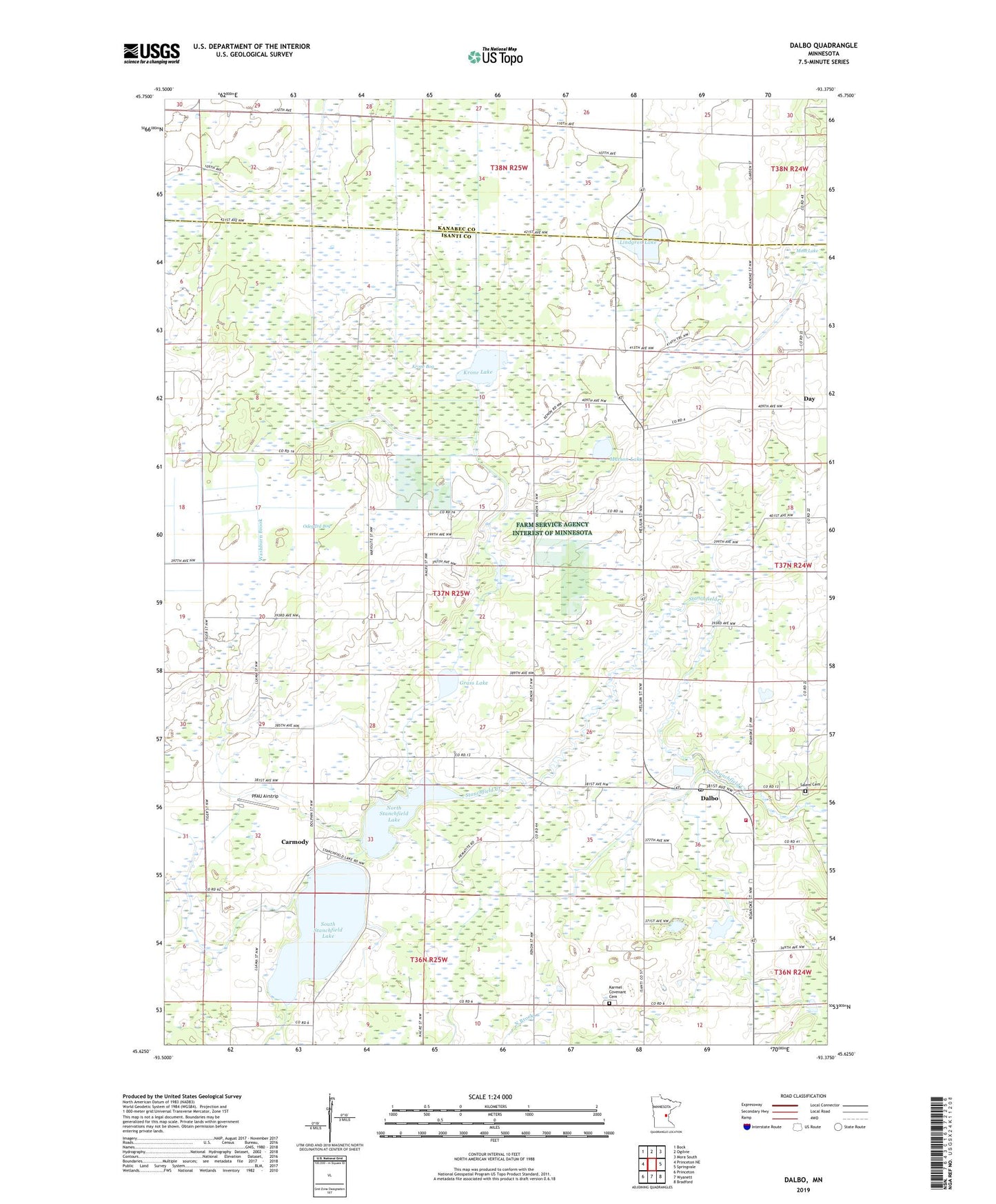
2019 topographic map quadrangle Dalbo in the state of Minnesota. Scale: 1:24000. Based on the newly updated USGS 7.5' US Topo map series, this map is in the following counties: Isanti, Kanabec. The map contains contour data, water features, and other items you are used to seeing on USGS maps, but also has updated roads and other features. This is the next generation of topographic maps. Printed on high-quality waterproof paper with UV fade-resistant inks.
Quads adjacent to this one:
West: Princeton NE
Northwest: Bock
North: Ogilvie
Northeast: Mora South
East: Springvale
Southeast: Bradford
South: Wyanett
Southwest: Princeton
Contains the following named places: Carmody, Carmody Post Office, Dalbo, Dalbo Baptist Church, Dalbo Fire Department, Dalbo Memorial Park, Dalbo Post Office, Dalbo Wildlife Management Area, Day, Day Post Office, Dobe Wildlife Management Area, Grass Lake, Hawthorne School, Karmel Church, Karmel Covenant Cemetery, Karmel School, Krone Bog, Krone Lake, Lewis Lake Church, Lincoln School, Lindgren Lake, Matson Lake, Moss Lake, North Stanchfield Lake, North Star School, Odegard Bog, PFAU Airstrip, Salem Church, Salem Lutheran Cemetery, South Stanchfield Lake, South Stanchfield Lake Dam, Stanchfield Lake, Township of Dalbo, West Lake, Whittier School, ZIP Code: 55017