MyTopo
Springvale Minnesota US Topo Map
Couldn't load pickup availability
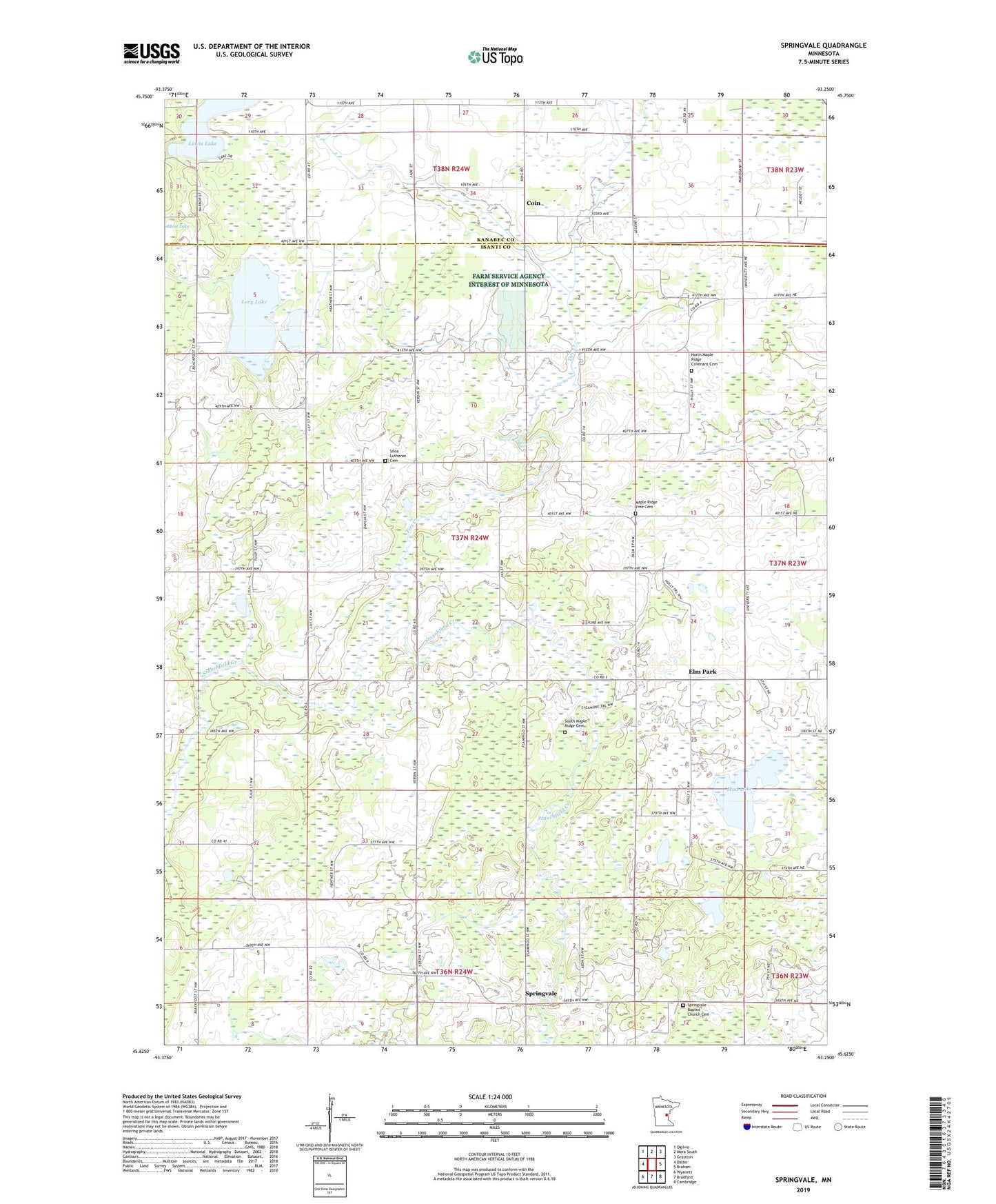
2022 topographic map quadrangle Springvale in the state of Minnesota. Scale: 1:24000. Based on the newly updated USGS 7.5' US Topo map series, this map is in the following counties: Isanti, Kanabec. The map contains contour data, water features, and other items you are used to seeing on USGS maps, but also has updated roads and other features. This is the next generation of topographic maps. Printed on high-quality waterproof paper with UV fade-resistant inks.
Quads adjacent to this one:
West: Dalbo
Northwest: Ogilvie
North: Mora South
Northeast: Grasston
East: Braham
Southeast: Cambridge
South: Bradford
Southwest: Wyanett
This map covers the same area as the classic USGS quad with code o45093f3.
Contains the following named places: Coin, Cranberry Wildlife Management Area, Day School, Elm Park, Elmpark Post Office, Franklin School, Grohnke Field, Hiawatha School, Lory Lake, Lory Lake Structure One Dam, Maple Ridge Church, Maple Ridge Free Cemetery, Mud Lake, North Maple Ridge Church, North Maple Ridge Covenant Cemetery, Pangerl Airport, Siloa Church, Siloa Lutheran Cemetery, South Maple Ridge Cemetery, South Maple Ridge Church, Spring Vale Post Office, Springvale, Springvale Baptist Church Cemetery, Springvale Campground, Springvale Church, Ties Creek, Township of Maple Ridge