MyTopo
Mora South Minnesota US Topo Map
Couldn't load pickup availability
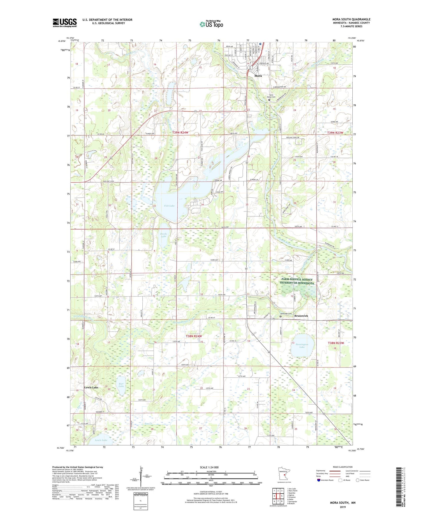
2022 topographic map quadrangle Mora South in the state of Minnesota. Scale: 1:24000. Based on the newly updated USGS 7.5' US Topo map series, this map is in the following counties: Kanabec. The map contains contour data, water features, and other items you are used to seeing on USGS maps, but also has updated roads and other features. This is the next generation of topographic maps. Printed on high-quality waterproof paper with UV fade-resistant inks.
Quads adjacent to this one:
West: Ogilvie
Northwest: Ann Lake
North: Mora North
Northeast: Quamba
East: Grasston
Southeast: Braham
South: Springvale
Southwest: Dalbo
This map covers the same area as the classic USGS quad with code o45093g3.
Contains the following named places: Ann River, Ann River Dam, Brunswick, Brunswick Church, Conley Field, Devils Lake, Ernest Linder Wildlife Pond Dam, Fish Lake, Fish Lake Church, Groundhouse River, Gus Herwig Dam, Gust Herwigs Fish Pond, Kanabec Hospital Heliport, Kent Lake, Lewis Lake, Monroe School, Mora Hospital, Pennington Lake, Rice Lake, Riverside Cemetery, Saint Marys Cemetery, Spring Brook, Tosher Creek State Wildlife Management Area, Township of Arthur, Township of Brunswick