
MyTopo
Dorothy Minnesota US Topo Map
Couldn't load pickup availability
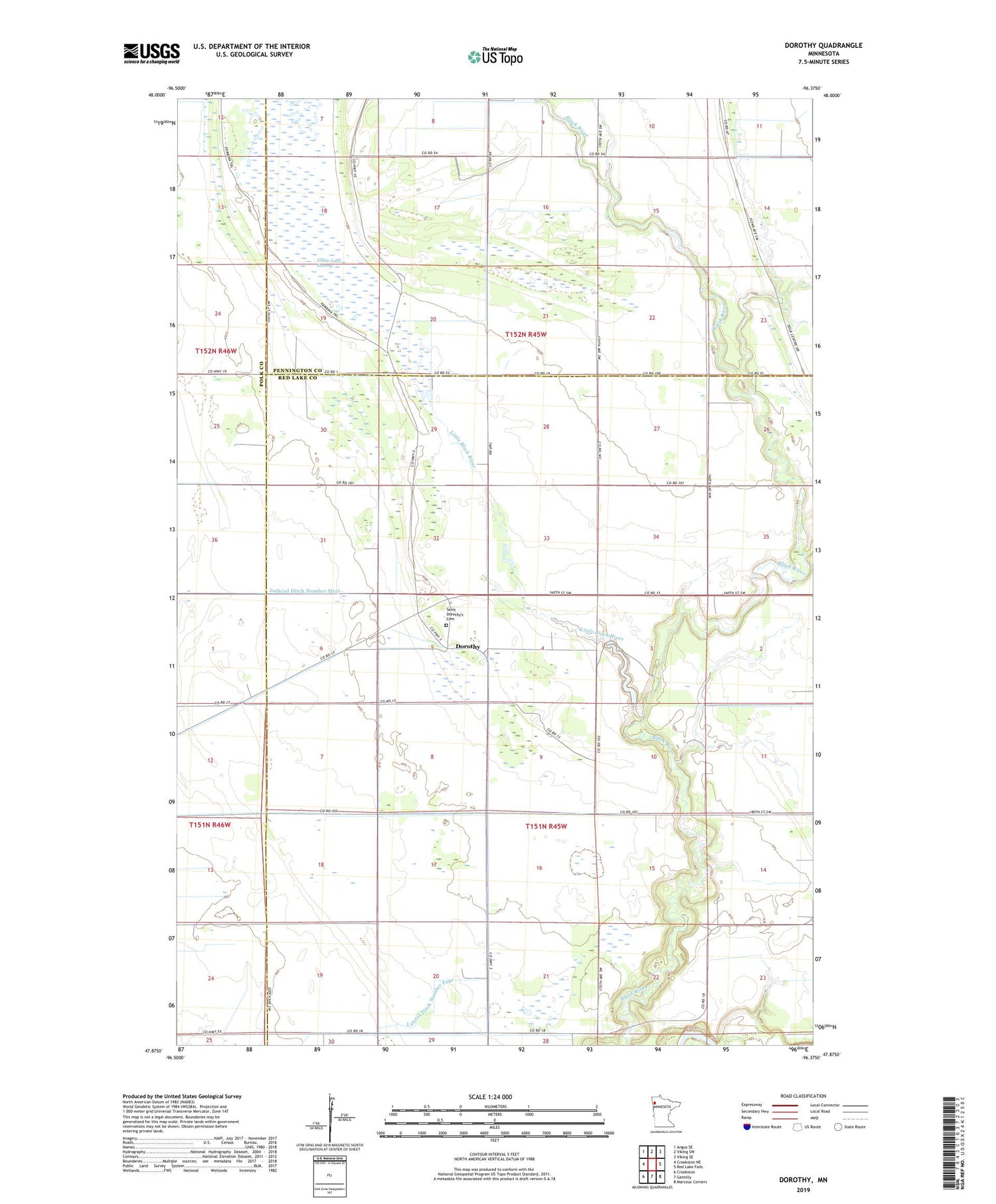
2019 topographic map quadrangle Dorothy in the state of Minnesota. Scale: 1:24000. Based on the newly updated USGS 7.5' US Topo map series, this map is in the following counties: Red Lake, Pennington, Polk. The map contains contour data, water features, and other items you are used to seeing on USGS maps, but also has updated roads and other features. This is the next generation of topographic maps. Printed on high-quality waterproof paper with UV fade-resistant inks.
Quads adjacent to this one:
West: Crookston NE
Northwest: Angus SE
North: Viking SW
Northeast: Viking SE
East: Red Lake Falls
Southeast: Marcoux Corners
South: Gentilly
Southwest: Crookston
Contains the following named places: Black River School, Browns Creek, Dorothy, Dorothy Post Office, Harding School, Lateral Ditch Number Four, Little Black River, Moran State Wildlife Management Area, Saint Dorothy's Cemetery, Saint Dorothys Church, Township of Louisville, Township of Polk Centre, Township of Wylie, Woodland School


