MyTopo
Crookston NE Minnesota US Topo Map
Couldn't load pickup availability
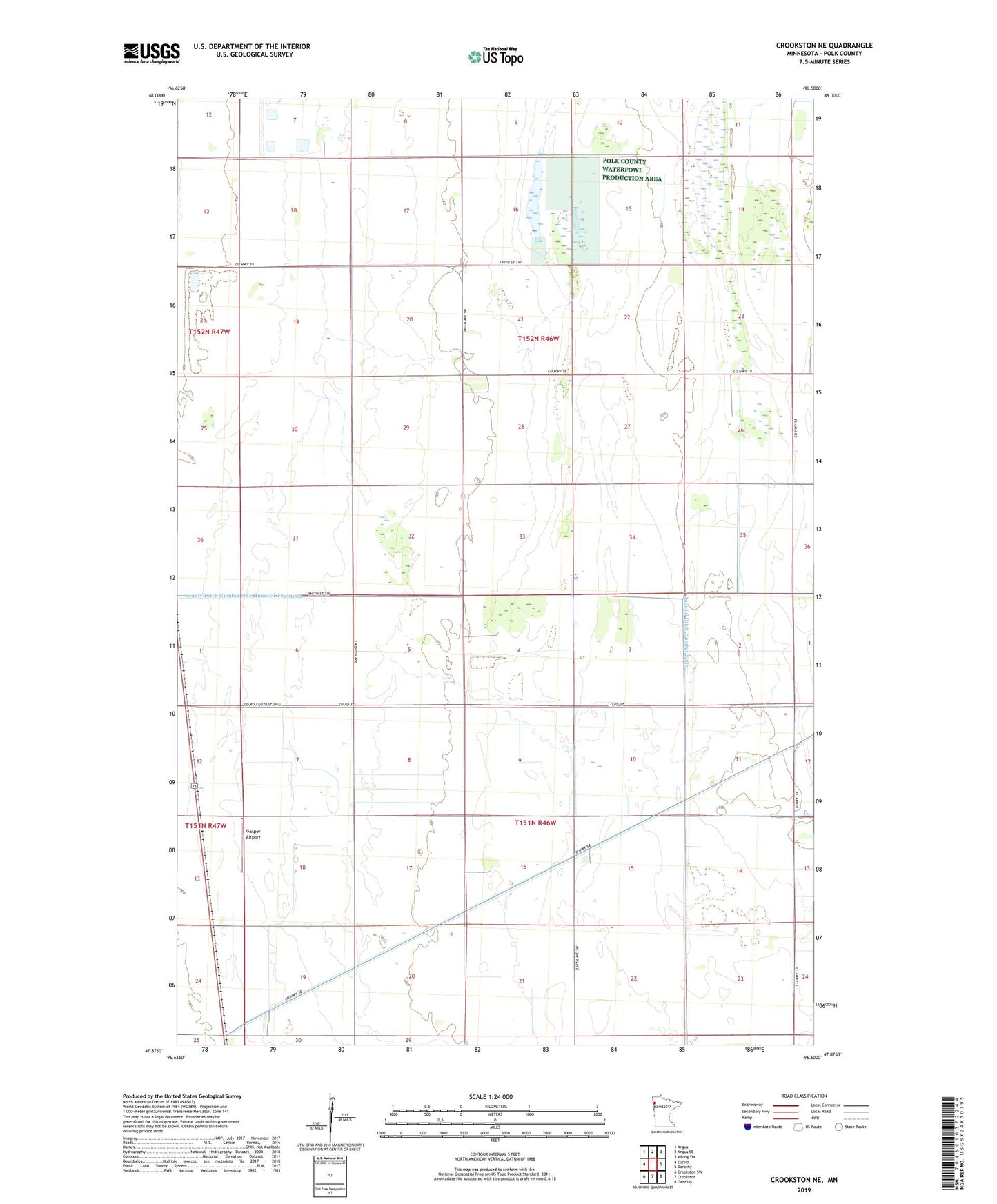
2022 topographic map quadrangle Crookston NE in the state of Minnesota. Scale: 1:24000. Based on the newly updated USGS 7.5' US Topo map series, this map is in the following counties: Polk. The map contains contour data, water features, and other items you are used to seeing on USGS maps, but also has updated roads and other features. This is the next generation of topographic maps. Printed on high-quality waterproof paper with UV fade-resistant inks.
Quads adjacent to this one:
West: Euclid
Northwest: Angus
North: Angus SE
Northeast: Viking SW
East: Dorothy
Southeast: Gentilly
South: Crookston
Southwest: Crookston SW
This map covers the same area as the classic USGS quad with code o47096h5.
Contains the following named places: Belgium State Wildlife Management Area, County Ditch Number One Hundred Fortyseven, Gasper Airport, Kaml Airstrip, KQMN-FM (Thief River Falls), KSNR-FM (Thief River Falls), KVVL-FM (Thief River Falls), Pembina State Wildlife Management Area, School Number 179, School Number 29, Township of Belgium, Township of Parnell