MyTopo
Gentilly Minnesota US Topo Map
Couldn't load pickup availability
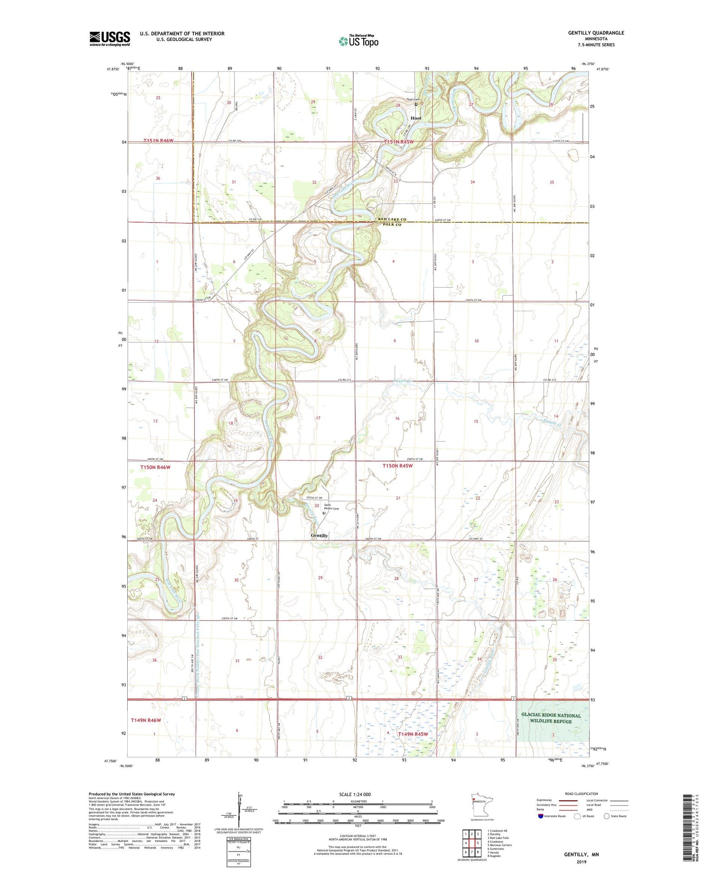
2022 topographic map quadrangle Gentilly in the state of Minnesota. Scale: 1:24000. Based on the newly updated USGS 7.5' US Topo map series, this map is in the following counties: Polk, Red Lake. The map contains contour data, water features, and other items you are used to seeing on USGS maps, but also has updated roads and other features. This is the next generation of topographic maps. Printed on high-quality waterproof paper with UV fade-resistant inks.
Quads adjacent to this one:
West: Crookston
Northwest: Crookston NE
North: Dorothy
Northeast: Red Lake Falls
East: Marcoux Corners
Southeast: Dugdale
South: Harold
Southwest: Greenview
This map covers the same area as the classic USGS quad with code o47096g4.
Contains the following named places: Black River, County Ditch Number One Hundred Fiftyeight, Gentilly, Gentilly Post Office, Gentilly River, Huot, Huot Cemetery, Huot School, Kripple Creek, Kripple Creek School, Old Crossing Memorial Park Historical Marker, Old Crossing Treaty State Wayside Park, Polk County, Prairie Queen School, Saint Peters Cemetery, Saint Peters Church, School Number 292, Stipa State Wildlife Management Area, Township of Gentilly