MyTopo
Edgerton NE Minnesota US Topo Map
Couldn't load pickup availability
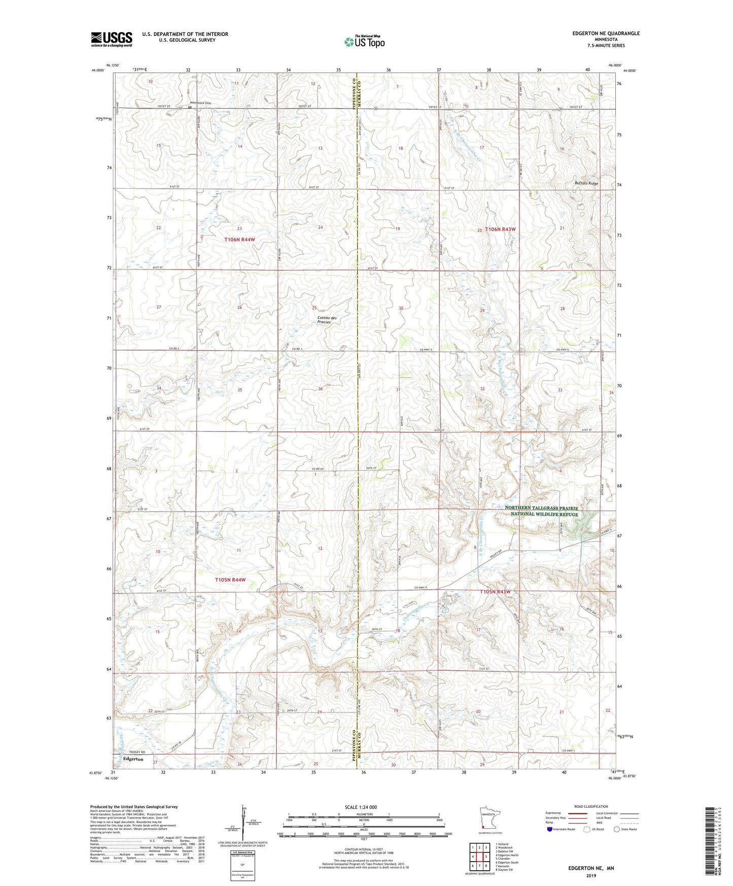
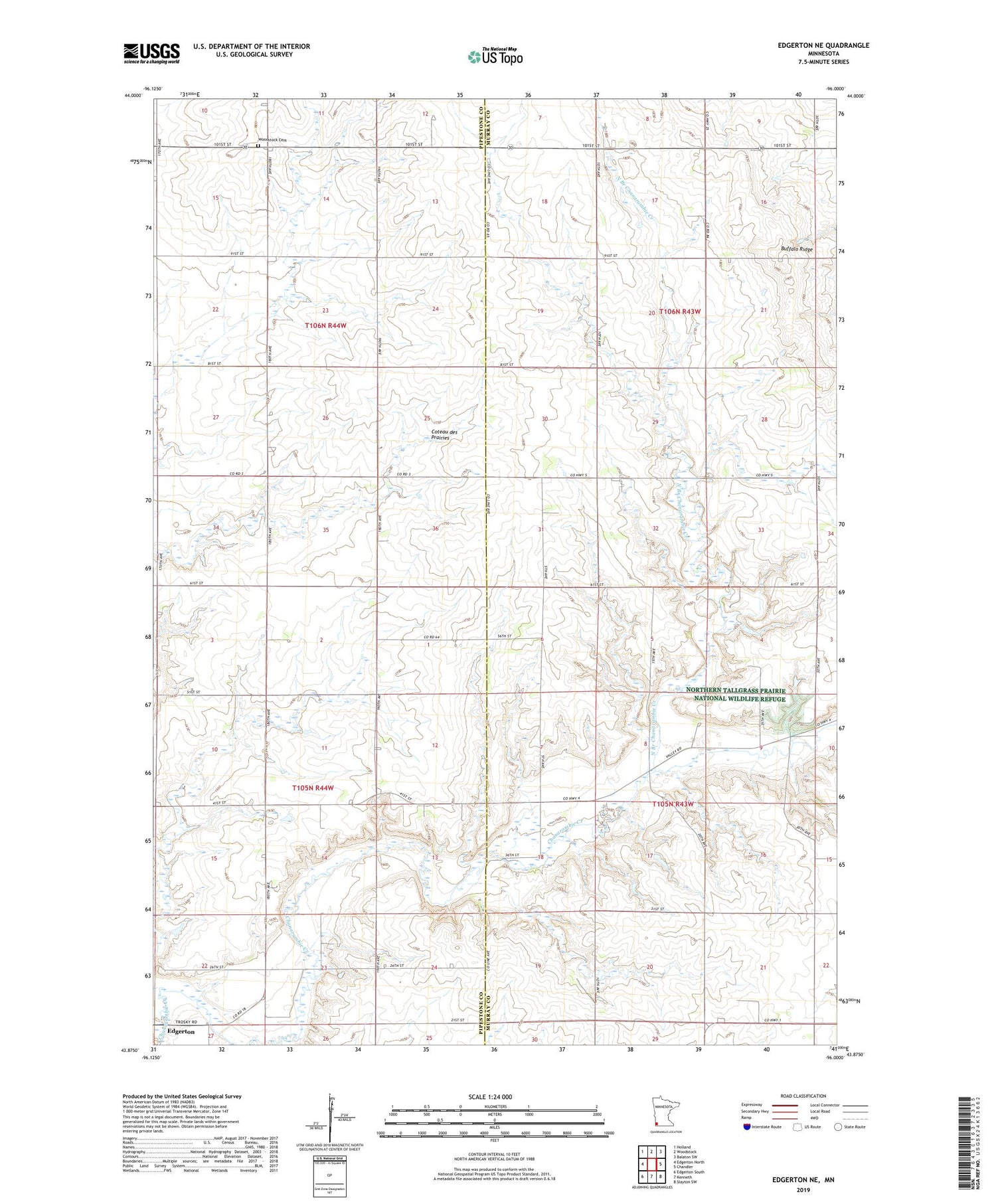
2019 topographic map quadrangle Edgerton NE in the state of Minnesota. Scale: 1:24000. Based on the newly updated USGS 7.5' US Topo map series, this map is in the following counties: Murray, Pipestone. The map contains contour data, water features, and other items you are used to seeing on USGS maps, but also has updated roads and other features. This is the next generation of topographic maps. Printed on high-quality waterproof paper with UV fade-resistant inks.
Quads adjacent to this one:
West: Edgerton North
Northwest: Holland
North: Woodstock
Northeast: Balaton SW
East: Chandler
Southeast: Slayton SW
South: Kenneth
Southwest: Edgerton South
Contains the following named places: Buffalo Ridge, Degroot Farms, Diamond Corner, Fey Farms, Jasper Dairy, North Branch Chanarambie Creek, Rylaarsdam Dairy Farm, Township of Burke, Township of Chanarambie, Township of Moulton, Township of Osborne, Woodstock Cemetery, ZIP Code: 56128