MyTopo
Woodstock Minnesota US Topo Map
Couldn't load pickup availability
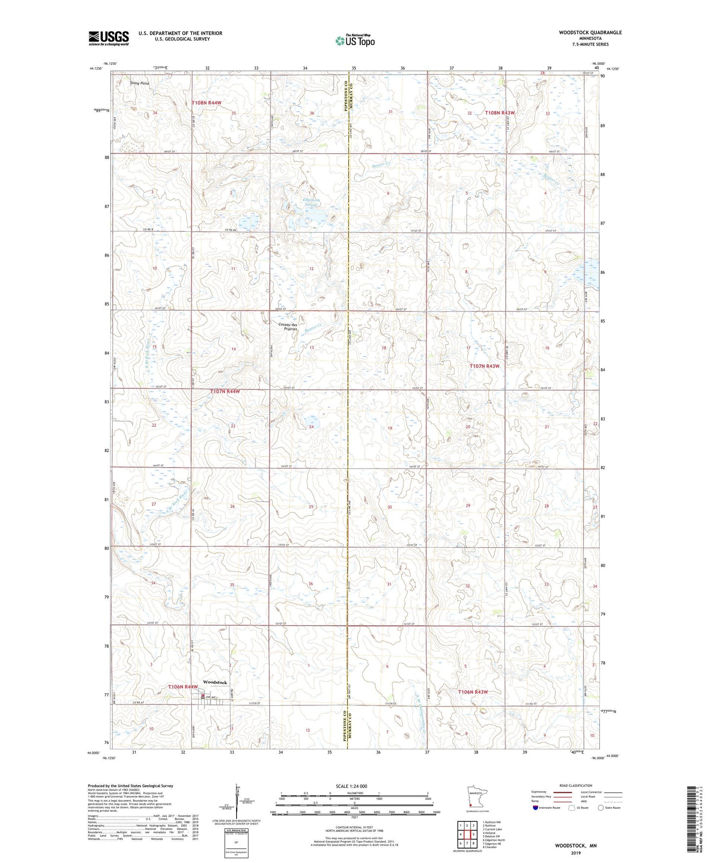
2022 topographic map quadrangle Woodstock in the state of Minnesota. Scale: 1:24000. Based on the newly updated USGS 7.5' US Topo map series, this map is in the following counties: Murray, Pipestone. The map contains contour data, water features, and other items you are used to seeing on USGS maps, but also has updated roads and other features. This is the next generation of topographic maps. Printed on high-quality waterproof paper with UV fade-resistant inks.
Quads adjacent to this one:
West: Holland
Northwest: Ruthton NW
North: Ruthton
Northeast: Current Lake
East: Balaton SW
Southeast: Chandler
South: Edgerton NE
Southwest: Edgerton North
This map covers the same area as the classic USGS quad with code o44096a1.
Contains the following named places: American Reformed Church, Church of God the Father, City of Woodstock, Engbarth Slough, Gleis Farms, Klinker Slough, New Life Treatment Center, Saint Martin Catholic Church, School Number 1264, Stony Point, Township of Cameron, Township of Rock, Van Beek State Wildlife Management Area, Woodstock, Woodstock Fire Department, Woodstock Post Office, Woodstock State Wildlife Management Area, ZIP Code: 56186