MyTopo
Kenneth Minnesota US Topo Map
Couldn't load pickup availability
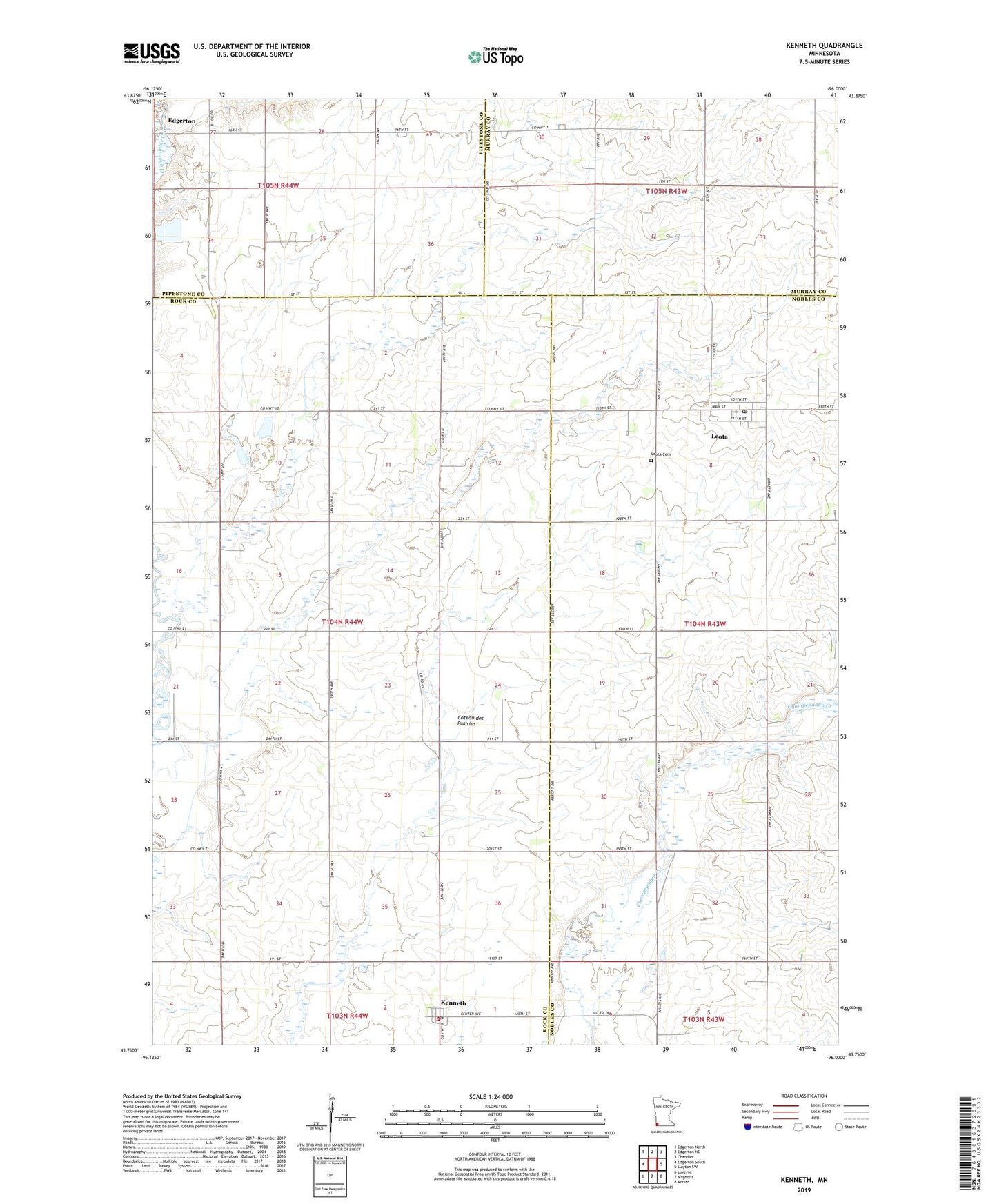
2022 topographic map quadrangle Kenneth in the state of Minnesota. Scale: 1:24000. Based on the newly updated USGS 7.5' US Topo map series, this map is in the following counties: Rock, Nobles, Murray, Pipestone. The map contains contour data, water features, and other items you are used to seeing on USGS maps, but also has updated roads and other features. This is the next generation of topographic maps. Printed on high-quality waterproof paper with UV fade-resistant inks.
Quads adjacent to this one:
West: Edgerton South
Northwest: Edgerton North
North: Edgerton NE
Northeast: Chandler
East: Slayton SW
Southeast: Adrian
South: Magnolia
Southwest: Luverne
This map covers the same area as the classic USGS quad with code o43096g1.
Contains the following named places: Bethel Reformed Church, City of Kenneth, Kenneth, Kenneth Lutheran Church, Kenneth Post Office, Kenneth Volunteer Fire Department, Leota, Leota Cemetery, Leota Census Designated Place, Leota Christian Elementary School, Leota Christian Reformed Church, Leota Post Office, Sas Farms, Township of Battle Plain, ZIP Codes: 56147, 56153