MyTopo
Erhard Minnesota US Topo Map
Couldn't load pickup availability
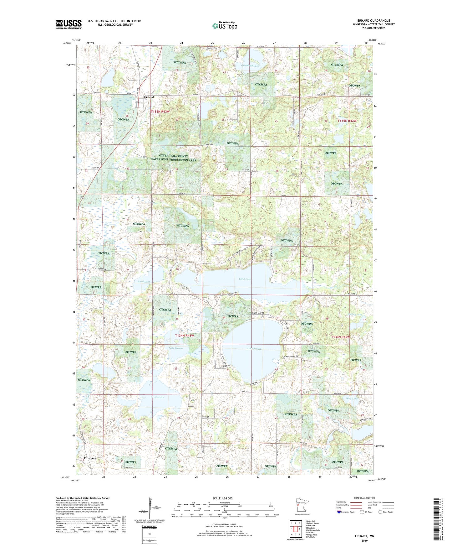
2019 topographic map quadrangle Erhard in the state of Minnesota. Scale: 1:24000. Based on the newly updated USGS 7.5' US Topo map series, this map is in the following counties: Otter Tail. The map contains contour data, water features, and other items you are used to seeing on USGS maps, but also has updated roads and other features. This is the next generation of topographic maps. Printed on high-quality waterproof paper with UV fade-resistant inks.
Quads adjacent to this one:
West: Elizabeth
Northwest: Lake Olaf
North: Pelican Rapids
Northeast: Lake Lida
East: Heilberger Lake
Southeast: Wall Lake
South: Fergus Falls
Southwest: Carlisle
Contains the following named places: City of Erhard, Devils Lake, Elizabeth, Erhard, Erhard Post Office, Friberg Dam-Taplin Gorge, Grace Lutheran Church, Grandrud Lake, Lake Jewett, Lake Mason, Lake View School, Long Lake, McCoy Lake, Otter Tail County Waterfowl Production Area, Red River Lake, Reed Creek, Reed Lake, School Number 203, School Number 230, School Number 278, School Number 36, Sverre Post Office, Taplin Gorge Dam, Township of Elizabeth, Township of Erhards Grove, Wolf Lake, ZIP Code: 56534