MyTopo
Elizabeth Minnesota US Topo Map
Couldn't load pickup availability
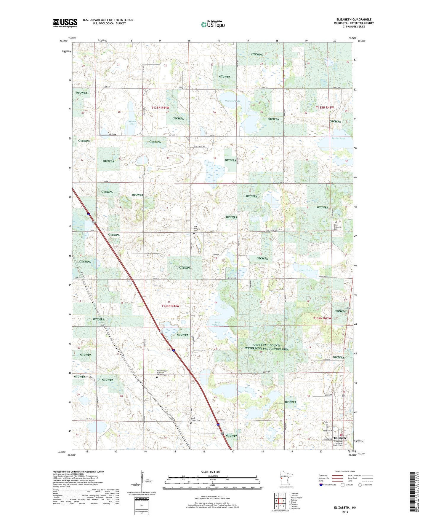
2022 topographic map quadrangle Elizabeth in the state of Minnesota. Scale: 1:24000. Based on the newly updated USGS 7.5' US Topo map series, this map is in the following counties: Otter Tail. The map contains contour data, water features, and other items you are used to seeing on USGS maps, but also has updated roads and other features. This is the next generation of topographic maps. Printed on high-quality waterproof paper with UV fade-resistant inks.
Quads adjacent to this one:
West: Rothsay
Northwest: Lawndale
North: Lake Olaf
Northeast: Pelican Rapids
East: Erhard
Southeast: Fergus Falls
South: Carlisle
Southwest: Foxhome
This map covers the same area as the classic USGS quad with code o46096d2.
Contains the following named places: Altner Lake, Augustana Lutheran Church, Christopherson Lake, City of Elizabeth, Elizabeth, Elizabeth Fire Department, Elizabeth Post Office, Evangelical Lutheran Kirchof Cemetery, Friborg Church, Friborg Lutheran Church Cemetery, German Evangelical Cemetery, Hedemarken Church, Hedemarken Lutheran Church Cemetery, Houland Lake, KBRF-FM (Fergus Falls), Knobel Lake, Lake Haldorsen, Moen Lake, Nelson Lake, Old Friborg Cemetery, Oscar Post Office, Oscar State Wildlife Management Area, Pelican River Dam, Peterson Lake, Saint Elizabeth's Catholic Church, Saint John Lutheran Church, School Number 111, School Number 125, School Number 62, School Number 83, School Number 89, South Friborg Cemetery, Township of Oscar, Zion Elizabeth Cemetery, ZIP Code: 56533