MyTopo
Eyota Minnesota US Topo Map
Couldn't load pickup availability
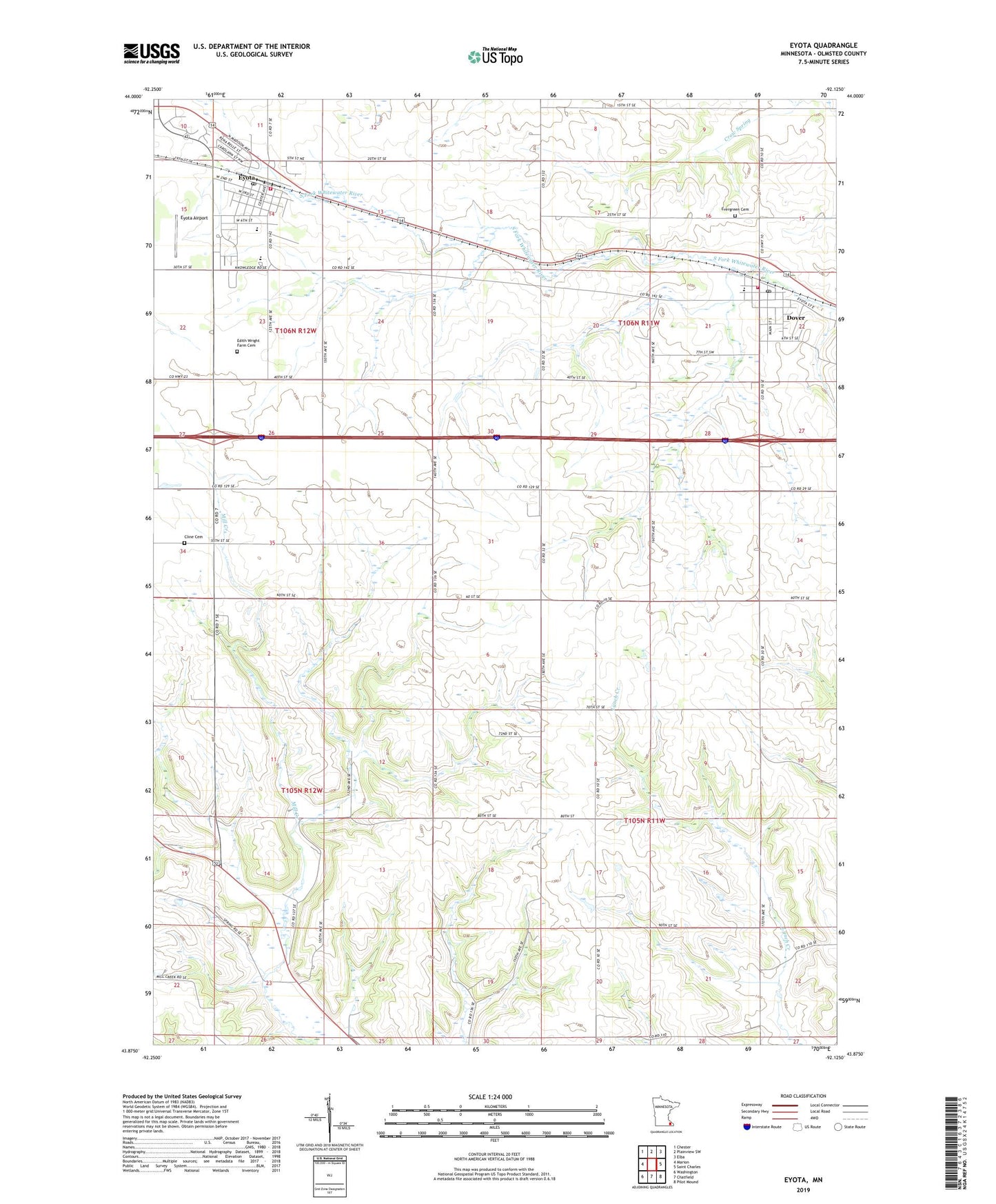
2019 topographic map quadrangle Eyota in the state of Minnesota. Scale: 1:24000. Based on the newly updated USGS 7.5' US Topo map series, this map is in the following counties: Olmsted. The map contains contour data, water features, and other items you are used to seeing on USGS maps, but also has updated roads and other features. This is the next generation of topographic maps. Printed on high-quality waterproof paper with UV fade-resistant inks.
Quads adjacent to this one:
West: Marion
Northwest: Chester
North: Plainview SW
Northeast: Elba
East: Saint Charles
Southeast: Pilot Mound
South: Chatfield
Southwest: Washington
Contains the following named places: City of Dover, City of Eyota, Clemens Farms, Cline Cemetery, Dover, Dover - Eyota Elementary School, Dover - Eyota High School, Dover Fire Department, Dover Post Office, Edith Wright Farm Cemetery, Elmira Church, Evergreen Cemetery, Eyota, Eyota Airport, Eyota Police Department, Eyota Post Office, Eyota Volunteer Fire Department, Faith United Methodist Church, Franke Farms, Gar Lin Dairy Farm, Grace Church, Holy Redeemer Catholic Church, Olmstead County Road 10 Dam, Our Saviour's Lutheran Church, Peace Lutheran Church, Township of Dover, Township of Elmira, Wendt Farms of Eyota, ZIP Code: 55929