MyTopo
Saint Charles Minnesota US Topo Map
Couldn't load pickup availability
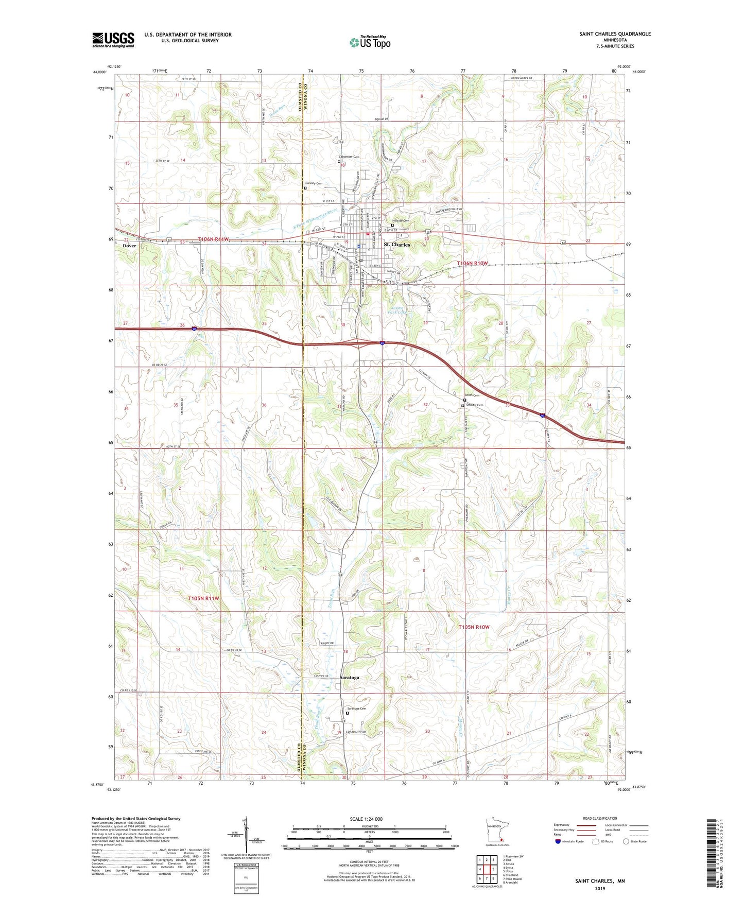
2022 topographic map quadrangle Saint Charles in the state of Minnesota. Scale: 1:24000. Based on the newly updated USGS 7.5' US Topo map series, this map is in the following counties: Winona, Olmsted. The map contains contour data, water features, and other items you are used to seeing on USGS maps, but also has updated roads and other features. This is the next generation of topographic maps. Printed on high-quality waterproof paper with UV fade-resistant inks.
Quads adjacent to this one:
West: Eyota
Northwest: Plainview SW
North: Elba
Northeast: Altura
East: Utica
Southeast: Arendahl
South: Pilot Mound
Southwest: Chatfield
This map covers the same area as the classic USGS quad with code o43092h1.
Contains the following named places: Berea Moravian Church, Calvary Cemetery, Carpenter Cemetery, Church of Christ, City of Saint Charles, Faith Lutheran Church, Frank Hilke Detention Dam, Hillside Cemetery, Jessen Park Lake, Jesson Park Dam, Klassen Farms, Olmsted Medical Group Center, Pagel-Young Detention Number 1 Dam, Saint Charles, Saint Charles Ambulance, Saint Charles Bible Church, Saint Charles Catholic Church, Saint Charles Christian School, Saint Charles City Hall, Saint Charles Elementary School, Saint Charles Fire and Rescue Department, Saint Charles Golf Course, Saint Charles Library, Saint Charles Police Department, Saint Charles Post Office, Saint Charles Secondary School, Saint Matthew Lutheran Church, Saratoga, Saratoga Cemetery, Saratoga Post Office, Sinclair Cemetery, Smith Cemetery, Sportsman Park, Stanley Harcey Stabilizer Dam, Township of Saint Charles, Township of Saratoga, United Methodist Church, Whitewater Health Care Center, ZIP Code: 55972