MyTopo
Fisher Minnesota US Topo Map
Couldn't load pickup availability
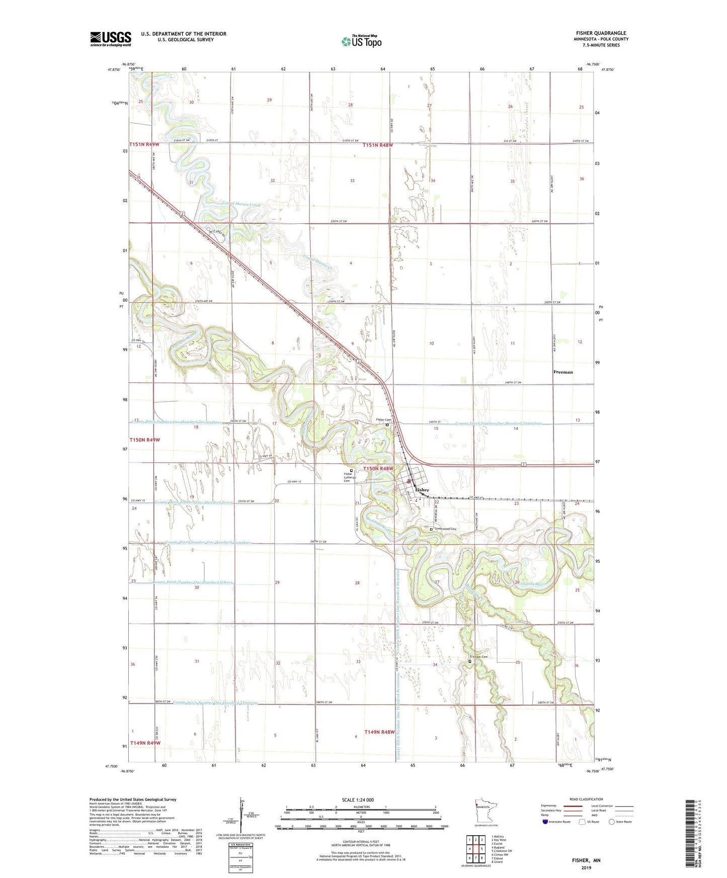
2019 topographic map quadrangle Fisher in the state of Minnesota. Scale: 1:24000. Based on the newly updated USGS 7.5' US Topo map series, this map is in the following counties: Polk. The map contains contour data, water features, and other items you are used to seeing on USGS maps, but also has updated roads and other features. This is the next generation of topographic maps. Printed on high-quality waterproof paper with UV fade-resistant inks.
Quads adjacent to this one:
West: Bygland
Northwest: Mallory
North: Key West
Northeast: Euclid
East: Crookston SW
Southeast: Girard
South: Eldred
Southwest: Climax NW
Contains the following named places: Burnham Creek, City of Fisher, County Ditch Number Fiftyone, County Ditch Number One Hundred Seven, County Ditch Number One Hundred Sixtynine, County Ditch Number One Hundred Sixtythree, County Ditch Number One Hundred Thirtyfour, County Ditch Number One Hundred Thirtyone, County Ditch Number Thirty, Erickson Cemetery, Fisher, Fisher Cemetery, Fisher Fire Department, Fisher High School, Fisher Lutheran Cemetery, Fisher Lutheran Church, Fisher Police Department, Fisher Post Office, Fisher's Landing Traveler Information Center, Freeman, Glacial Lake Agassiz Historical Marker, Greenwood Cemetery, KQHT-FM (Crookston), KYCK-FM (Crookston), Original Site of Fisher's Landing Historical Marker, Saint Francis Church, Township of Fisher, Trinity Lutheran Church, ZIP Code: 56723