MyTopo
Girard Minnesota US Topo Map
Couldn't load pickup availability
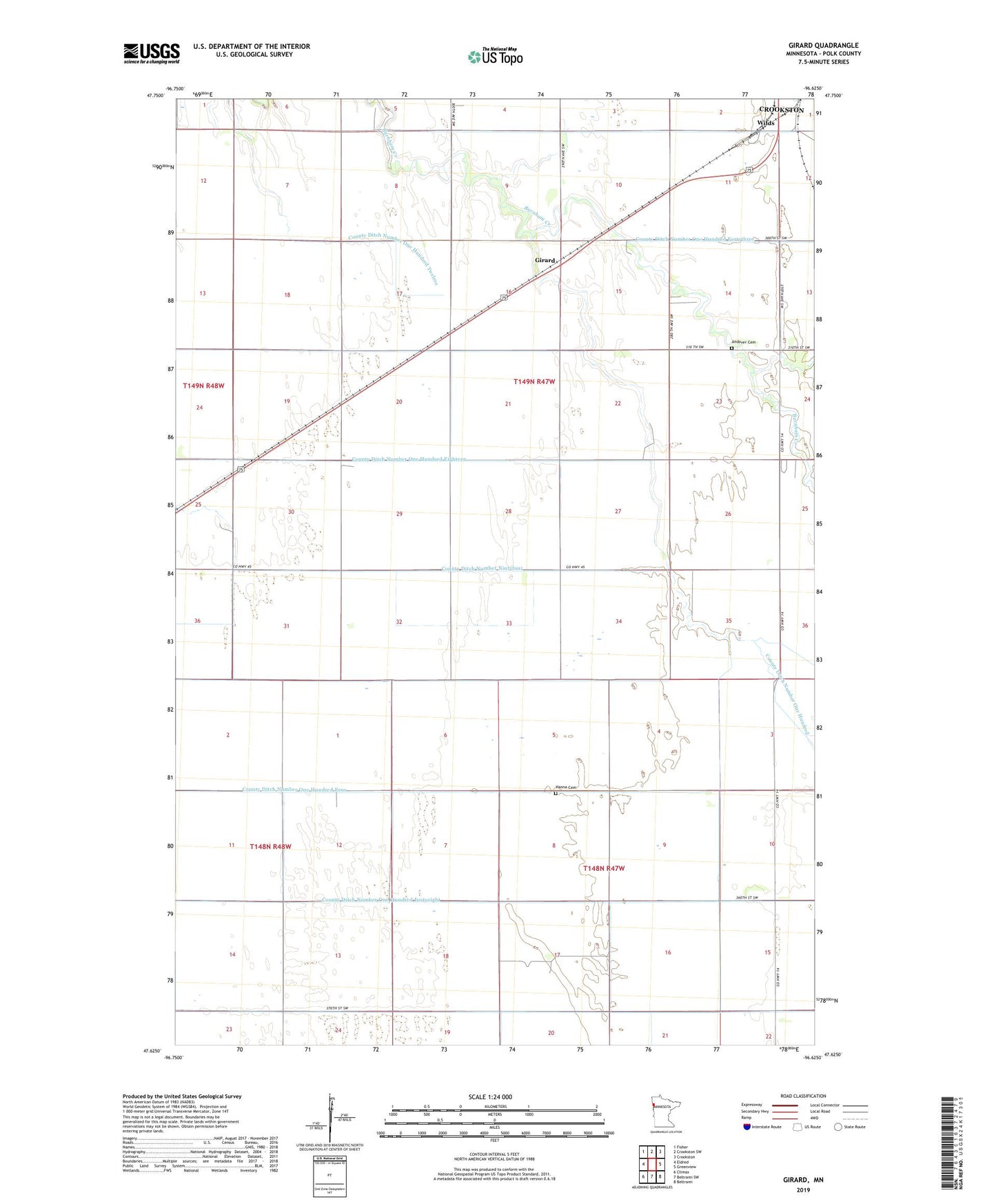
2022 topographic map quadrangle Girard in the state of Minnesota. Scale: 1:24000. Based on the newly updated USGS 7.5' US Topo map series, this map is in the following counties: Polk. The map contains contour data, water features, and other items you are used to seeing on USGS maps, but also has updated roads and other features. This is the next generation of topographic maps. Printed on high-quality waterproof paper with UV fade-resistant inks.
Quads adjacent to this one:
West: Eldred
Northwest: Fisher
North: Crookston SW
Northeast: Crookston
East: Greenview
Southeast: Beltrami
South: Beltrami SW
Southwest: Climax
This map covers the same area as the classic USGS quad with code o47096f6.
Contains the following named places: Andover Cemetery, Carman Post Office, County Ditch Number Fortyseven, County Ditch Number Ninetyfour, County Ditch Number Ninetythree, County Ditch Number One Hundred Eighteen, County Ditch Number One Hundred Fortyeight, County Ditch Number One Hundred Four, County Ditch Number One Hundred Twelve, County Ditch Number Sixtynine, County Ditch Number Sixtyone, County Ditch Number Sixtythree, County Ditch Number Ten, Girard, Hanna Cemetery, Township of Andover, Township of Hammond, Wilds