MyTopo
Eldred Minnesota US Topo Map
Couldn't load pickup availability
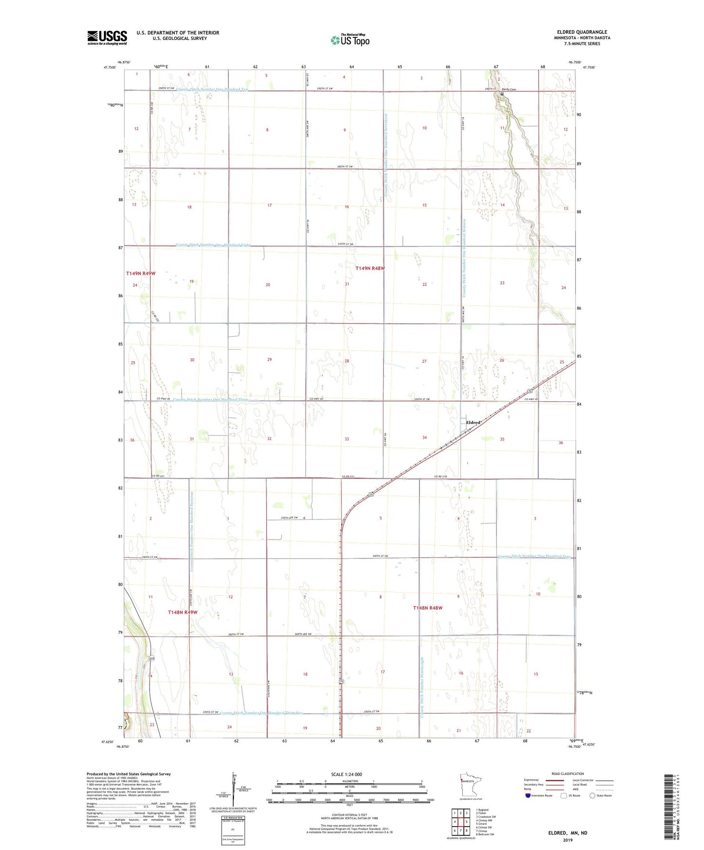
2022 topographic map quadrangle Eldred in the state of Minnesota. Scale: 1:24000. Based on the newly updated USGS 7.5' US Topo map series, this map is in the following counties: Polk, Traill. The map contains contour data, water features, and other items you are used to seeing on USGS maps, but also has updated roads and other features. This is the next generation of topographic maps. Printed on high-quality waterproof paper with UV fade-resistant inks.
Quads adjacent to this one:
West: Climax NW
Northwest: Bygland
North: Fisher
Northeast: Crookston SW
East: Girard
Southeast: Beltrami SW
South: Climax
Southwest: Climax SW
Contains the following named places: Bardo Cemetery, County Ditch Number Nineteen, County Ditch Number Ninetyeight, County Ditch Number Ninetysix, County Ditch Number One Hundred Eight, County Ditch Number One Hundred Seventeen, County Ditch Number One Hundred Sixteen, County Ditch Number One Hundred Sixtyone, County Ditch Number One Hundred Ten, County Ditch Number One Hundred Thirtyfive, County Ditch Number One Hundred Three, County Ditch Number One Hundred Twenty, County Ditch Number Twenty, Eldred, Eldred Post Office, Township of Roome, Township of Vineland, ZIP Code: 56523