MyTopo
Floodwood Minnesota US Topo Map
Couldn't load pickup availability
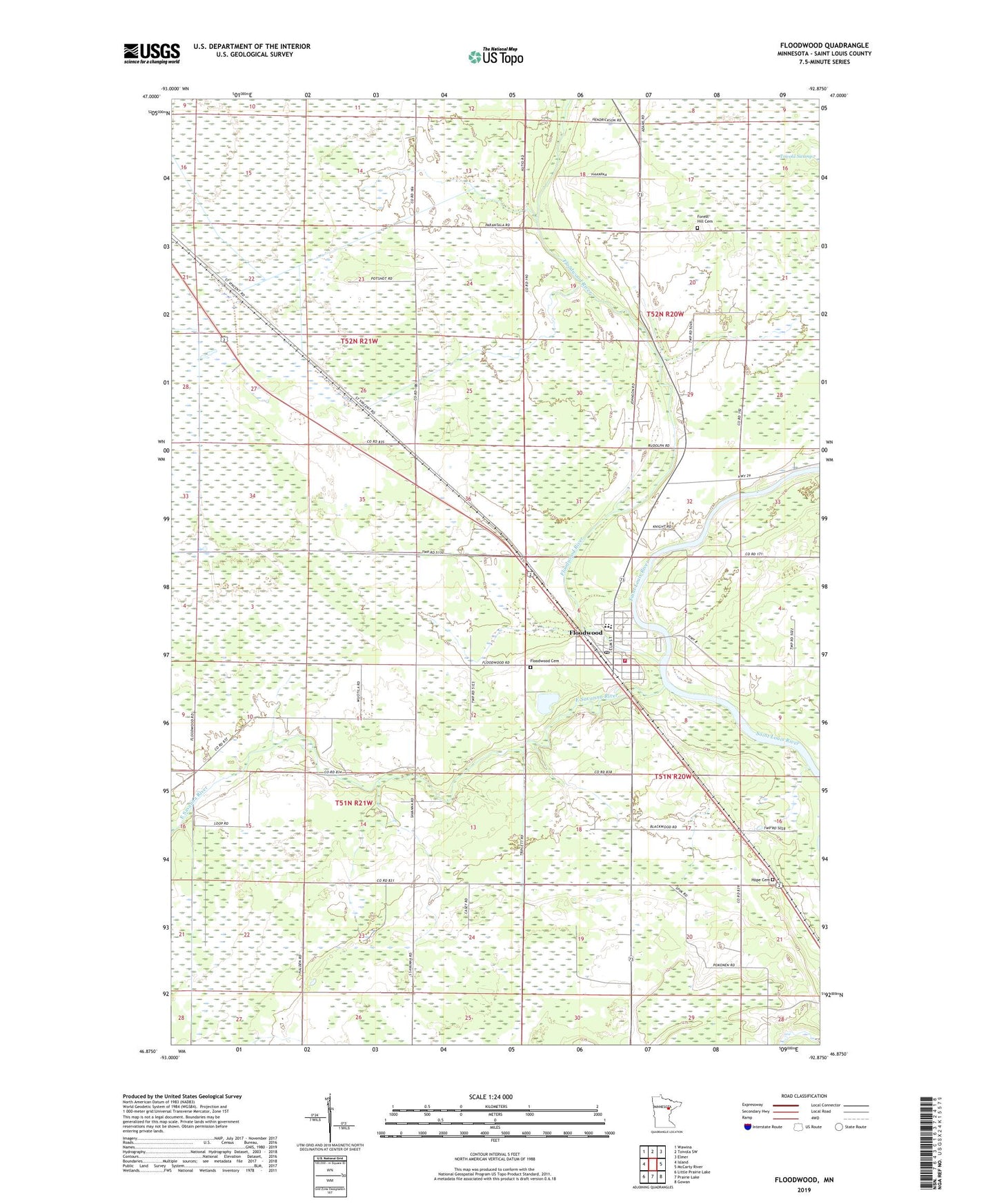
2019 topographic map quadrangle Floodwood in the state of Minnesota. Scale: 1:24000. Based on the newly updated USGS 7.5' US Topo map series, this map is in the following counties: St. Louis. The map contains contour data, water features, and other items you are used to seeing on USGS maps, but also has updated roads and other features. This is the next generation of topographic maps. Printed on high-quality waterproof paper with UV fade-resistant inks.
Quads adjacent to this one:
West: Island
Northwest: Wawina
North: Toivola SW
Northeast: Elmer
East: McCarty River
Southeast: Gowan
South: Prairie Lake
Southwest: Little Prairie Lake
Contains the following named places: Arrowhead Regional Law Enforcement Center, Assemblies of God Church, City of Floodwood, Duluth Clinic-Floodwood, East Savanna River, Floodwood, Floodwood Ambulance Service, Floodwood Cemetery, Floodwood City Hall, Floodwood Historical Marker, Floodwood Police Department, Floodwood Post Office, Floodwood Rest Area, Floodwood River, Floodwood Station, Floodwood Volunteer Fire Department, Forest Hill Cemetery, French River Lutheran Church, Halden Community Center, Hope Lutheran Cemetery, Hope Lutheran Church, Independence Apostolic Lutheran Church, Judicial Ditch Number Three, Old Apostolic Lutheran Church, Sixteen Creek, Township of Halden, Unorganized Territory of Potshot Lake, ZIP Code: 55736