MyTopo
Foley Minnesota US Topo Map
Couldn't load pickup availability
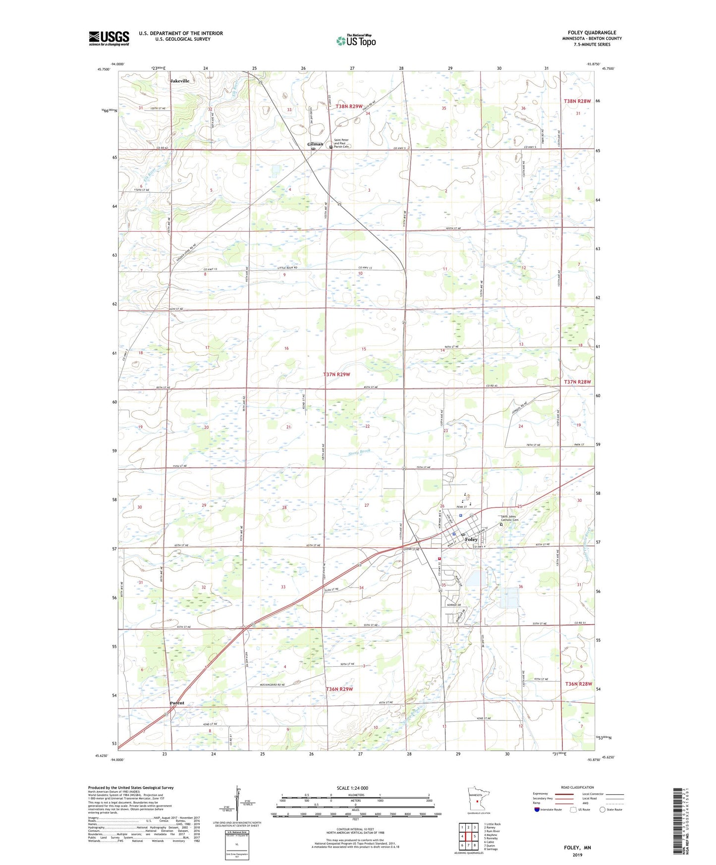
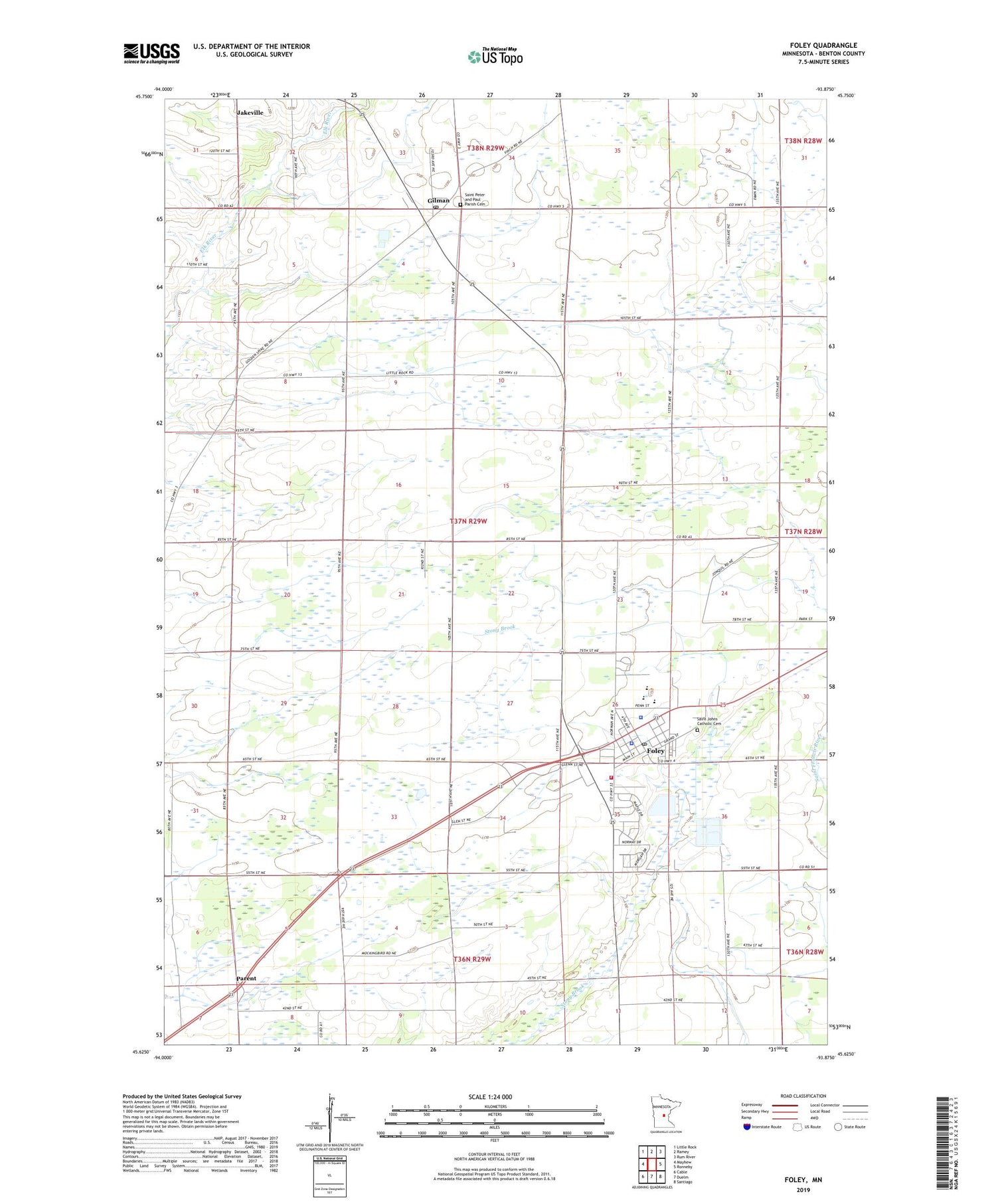
2019 topographic map quadrangle Foley in the state of Minnesota. Scale: 1:24000. Based on the newly updated USGS 7.5' US Topo map series, this map is in the following counties: Benton. The map contains contour data, water features, and other items you are used to seeing on USGS maps, but also has updated roads and other features. This is the next generation of topographic maps. Printed on high-quality waterproof paper with UV fade-resistant inks.
Quads adjacent to this one:
West: Mayhew
Northwest: Little Rock
North: Ramey
Northeast: Rum River
East: Ronneby
Southeast: Santiago
South: Duelm
Southwest: Cable
Contains the following named places: Benton County, Benton County Courthouse, Benton County Jail, Benton County Sheriff's Office, Benton County Takes Shape Historical Marker, City of Foley, City of Gilman, First Presbyterian Church, Foley, Foley City Hall, Foley Community Library, Foley Elementary School, Foley Fire Department, Foley High School, Foley Intermediate School, Foley Medical Center, Foley Mobile Home Park, Foley Mobile Home Park South, Foley Nursing Center, Foley Police Department, Foley Post Office, Foley School, Gilman, Gilman Post Office, Glen Oaks Mobile Home Park, Gustavus Adolphus Lutheran Church, Parent, Parent Post Office, Saint Johns Catholic Cemetery, Saint John's Church, Saint Johns School, Saint Pauls Lutheran Church, Saint Peter and Paul Parish Cemetery, Stone Creek Golf Club, Township of Gilmanton, ZIP Code: 56329